geo.wikisort.org - Mountains
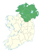
Benbradagh (from Irish Binn Bhradach 'thief's peak')[2] is a mountain in Dungiven County Londonderry, Northern Ireland. It is the second most northerly summit in the Sperrin Mountains area and the 564th highest summit in Ireland.[1] It rises to 465 metres (1,526 ft) and lies to the east of Dungiven. It was used from the 1940s to the early 1970s as a United States Military Base. Col Buckley, of the Directorate of Military Intelligence (Ireland), believed nuclear weapons could be situated at underground facilities inside Benbradagh mountain in Derry, which US forces used as a communications hub in order to communicate with its North Atlantic fleet, but which were also designed for the storage of conventional high explosives. Col Buckley complained that he did not have "the monitoring or surveillance systems" to confirm the presence of nuclear weapons in Northern Ireland, but that the British strongly denied land-based systems in the territory and refused to confirm the movements of air and sea-based nuclear weapons.[3][4] It is popular with paragliders due to the steep terrain. The mountain is accessible via the Curragh Road which stops near the summit.
| Benbradagh | |
|---|---|
| Binn Bhradach | |
 Benbradagh Mountain as seen from Derryork, in October 2008 | |
| Highest point | |
| Elevation | 465 m (1,526 ft)[1] |
| Prominence | 171 m (561 ft)[1] |
| Coordinates | 54°56′40″N 6°52′27″W[1] |
| Geography | |
| Location | County Londonderry, Northern Ireland |
| Parent range | Sperrin Mountains |
| OSI/OSNI grid | C7219411337 |
| Topo map | OSNI Discoverer Series 13 The Sperrins (1:50000), OSNI Activity Map Sperrins (1:25000) |
Benbradagh is also the name of a district electoral area centred in Dungiven which is part of the Causeway Coast and Glens Borough Council[5]
References
- "Benbradagh". MountainViews. Retrieved 13 December 2008.
- "Binn Bhradach". Placenames Database of Ireland. Retrieved 12 January 2010.
- "Óglaigh na hÉireann intelligence boss believed Derry mountain Benbradagh could be used to store nuclear weapons, new 'confidential' files show". www.derryjournal.com. Retrieved 13 January 2022.
- Hutton, Brian. "Security forces feared nuclear weapons in Northern Ireland". ISSN 0140-0460. Retrieved 13 January 2022.
- "Local Government District Electoral Areas 2013" (PDF). Index map of Northern Ireland. Archived from the original (PDF) on 29 September 2015. Retrieved 17 October 2020.
Другой контент может иметь иную лицензию. Перед использованием материалов сайта WikiSort.org внимательно изучите правила лицензирования конкретных элементов наполнения сайта.
WikiSort.org - проект по пересортировке и дополнению контента Википедии


