geo.wikisort.org - Mountains
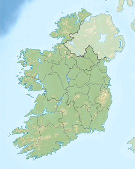
The Blue Stack Mountains[1] or Bluestack Mountains, also called the Croaghgorms (Irish: na Cruacha Gorma, meaning 'the blue stacks'), are the major mountain range in the south of County Donegal, Ireland. They provide a barrier between the south of the county, such as Donegal Town and Ballyshannon, and the towns to the north and west such as Dungloe and Letterkenny. The road between the two parts of the county goes through the Barnesmore Gap.
This article needs additional citations for verification. (March 2013) |
| Blue Stack Mountains | |
|---|---|
| Irish: na Cruacha Gorma | |
 Binnasruell in the Blue Stack Mountains | |
| Highest point | |
| Peak | Croaghgorm |
| Elevation | 674 m (2,211 ft) |
| Coordinates | |
| Geography | |
 Blue Stack Mountains | |
| Country | Ireland |
| Provinces of Ireland | Ulster |
The highest mountain in the range is Croaghgorm, which is 674 metres (2,211 ft) high. Nearby summits include Ardnageer (642 m [2,106 ft], Croaghanirwore (548 m [1,798 ft]), Croaghbarnes (499 m [1,637 ft]), Croaghblane (641 m [2,103 ft]), Croaghnageer (571 m [1,873 ft]), Croveenananta (476 m [1,562 ft]), Gaugin Mountain (565 m [1,854 ft]), Lacroagh (403 m [1,322 ft]), Lavagh More (671 m [2,201 ft]) and Lavagh Beg (650 m [2,130 ft]).[2] Silver Hill (600 m [2,000 ft]), is the smallest mountain in Ireland to meet the 600 m threshold for a Simms classification.
PGallery
 Eglish Valley
 Binnasruell
 The Blue Stacks from earth orbit (top right)


References
- Blue Stack Mountains Placenames Database of Ireland. Retrieved: 2013-03-19
- Croaghgorm MountainViews. Retrieved: 2013-03-19.
External links
Mountains and hills of Ulster | ||
|---|---|---|
| Antrim Hills |  | |
| Antrim Plateau |
| |
| Belfast Hills | ||
| Croaghgorms | ||
| Derryveagh | ||
| Inishowen | ||
| Mournes | ||
| Sperrins | ||
| Southwest Donegal | ||
| Others | ||
This article related to the geography of County Donegal, Ireland is a stub. You can help Wikipedia by expanding it. |
На других языках
- [en] Blue Stack Mountains
[es] Montañas Blue Stack
Las montañas Blue Stack (Na Cruacha Gorma en irlandés. También conocidas en inglés como las Blue Stack o, en Donegal meridional, las Croaghs son la principal sierra en el sur del Condado de Donegal en Ulster occidental, Irlanda. Proporcional una barrera casi infranqueable entre el sur del país, tal como la ciudad de Donegal y Ballyshannon, y las ciudades al norte y oeste como Dungloe y Letterkenny. La carretera entre las dos partes del país pasa por el Barnesmore Gap.[fr] Bluestack Mountains
Les montagnes Bluestack (en anglais Bluestack Mountains et en irlandais Na Cruacha Gorma) sont un massif montagneux situé au sud du comté de Donegal dans l’ouest de l’Ulster en Irlande. Ce massif coupe littéralement en deux le comté en empêchant quasiment toute circulation entre le Sud du comté (Ballyshannon et Donegal) et le Nord (Letterkenny et Dungloe). La seule voie de circulation passe par le col de Barnesmore.[it] Bluestack Mountains
Le Blue Stack Mountains[1] o Bluestack Mountains, anche chiamate Croaghgorms (dal nome gaelico irlandese na Cruacha Gorma, che significa proprio "i comignoli blu" come quello inglese), sono una catena montuosa del Donegal, Irlanda. Situate nella parte centro-meridionale della propria contea, costituiscono una barriera naturale che da sempre ha diviso i principali centri del sud come Donegal Town e Ballyshannon da quelli del nord come Dungloe e Letterkenny. L'unica via di comunicazione seria che collega queste due regioni senza aggirare lateralmente i monti passa per il cosiddetto Barnesmore Gap, uha strada all'interno di un suggestivo glen. L'estensione della catena è piuttosto considerevole se si pensa che si innalza nei pressi di Donegal Town fino a raggiungere il piccolo abitato di Glenties nelle aree remote ed occidentali del Donegal.Другой контент может иметь иную лицензию. Перед использованием материалов сайта WikiSort.org внимательно изучите правила лицензирования конкретных элементов наполнения сайта.
WikiSort.org - проект по пересортировке и дополнению контента Википедии