geo.wikisort.org - Mountains
Ben Vorlich (Scottish Gaelic: Beinn Mhùrlaig)[2] is a mountain in the Arrochar Alps of Argyll, in the Southern Highlands of Scotland. It reaches 943 metres (3,094 ft), making it a Munro. It lies between Loch Lomond and Loch Sloy. Ben Vorlich is the highest point of the historic county of Dunbartonshire.
| Ben Vorlich | |
|---|---|
| Beinn Mhùrlaig | |
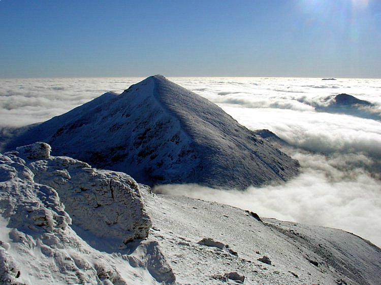
 Ben Vorlich from the south | |
| Highest point | |
| Elevation | 943 m (3,094 ft)[1] |
| Prominence | 632 m (2,073 ft) |
| Parent peak | Beinn Ìme |
| Listing | Munro, Marilyn, County top (Dunbartonshire) |
| Naming | |
| Language of name | Gaelic |
| Pronunciation | Gaelic [peɲ ˈvuːrˠl̪ˠɛkʲ] ( |
| Geography | |
| Location | Arrochar Alps, Argyll, Scotland |
| Parent range | Arrochar Alps, Grampian Mountains |
| OS grid | NN295124 |
| Topo map | OS Landranger 56 |
The A82 road and the West Highland railway line run on the eastern side of Ben Vorlich, above the shoreline of Loch Lomond.
The peak forms a north–south ridge on the western side of Loch Lomond, with a subsidiary ridge known as Little Hills running from the summit east down to the shores of the loch. There are three small summits around 800 m apart along the main ridge; the central one is the highest, though the southern one has a trig point.
References
- "walkhighlands Ben Vorlich (Loch Lomond)". walkhighlands.co.uk. 2013. Retrieved 16 October 2013.
- "Ben Vorlich, Loch Lomond". Ainmean-Àite na h-Alba: Gaelic Place-Names of Scotland.
 |
|  | |
List of Munros | |||
Most prominent mountains of Britain and Ireland (the P600s) | ||
|---|---|---|
| Northern Highlands (20) |    | |
| Western Highlands (20) | ||
| Central and Eastern Highlands (13) | ||
| Southern Highlands (15) |
| |
| Islands (13) | ||
| Scottish Lowlands, England and Wales (13) | ||
| Republic of Ireland, Northern Ireland (25) | ||
This Argyll and Bute location article is a stub. You can help Wikipedia by expanding it. |
На других языках
[de] Ben Vorlich (Loch Lomond)
Der Ben Vorlich ist ein 943 m (3.094 ft) hoher Berg in Schottland. Sein gälischer Name Beinn Mhùrlaig bedeutet ungefähr Berg oder Hügel der Bucht.[1] Der Berg ist die nördlichste Erhebung der Arrochar Alps. Diese Berggruppe liegt zwischen dem nördlichen Ende von Loch Long und dem Westufer von Loch Lomond in den südlichen Highlands im Loch Lomond and the Trossachs National Park. Von der Hauptgruppe der Arrochar Alps mit dem Ben Arthur, dem Beinn Ìme und dem Ben Vane ist der Ben Vorlich durch Loch Sloy und das diesen Stausee entwässernde Inveruglas Water getrennt. Der über dem Westufer von Loch Lomond aufragende Ben Vorlich ist als Munro eingestuft.- [en] Ben Vorlich, Loch Lomond
Другой контент может иметь иную лицензию. Перед использованием материалов сайта WikiSort.org внимательно изучите правила лицензирования конкретных элементов наполнения сайта.
WikiSort.org - проект по пересортировке и дополнению контента Википедии