geo.wikisort.org - Island
Kasos (/ˈkɑːsoʊs/; Greek: Κάσος, pronounced [ˈka̠so̞s]), also Casos, is a Greek island municipality in the Dodecanese. It is the southernmost island in the Aegean Sea, and is part of the Karpathos regional unit. The capital of the island is Fri. As of 2021[update], its population was 1,224.[1]
Κάσος
Kasos | |
|---|---|
 Old Harbor of Fri | |
 Κάσος Location within the region 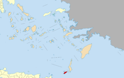 | |
| Coordinates: 35°23′51″N 26°55′30″E | |
| Country | Greece |
| Administrative region | South Aegean |
| Regional unit | Karpathos |
| Area | |
| • Municipality | 69.464 km2 (26.820 sq mi) |
| Highest elevation | 550 m (1,800 ft) |
| Lowest elevation | 0 m (0 ft) |
| Population (2021) | |
| • Municipality | 1,224 [1] |
| Time zone | UTC+2 (EET) |
| • Summer (DST) | UTC+3 (EEST) |
| Postal code | 85800 |
| Area code(s) | 22450 |
| Vehicle registration | ΚΧ, ΡΟ, ΡΚ |
| Website | www.kasos.gr |

Names
There are several references to the island in the works of ancient authors, including as Amphe (Ἄμφη),[2] Astrabe (Άστράβη),[2] and Achni (Άχνη). Kasos is thought to derive from the Phoenician kas.[3][better source needed] The island is also known in Italian as Caso[4] and in Turkish as Kaşut or Çoban (چوبان).[5]
Geography
Kasos lies southwest of Karpathos, and east of Crete. The island lies within the subtropical zone, being at 35ºN latitude. Adjacent to the island is the Strait of Kasos, through which some of the Modified Atlantic Water enters the Sea of Crete.[6] Its shape is elliptic and resembles that of Rhodes. The main island has a surface of 49 square kilometres (19 sq mi), and it is 17 km (11 mi) long and 6 km (4 mi) wide.[7] It is very mountainous, with its highest mount being Mt. Prionas, which is 550 metres (1,800 feet) high.[7] There is fresh water on the island.[7] Lawrence Durrell is rather disparaging about the island, begrudging it a mere 22 words in a brief comparison to Karpathos, calling it a "smaller, stonier version of the same sort of thing."[8]
The Florentine monk and geographer Christoforo Buondelmonti, around 1415, explored Karpathos and makes a reference to seeing Kasos in the distance.[9] His map of Karpathos seems to include a schematic view of Kasos to the west.[10] In 1687, the English merchant Bernard Randolph referred to the island as Cassio or Casos, and wrote the following about it:[11]
Tho 'tis but a small Island, yet it abounds in all things necessary for life. The middle of the Island is almost a plain, well planted with Olive trees, and Vine-yards; with all sorts of Fruits. To the West are five small Islands, amongst which is very good riding for ships. These Islanders have obtained a great favour from the Port, by means of a Favorite of Solyman the Magnificent, who obtained a Command, that none of the tribute-Masters should molest them, they shewing a discharge, for 1000 dollars yearly to be paid at Constantinople for all taxes. Yet are they but poor, (or at least pretend so) Here is a Monastery of Candiotes, who came from the City of Settia, when that City was destroyed; They live here very well, and have the enjoyment of their possessions on the Island of Candia, paying only the tenths to the Turks.
A bona fide early tourist to leave an engaging description of the island's interior and inhabitants was the Orientalist, pioneer of Egyptology, and translator of the Quran, Claude-Étienne Savary; while on his way to Crete in late 1779, bad weather made him remain several days on the island. His account is made more poignant, depicting as it does a harmonious setting just forty years before the Ottoman devastation of 1824.[12] The French naturalist Charles Sigisbert Sonnini, visiting a few years after Savary, at the end of the 18th century, commented on the "very good wine" and "the honey which they gather [being] still, as in ancient times, abundant, and of excellent quality".[13]
In 1888, the Austro-Polish geologist Gejza Edler Bukowski von Stolzenburg (1858–1937), was on the island to conduct a geological survey. He writes (translated from the German): "A few days were enough to get an overview of the geological construction of this small island…" His results were published in 1890 in Vienna, along with a map.[14]
The Municipality of Kasos (Δήμος Κάσου) includes several uninhabited offshore islands, the largest of which are Armathia and Makronisi.[15] Its total land area is 69.464 square kilometres (26.820 sq mi).[16]
The island has five villages, Fri (pronounced like "free", pop. 357[15]), Agia Marina (444[15]), Panagia (34[15]), Poli (80[15]), and Arvanitochori (169[15]). Fri is the capital and home to the island's harbor and Agia Marina is the most populous village. The airport is located close to Fri and is big enough for an ATR 42 to land.
In the early 1950s, the English travel-writer Robert Liddell visited the island for the memorial of the 1824 holocaust, that takes place every June. He wrote that "[t]he best things about Phry are its odd, little name (short for Ophrys), and the magnificent outline of Cárpathos seen in the east."[17]
History
From the apparent derivation of the name, it would seem that the island was known to Phoenician traders, who might have sought shelter there, although no evidence has come to light.[18][19] The first known settlements are Minoan and Mycenaean in origin.[20] According to Homer (Iliad, 2.676), Kasos contributed ships toward the Trojan War.[21] During Classical Antiquity it closely followed the history of nearby Karpathos.[4] It was a member of the Delian League.[22]
After a short period in the hands of the Knights of St John, Kasos was governed by the Venetian Cornaro family from 1306, before falling to Barbarossa and the Ottomans in 1537.[4] The whereabouts of the Venetian administrative centre are not recorded; there are considerable structural remains in and around the Byzantine area of Panagia, with its picturesque group of early chapels known as "Six Churches" (Έξι Εκκλησίες). In 1912, Frederick W. Hasluck discovered a collection of medieval coins in Smyrna, that are believed to have been concealed on the island of Kasos around 1370; they are now known as the "Kasos Hoard".[23]
Kasos took part in the Greek Revolution and supported the cause with its fleet. In 1824, Mehmet Ali Pasha of Egypt, furious with the Kasiots, dispatched his fleet to the island, where the Egyptian armada plundered the island, killed 500 people and enslaved 2000, an event described as the Kasos massacre.
The island's population recovered as did its economy, still largely based on shipping. The introduction of steam ships made Kasos' shipyard (which produced wooden sailing ships) redundant and its economy suffered accordingly. Beginning in the later half of the 19th century, many emigrated from Kasos, initially to Egypt (about 5,000 people), then to Istanbul, Greece, USA and South Africa. By the 1920s, out of about 2,300 houses on the island, only 400 were permanently inhabited.[4]
On 12 May 1912, during the Italo-Turkish War of 1911-12, after the so-called "Battle of Cassos" which took place on 29 January 1912, the island was occupied by the sailors of the Regia Marina ship Regina Elena.[4] With the 1923 Treaty of Lausanne, Kasos joined the other islands of the Dodecanese in the Italian possession of the Italian Aegean Islands.
In March 1935 the Greek naval warship Averof evacuated Eleftherios Venizelos from Helatros beach,[24] where today a commemorative bust marks the statesman's failed coup attempt and subsequent exile and death in Paris the following year.[25]
As the Second World War unfolded in the Aegean, in the spring of 1941 a small band of British special operatives based on Crete planned a raid on Kasos to assess the strength of the Italian garrison. On 20 May, the raiding party, including John Pendlebury, and their vessel, H.M.S. Dolphin, an armed caique, got as far as the islet of Elasa, some 50 km east of Kasos, before they were forced to abort their mission by German fighter aircraft. Crete fell to the Germans a few days later.[26] In September 1943, after the armistice with the angloamericans, the Italians lost control of the Dodecanese for the rest of the war to Nazi Germany, which already occupied almost all of Greece: although defended by a small Italian garrison, Kasos was lost to the Germans on the 18th of that month, remaining under German occupation until the summer of 1945.[27]
Dr. Raymond Mills[28] records being the medical officer on Kasos at the end of the war in charge of 3000 Greek and Italian refugees, who had escaped from the German occupation of the three islands of Rhodes, Kos and Leros; these men were repatriated later in 1945.[29]
Kasos was ceded by Italy to Greece with the Paris Peace Treaties of 1947. The island formally joined the Kingdom of Greece on 7 March 1948 together with the other Dodecanese islands.
Archaeology
The Kasos Archaeological Museum,[30] curated in Fri's original demarcheion, includes material from all periods of the island's history: Prehistoric to Early Christian times; exhibits linked to the 1821 Greek War of Independence, and the Kasos Massacre of 1824; and artefacts related to local history and folklore.
The Ellinokamara site outside Agia Marina, with remains from prehistory to Byzantine times, has been extensively investigated.[31] The site first reached the attention of Western scholarship in 1845 as a result of a visit in September 1843 by the German classical archaeologist Ludwig Ross.[32] In 1879, Pierre-Marie-Mondry Beaudouin[33] recorded several inscriptions, carefully identifying their findspots.[34]
The Bronze Age and later acropolis of Poli has a few vestiges of early defensive walling. The associated cemeteries featured some burials with unique, inscribed lenticular discs, mainly from the 4th and 3rd centuries BC, some of which are on display in Fri's museum.[35] One of them, immortalizing one Αυσίδαμος (Avsidamos), was acquired by Charles Thomas Newton in the mid 1850s and given to the British Museum.[36]
In 2019, archaeologists discovered a number of shipwrecks dating from several different historical periods. Scientists have also found evidence that points towards an ancient port facility.[37] The investigations in the area continued in January 2021, and the scientists revealed four further wrecks, dating back to the Greek, Roman and Byzantine eras; one was a 2,000-year-old Roman ship with amphorae. Archaeologists also found iron cannons, pottery and some random objects.[38]
Natural history
Early identification of some of the botanical species of the island was undertaken in a brief visit by Charles Forsyth Major in 1886 and published in 1894.[39] More recently (2021), scientists Cristina Cattaneo and Mauro Grano undertook an updated floristic and ecological analysis.[40]
In 1993, an account was published of the discovery on the island of a slug described as "obviously an endemic species of Kasos island".[41]
A dead specimen of the grass snake Natrix natrix (Linnaeus, 1758) (Squamata, Serpentes) was found on the island by Mauro Grano and Cristina Cattaneo in August 2019, representing a new record for the island. They write in their paper that the island's "position, geological history, small size and extreme aridity lead to a rather poor herpetofauna containing one amphibian… and six reptiles".[42]
In 2021, researchers published the first identification on the island of the lesser shrew (Crocidura suaveolens).[43]
Climate
Kasos has a dry and mild climate throughout the year, with the most rain falling during autumn and winter. According to the data of the National Observatory of Athens station, Kasos has a hot semi-arid climate and records the mildest winters in Greece, with a record low temperature of 2.7 °C (for the period 1989-2022).[44]
| Climate data for Kasos (2010-2022) | |||||||||||||
|---|---|---|---|---|---|---|---|---|---|---|---|---|---|
| Month | Jan | Feb | Mar | Apr | May | Jun | Jul | Aug | Sep | Oct | Nov | Dec | Year |
| Record high °C (°F) | 22.1 (71.8) |
25.2 (77.4) |
25.8 (78.4) |
30.5 (86.9) |
36.7 (98.1) |
37.2 (99.0) |
35.7 (96.3) |
36.9 (98.4) |
35.7 (96.3) |
32.8 (91.0) |
27.4 (81.3) |
24.4 (75.9) |
37.2 (99.0) |
| Average high °C (°F) | 15.8 (60.4) |
16.4 (61.5) |
17.4 (63.3) |
19.8 (67.6) |
23.5 (74.3) |
26.0 (78.8) |
28.1 (82.6) |
28.2 (82.8) |
26.7 (80.1) |
23.7 (74.7) |
20.7 (69.3) |
17.6 (63.7) |
22.0 (71.6) |
| Daily mean °C (°F) | 13.7 (56.7) |
14.3 (57.7) |
15.1 (59.2) |
17.1 (62.8) |
20.7 (69.3) |
23.9 (75.0) |
26.2 (79.2) |
26.6 (79.9) |
24.9 (76.8) |
21.8 (71.2) |
18.7 (65.7) |
15.6 (60.1) |
19.9 (67.8) |
| Average low °C (°F) | 11.6 (52.9) |
12.1 (53.8) |
12.9 (55.2) |
14.5 (58.1) |
18.0 (64.4) |
21.7 (71.1) |
24.2 (75.6) |
24.9 (76.8) |
23.2 (73.8) |
19.8 (67.6) |
16.7 (62.1) |
13.5 (56.3) |
17.7 (63.9) |
| Record low °C (°F) | 2.7 (36.9) |
4.3 (39.7) |
5.2 (41.4) |
7.2 (45.0) |
13.6 (56.5) |
16.2 (61.2) |
20.4 (68.7) |
21.1 (70.0) |
17.6 (63.7) |
14.4 (57.9) |
11.1 (52.0) |
6.3 (43.3) |
2.7 (36.9) |
| Average rainfall mm (inches) | 62.2 (2.45) |
33.5 (1.32) |
42.9 (1.69) |
14.6 (0.57) |
8.0 (0.31) |
1.1 (0.04) |
1.2 (0.05) |
0.1 (0.00) |
4.1 (0.16) |
24.5 (0.96) |
29.3 (1.15) |
50.0 (1.97) |
271.5 (10.69) |
| Source: Karpathiakanea.gr[45] | |||||||||||||
Notable residents
- Dimitrios Antoniou (1906-1994), poet, better known by his pen name D. I. Antoniou (Greek: Δ.Ι. Αντωνίου).
- Kassia (revered in the Eastern Orthodox Church as St. Kassiane), a Byzantine abbess, poet, composer, and hymnographer.
- Antoine Malliarakis Mayo (French/Greek, 1905-1990) surrealist artist, born in Port Said, the son of an engineer from Kasos.[46] The surname is shared with that of the hero of the 1824 massacre.[47]
- Nikolaos G. Mavris (1899–1978), physician, regional administrator, philanthropist, author, folklorist. The Municipal Library in Fri was his foundation. His papers are archived in the American School of Classical Studies at Athens.[48]
See also
- Kasos Massacre
References
- "Results of the 2021 Population-Housing Census (Αποτελέσματα Απογραφής Πληθυσμού - Κατοικιών 2021)". statistics.gr. Hellenic Statistical Authority. 19 July 2022. Retrieved 2 August 2022.
- Stephanus of Byzantium. Ethnica. Vol. s.v. Κάαος.
- "ToposText".
- Bertarelli, 139
- Osmanlı Yer Adları, Ankara 2017
- Peter Saundry, C.Michael Hogan & Steve Baum. 2011. Sea of Crete. Encyclopedia of Earth. Eds.M.Pidwirny & C.J.Cleveland. National Council for Science and Environment. Washington DC.
- Bertarelli, 138
- Lawrence Durrell, The Greek Islands (1978), p.145.
- 'Et in conspectu Casso insula est, Venetesque Corachi oppidum prope montem Gomali apparent in alto', Christoforo Buondelmonti, Librum Insularum Archipelagi, edited by Gabriel Rudolf Ludwig von Sinner, Leipzig, 1824, p.71.
- "BUONDELMONTI, Cristoforo - Ionian islands - TRAVELLERS' VIEWS - Places – Monuments – People Southeastern Europe – Eastern Mediterranean – Greece – Asia Minor – Southern Italy, 15th -20th century".
- Bernard Randolph (1687), The present state of the islands in the archipelago, or Arches, seas of Constantinople and gulph of Smyrna with the islands of Candia and Rhodes. Oxford Text Archive, http://hdl.handle.net/20.500.12024/A70955.
- With something of his contemporary the Vicomte de Valmont about him, Savary was much taken by the place… "and the wind must detain us here a long time before I wish it to change…" (Claude-Étienne Savary: Letters on Greece: being a sequel to Letters on Egypt, and containing travels through Rhodes, Crete, and other islands of the Archipelago..., translated into English and published in Dublin in 1788, Letter XVI, pp.119-141).
- Travels in Greece and Turkey, undertaken by order of Louis XVI, and with the authority of the Ottoman court, C.S. Sonnini, London, 1801, p.134.
- Gejza Edler Bukowski (1890), Der geologische Bau der Insel Kasos : (Mit 1 geologischen Karte.) Aus d. Sitz.-Ber. d. k. Akad. d. Wissensch. in Wien. Mathem.-naturw. Classe; Bd. 98, Abth. 1. Juli 1889, pp. 653-669. The geologist concludes by thanking 'Mr. Elie Manolaki and Andrea Manolakaki for the very friendly hospitality… which I have had with them throughout my stay on Kasos.' (translated from the German).
- 2011 Greek census: "Απογραφή Πληθυσμού - Κατοικιών 2011. ΜΟΝΙΜΟΣ Πληθυσμός". Hellenic Statistical Authority. (in Greek)
- "Population & housing census 2001 (incl. area and average elevation)" (PDF) (in Greek). National Statistical Service of Greece. Archived from the original (PDF) on 2015-09-21.
- Robert Liddell, Aegean Greece (1954), pp. 207-212.
- Svidae Lexicon, pars ΙΙΙ, λήμμα 454, "Κάσιον ρος παρά τ Ε φράτ ..,", Ευαγγελίδης - Μιχαηλίδης Νουάρος 1935, 19-20 (see fn 8 in Αγγελική Γιαννικουρή – Φωτεινή Ζερβάκη, ΔΩΕΚΑΝΗΣΙΑΚΑ ΧΡΟΝΙΚΑ 21, 2007, pp.331-354).
- 'From as early as Neolithic times, all three islands must have served as intermediary stations for people who were moving across the Aegean, from Phoenicia and Western Anatolia to Crete and vice versa', Emmanuel Melas, The Islands of Karpathos, Saros and Kasos in the Neolithic and Bronze Ages, unpublished PhD thesis, Bedford College, University of London, 1985, p.39.
- Melas, E.M. (2010-03-12). "Minoan and Mycenaean Settlement in Kasos and Karpathos". Bulletin of the Institute of Classical Studies. 30: 53–61. doi:10.1111/j.2041-5370.1983.tb00435.x.
- "And they that held Nisyrus and Crapathus and Casus and Cos, the city of Eurypylus, and the Calydnian isles..." (trans. A.T. Murray, 1924).
- "ToposText". topostext.org.
- F.W. Hasluck (1912), "Contributions to the History of Levant Currencies. 1 – A Hoard of Medieval Coins from the Sporades", The Annual of the British School at Athens, vol. 19, pp. 174–181. Julian Baker (2021), Coinage and Money in Medieval Greece 1200-1430, Leiden, p.1497.
- "Kasos Island | Greece | Dodecanese | Official website of the Municipality of Kasos".
- "Τέτοιες μέρες του 1935 ο Ελ. Βενιζέλος περνούσε από Κάσο και Κάρπαθο". 15 March 2021.
- Nicholas Hammond, in J.D.S Pendlebury, S.C. Roberts, T.J. Dunbabin, N. Hammond (1948), John Pendlebury in Crete: comprising his 'Travelling Hints', and his 'First Trip to Eastern Crete' (1928) together with appreciations.
- Barbara Tomblin (2004, p.311), With Utmost Spirit: Allied Naval Operations in the Mediterranean, 1942-1945.
- Tait, Mr (September 5, 2013). "Dr Alfred Raymond Mills, FRCP Edin". www.rcpe.ac.uk.
- Raymond Mills (1987), 'With Lawrence Durrell on Rhodes, 1945-47' in Twentieth Century Literature Vol. 33/3 (Autumn, 1987), pp. 312-316.
- "Archaeological Collection of Kasos | Directorate of Archaeological Museums, Exhibitions and Educational Programs".
- "ToposText".
- Ross, Ludwig: 'Reisen auf den griechischen Inseln des ägäischen Meeres.' Dritter Band [= Vol. III]. Enthaltend Melos, Kimolos, Thera, Kasos, Karpathos, Rhodos, Chalke, Syme, Kos, Kalymnos, Ios (Reisen und Länderbeschreibungen in der älteren und neuesten Zeit, eine Sammlung der interessantesten Werke über Länder- und Staaten-Kunde, Geographie und Statistik, 31. Lieferung). Stuttgart und Tübingen 1845, p.32.
- "CTHS - MONDRY BEAUDOUIN Pierre-Marie".
- M. Beaudouin, 'Inscriptions de Kasos', BCH 4 (1880), pp.121-124.
- R. Stillwell (ed.), The Princeton Encyclopedia of Classical Sites, 1976, Princeton, NJ, p.440. See also, F. Hiller von Gaertringen (ed.), 'Inscriptiones Graecae XII, 2. Inscriptiones Rhodi, Chalces, Carpathi cum Saro, Casi (Inscriptions de Rhodes, Chalcis, Carpathus avec Saros et Kasos)', 1895, pp.173-174.
- Item 2011,5008.2, and see The Collection of Greek Inscriptions in the British Museum, London, 1916, Part II, Chapter 4, p.138.
- Day, Joel (November 26, 2019). "Archeology breakthrough: 2,500-year-old ancient Greek shipwrecks found". Express.co.uk.
- "Marine archeologists discover ancient shipwrecks off island in the Aegean". news.yahoo.com. Retrieved 2021-01-27.
- Major, C.J.F. & Barbey, W., 'Kasos. Etude botanique', in Bull. Herb. Boissier, 1894 (2): 329-341.
- Cristina Cattaneo & Mauro Grano, 'Kasos: an unexpected island. Floristic and ecological analysis of Kasos Island (SE Aegean, Dodecanese, Greece), with noteworthy floristic additions', in Phytologia Balcanica 27 (3): 345-371, Sofia, 2021.
- Wolfgang Rähle (1993), 'Deroceras kasium n. sp., eine neue Nacktschnecke von der Insel Kasos (Dodekanes, Greichenland) (Gastropoda: Pulmonata: Agriolimacidae)', in Archiv für Molluskenkunde, Band 121, Heft 1-6 (1992), pp.111-115.
- Mauro Grano and Cristina Cattaneo (2020), A new record of the grass snake, Natrix Natrix (Linnaeus, 1758) (Squamata, Serpentes) in Kasos Island (Dodecanese, Greece), in PARNASSIANA ARCHIVES 8, pp. 13-16 (published online: January 17, 2020). Their paper contains a useful bibliography.
- Armando Nappi, Cristina Cattaneo & Mauro Grano, 'A new mammal species from Kasos Island (Dodecanese, Greece): Crocidura suaveolens (Pallas, 1811) (Mammalia Soricomorpha Soricidae)', in Biodiversity Journal, 2021, 12 (1): 201-204.
- "The areas with the mildest winters in Greece". Karpathiakanea.gr. 12 April 2022. Retrieved 16 April 2022.
- "The areas with the mildest winters in Greece" (in Greek). Karpathiakanea.gr. 12 April 2022. Retrieved 16 April 2022.
- "Exhibition "MAYO 1905-1990. DONATION BY LUCILLA MUSSINI-BOMBIERI"".
- "Το αεροδρόμιο της Ηρωικής Ν. Κάσου ονομάζεται πλέον «Μάρκος Μαλλιαράκης»". in.gr. June 12, 2021.
- "Nicholas G. Mavris Papers | American School of Classical Studies at Athens".
Sources
- Bertarelli, L.V. (1929). Guida d'Italia, Vol. XVII. Consociazione Turistica Italiana, Milano..
External links
- Official website (in English and Greek)
Administrative division of the Southern Aegean Region | ||
|---|---|---|
| ||
| Regional unit of Andros |
|  |
| Regional unit of Kalymnos | ||
| Regional unit of Karpathos | ||
| Regional unit of Kea-Kythnos | ||
| Regional unit of Kos | ||
| Regional unit of Milos | ||
| Regional unit of Mykonos | ||
| Regional unit of Naxos |
| |
| Regional unit of Paros | ||
| Regional unit of Rhodes |
| |
| Regional unit of Syros | ||
| Regional unit of Thira | ||
| Regional unit of Tinos | ||
| ||

Authority control | |
|---|---|
| General |
|
| National libraries | |
На других языках
[de] Kasos
Die griechische Insel Kasos (griechisch Κάσος (f. sg.)) bildet mit den unbewohnten Inseln Armathia, Makronisi und weiteren Felseninselchen die gleichnamige Gemeinde (griechisch δήμος, Dimos) in der Region Südliche Ägäis. Die 66,419 km²[2] große Dodekanes-Insel liegt etwa 7 km südwestlich von Karpathos und rund 70 km nordöstlich von Kreta und ist damit die südlichste Insel der Dodekanes. Der Prionas ist mit 601 Meter der höchste Berg der Insel.[3]- [en] Kasos
[es] Kasos
Kasos (en griego, Κάσος) es una isla griega perteneciente al archipiélago del Dodecaneso, en el mar Egeo. Su población es de aproximadamente 1000 habitantes siendo su capital el puerto de Fry.[1][fr] Kassos
Kassos (grec moderne : Κάσος) est une île grecque qui fait partie de l'archipel et du nome du Dodécanèse dans la mer Égée. Elle compte environ 1 000 habitants. Sa capitale est le port de Fry qui compte 357 habitants.[ru] Касос
Ка́сос[1][2] (греч. Κάσος) — остров на юго-востоке Эгейского моря, принадлежит Греции.Другой контент может иметь иную лицензию. Перед использованием материалов сайта WikiSort.org внимательно изучите правила лицензирования конкретных элементов наполнения сайта.
WikiSort.org - проект по пересортировке и дополнению контента Википедии