geo.wikisort.org - Coast
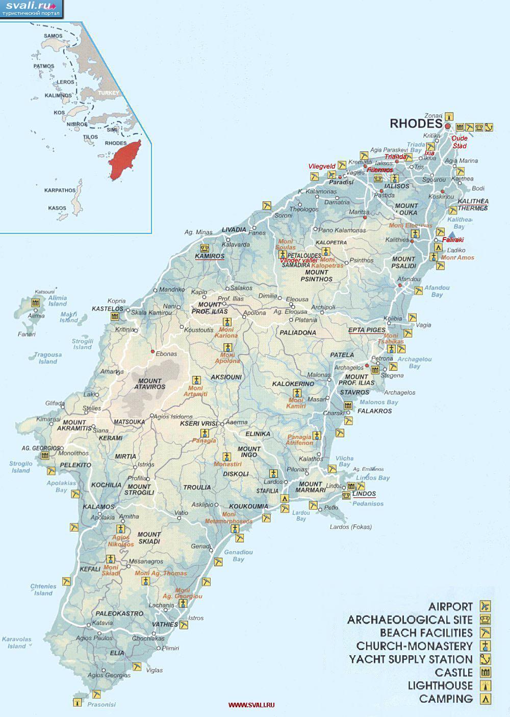
Prasonisi (also Prassoníssi) cape is a part of the island of Rhodes. It is located 92 km from Rhodes town; 40 km from Lindos, at the southern part of Rhodes.[1]
This article needs additional citations for verification. (September 2019) |

Overview
Prasonisi is the Greek word for "green island". During summer time, and when water levels are low enough, this island is a peninsula attached to Rhodes. During the winter time, and when water levels are high enough, Prasonisi becomes an island. The southernmost tip of Prasonisi contains the Prasonisi Lighthouse. The closest Greek village is Katavia; however, there is a purpose-built settlement on Prasonisi that contains motels, convenience stores, restaurants, and windsurf rentals which are open seasonally. Near Prasonisi is Vroulia, an ancient settlement that contains an old mosaic tiled floor.
Watersports

Prasonisi is noted to be a good place for windsurfing and kitesurfing due to predictable and reliable winds with certain qualities (not gusty, constant direction and during particular times of the day). From one side of the cape there is the Aegean Sea with good waves and views for advanced surfers. From the other side, there is the Mediterranean Sea with flat water which is better suited for beginners. The area has its high season for tourists in July and August and the flat side of the water becomes very busy.
Prasonisi Environmental Deterioration
Due to the big number of tourists that gather there, Prasonisi has lost its pristine beauty and there is great evidence of environmental damage. Visitors (mostly tourists) used to drive all around the beach with scooters and cars. As such, the sand has a solid feeling now and it is almost like concrete at certain parts of the beach although this is changing since the creation of a line that cannot be crossed by vehicles. The protected turtle known as Caretta caretta used to hide its eggs at the specific region but this rarely happens anymore due to the lack of environmental management of the territory. For this reason rigorous protective measures have to be undertaken to protect virgin nature landscapes and ancient archaeological sites in the area.
The local authorities have been unable to organise any services or take the appropriate steps to ensure the preservation of the area. Large motor homes are allowed onto certain areas of the sandbar without any charged fees which could have been a source of revenue to provide services such as sanitary, water etc. to the motor home users and other Prasonisi visitors.
References
- Ancarola, Gabi (22 January 2018). "Prasonisi: Greek Island in Winter, Peninsula in Summer". Greek Reporter. Retrieved 17 July 2018.
External links
На других языках
[de] Prasonisi
Prasonisi (griechisch Πρασονήσι (n. sg.)) ist eine etwa 3 km² große, felsige Halbinsel, die durch eine Sandbank mit Rhodos verbunden ist.- [en] Prasonisi
[fr] Prassoníssi (Rhodes)
Prasonisi ou Prassoníssi (en grec moderne : Πρασονήσι) est une île grecque située dans le sud de la mer Égée reliée par une langue de terre à l'île de Rhodes dans le Dodécanèse. Son nom signifie l'« île verte ». Une seconde Prasonisi fait partie des Alcyonides, dans le golfe de Corinthe.[it] Prassonissi
Prassonissi, anche chiamata Prasonisi (in greco: Πρασονήσι), è un'isola tidale che si trova all'estremità meridionale dell'isola di Rodi. Si tratta di un promontorio, sul quale si erge un faro, unito all'isola da una striscia di sabbia, che diventa un'isola con l'alta marea, dando origine a quel fenomeno conosciuto come "l'incontro dei due mari", il mar di Levante ed il mar Egeo. Così, mentre il mare occidentale è agitato per il soffiare del vento Meltemi, quello orientale è calmo. Si assiste ad un fenomeno particolare che è il paradiso dei surfisti. Ancora oggi è una zona disabitata e con pochissime strutture, ancora lontana dal turismo di massa come quasi tutta la costa occidentale dell'isola che non ha strutture turistiche ma è prevalentemente agricola. Ci si arriva, dalla città di Rodi, sia dalla parte orientale che da quella occidentale oppure con itinerari interni se si vuol fare una visita a Petaloudes (la Valle delle farfalle) o ad altri piccoli centri storici tra i quali Psinthos, Epta Piges e Theologos.[ru] Прасонисион (Родос)
Прасони́сион[1] (греч. Πρασονήσιον), также Прасони́си[2][3] (Πρασονήσι от πράσινο νησί — зелёный остров), также Фарос (Φάρος — маяк) — полуостров[1] в Греции. Наивысшая точка 83 м над уровнем моря[1]. Его оконечностью является мыс Прасо[1] в проливе Карпатос[3], омываемый Критским и Ливийским морями, юго-западная оконечность Родоса. Представляет собой остров, летом при низком уровне воды соединённый песчаным перешейком с Родосом. Находится в 91 километре к юго-западу от города Родоса, в 12 километрах к югу от деревни Катавия (Κατταβία) и в 40 километрах к юго-западу от Линдоса.Другой контент может иметь иную лицензию. Перед использованием материалов сайта WikiSort.org внимательно изучите правила лицензирования конкретных элементов наполнения сайта.
WikiSort.org - проект по пересортировке и дополнению контента Википедии