geo.wikisort.org - Island
Fournoi Korseon (Greek: Φούρνοι Κορσέων), more commonly simply Fournoi (Greek: Φούρνοι), anciently known as Corsiae or Korsiai (Ancient Greek: Κορσίαι, Corseae or Korseai (Κορσεαί),[2] and Corsia or Korsia (Κορσία),[3] form a complex or archipelago of small Greek islands that lie between Ikaria, Samos and Patmos in Ikaria regional unit, North Aegean region. The two largest islands of the complex, the main isle of Fournoi 31 square kilometres (12 square miles) and the isle of Thymaina 10 square kilometres (3.9 square miles), are inhabited, as is Agios Minas Island 2.3 square kilometres (0.9 square miles) to the east. The municipality has an area of 45.247 km2.[4] On the main isle Fournoi (town) is the largest settlement and then Chrysomilia in the north the second largest (and third largest overall, after Thymaina). Fournoi (town) proper is the main ferry harbour, with ferries also landing on Thymaina.
Fournoi Korseon
Φούρνοι Κορσέων | |
|---|---|
 The main village | |
 Fournoi Korseon Location within the region  | |
| Coordinates: 37°34′N 26°30′E | |
| Country | Greece |
| Administrative region | North Aegean |
| Regional unit | Ikaria |
| Area | |
| • Municipality | 45.247 km2 (17.470 sq mi) |
| Population (2011)[1] | |
| • Municipality | 1,459 |
| • Municipality density | 32/km2 (84/sq mi) |
| Time zone | UTC+2 (EET) |
| • Summer (DST) | UTC+3 (EEST) |
| Postal code | 833 xx |
| Area code(s) | 22750 |
| Vehicle registration | MO |
| Website | www.fournikorseon.gr |


Many of the inhabitants are fishermen, although during the summer season the population is also occupied in tourist activities, mostly room rentals and catering. On the main island are a number of beaches such as Vlychada, Vitsilia, Petrokopio, Elidaki, and Bali.
The archipelago is famous for being a hub of the Ancient World, which resulted in 53 shipwrecks found in the area until 2017.[5] Another five shipwrecks were found in 2018, raising the total number to 58.[6] Those wrecks date back from 4th century BC to 19th century AD.[7]
Climate
The climate is arid and hot during summers. Winters are rather mild with average rainfall but constant strong archipelagic winds prevail.
Transportation
Transportation is often interrupted during the winter period (mostly from November to April) due to bad weather, mainly strong winds. The rest of the year regular links with the islands of Ikaria and Samos (by boat only) is available. Since 2008 a ferry coming from Samos reaches Athens stopping also in Icaria and Paros.
Archaeology
Archaeologist discovered a ship graveyard off the coast of the Fourni Islands, with 53 ships. It contains wrecks dating from the 4th century BC through the 19th century AD. In 2018, archaeologists discovered five additional vessels, bringing the total number of ships found there to 58. The newly discovered ships rest in shallow waters and show signs of damage from fishing nets and plunderers, the archaeological team also found cargoes of amphoras that carried wine, oil, and other foods, and a load of terracotta lamps dating to the 2nd century AD. The lamps were made in Corinthian workshops, and bear the names of the artisans who crafted them, Octavius and Lucius.[8]
Settlements and islands
The main island of Fournoi has a population of 1,320 (as of the 2011 census[update]), or over 90 percent of the municipality's population. The only other inhabited islands are Agios Minas, and Thymaina.
| Settlement or Place | Population | Island |
|---|---|---|
| Agios Minas | 3 | Agios Minas Island |
| Alatonisi | 0 | Alatonisi Island |
| Anthropofas | 0 | Anthropofas Island |
| Agios Ioannis Thermastis | 1 | Fournoi Island |
| Bali | 6 | Fournoi Island |
| Chrysomilea | 104 | Fournoi Island |
| Dafnolies | 2 | Fournoi Island |
| Fournoi | 1,120 | Fournoi Island |
| Kamari | 14 | Fournoi Island |
| Kampi Fournon | 15 | Fournoi Island |
| Kampi Chrysomileas | 50 | Fournoi Island |
| Kerameidou | 7 | Fournoi Island |
| Plagia | 1 | Fournoi Island |
| Kisiria | 0 | Kisiria Island |
| Makronisi | 0 | Makronisi Island |
| Mikros Anthropofas | 0 | Mikros Anthropofas Island |
| Petrokaravo | 0 | Petrokaravo Island |
| Plaka | 0 | Plaka Island |
| Plakaki | 0 | Plakaki Island |
| Strongylo | 0 | Strongylo Island |
| Thymaina | 136 | Thymaina Island |
| Thymainaki | 0 | Thymainaki Island |
References
- "Απογραφή Πληθυσμού - Κατοικιών 2011. ΜΟΝΙΜΟΣ Πληθυσμός" (in Greek). Hellenic Statistical Authority.
- Stephanus of Byzantium. Ethnica. Vol. s.v.
- Strabo. Geographica. Vol. 14.1.13. Page numbers refer to those of Isaac Casaubon's edition.
- "Population & housing census 2001 (incl. area and average elevation)" (PDF) (in Greek). National Statistical Service of Greece. Archived from the original (PDF) on 2015-09-21.
- "Shipwrecks Identify Fournoi as Significant Hub of Ancient World". gtp. 14 July 2017.
- "Greece: Ancient wrecks, pottery found at ships' 'graveyard'". AP News. 15 October 2018.
- "Five Shipwrecks Found Near Greece's Fourni Islands". Archaeology. 16 October 2018.
- Five Shipwrecks Found Near Greece’s Fourni Islands
External links
Administrative division of the Northern Aegean Region | ||
|---|---|---|
| ||
| Regional unit of Chios | 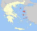 | |
| Regional unit of Ikaria | ||
| Regional unit of Lemnos | ||
| Regional unit of Lesbos |
| |
| Regional unit of Samos |
| |
| ||

| Authority control: National libraries |
|---|
На других языках
[de] Fourni (Ägäis)
Die griechische Inselgruppe Fourni (griechisch Φούρνοι (m. pl.)) bildet die Gemeinde Fourni Korseon (Δήμος Φούρνων Κορσεών) und gemeinsam mit der Gemeinde Ikaria den Regionalbezirk Ikaria in der Region Nördliche Ägäis. Fourni bedeutet „Backöfen“ (Einzahl Fournos Φούρνος); der antike Name der Inseln war Korasiai nēsoi Κοράσιαι νήσοι, wovon sich der zweite Name der Gruppe, Korsees (Κορσέες) ableitet. Von den Inseln der Gemeinde sind nur die Hauptinsel Fourni (Φούρνοι) und die westlich gelegene Insel Thymena und die östlich gelegene Insel Agios Minas bewohnt, die zahlreichen schärenartigen Inseln sind unbewohnt.- [en] Fournoi Korseon
[es] Fourni Korseon
La isla Fourni Korseon (en griego, Φούρνοι Κορσέων, o bien, Φούρνοι Ικαρίας - Fournoi Ikarias), más simplemente Fourni[1] o Fournoi,[2] es la isla principal de un archipiélago de pequeñas islas griegas del mar Egeo que se encuentran entre las islas de Icaria, Samos y Patmos, no lejos de la costa de Anatolia. Administrativamente, pertenece desde 2011 a la unidad periférica de Icaria (antes formó parte de la prefectura de Samos), en la periferia de Egeo Septentrional. Las dos islas más grandes del grupo, la isla principal de Fourni y la isla de Thymaina, están habitadas, mientras que la isla Agios Minas no lo está y se encuentra algo al este. En la isla principal está Fournoi que es el asentamiento más grande y luego Chryssomilia, en el norte (el tercero después del de Thymaina). La isla es estrecha y alargada, de forma sinuosa, en torno a una espina central.[fr] Fourni
Les Foúrnoi Korséon (grec moderne : Φούρνοι Κορσέων), appelés plus communément Fourni, sont un archipel de petites îles grecques situées dans la mer Égée entre les îles d'Ikaria, de Samos et de Patmos ; le nom est celui de l'île principale.[it] Furni
Le isole di Furni[1] (in greco: Φούρνοι Κορσέων, Fournoi Korseon) sono un arcipelago di piccole isole greche nel Mar Egeo, fra le isole di Icaria, di Samo e di Patmo; Furni è anche il nome dell'isola principale.[ru] Фурни (острова)
Фурни Корсеон (греч. Φούρνοι Κορσέων или Фурни Икариас греч. Φούρνοι Ικαρίας, чаще просто Фу́рни[1]) — архипелаг маленьких греческих островков (более 20-ти) и скал, расположенных между островами Икария (10 км к востоку), Самос (6,5 км к западу, юго-западу) и Патмос (14,5 км). Адиминистративно принадлежит к Самос. Основные острова: Фурни — 31 км², Тимена (Тимьян) — 10 км², Агиос Минас (Святой Минас) — 2,3 км².Другой контент может иметь иную лицензию. Перед использованием материалов сайта WikiSort.org внимательно изучите правила лицензирования конкретных элементов наполнения сайта.
WikiSort.org - проект по пересортировке и дополнению контента Википедии