geo.wikisort.org - Island
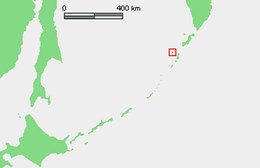
Makanrushi (Russian: Маканруши; Japanese 磨勘留島; Makanru-tō) is an uninhabited volcanic island located near the northern end of the Kuril Islands chain in the Sea of Okhotsk in the northwest Pacific Ocean. Its name is derived from the Ainu language.
Native name: Маканруши 磨勘留島 | |
|---|---|
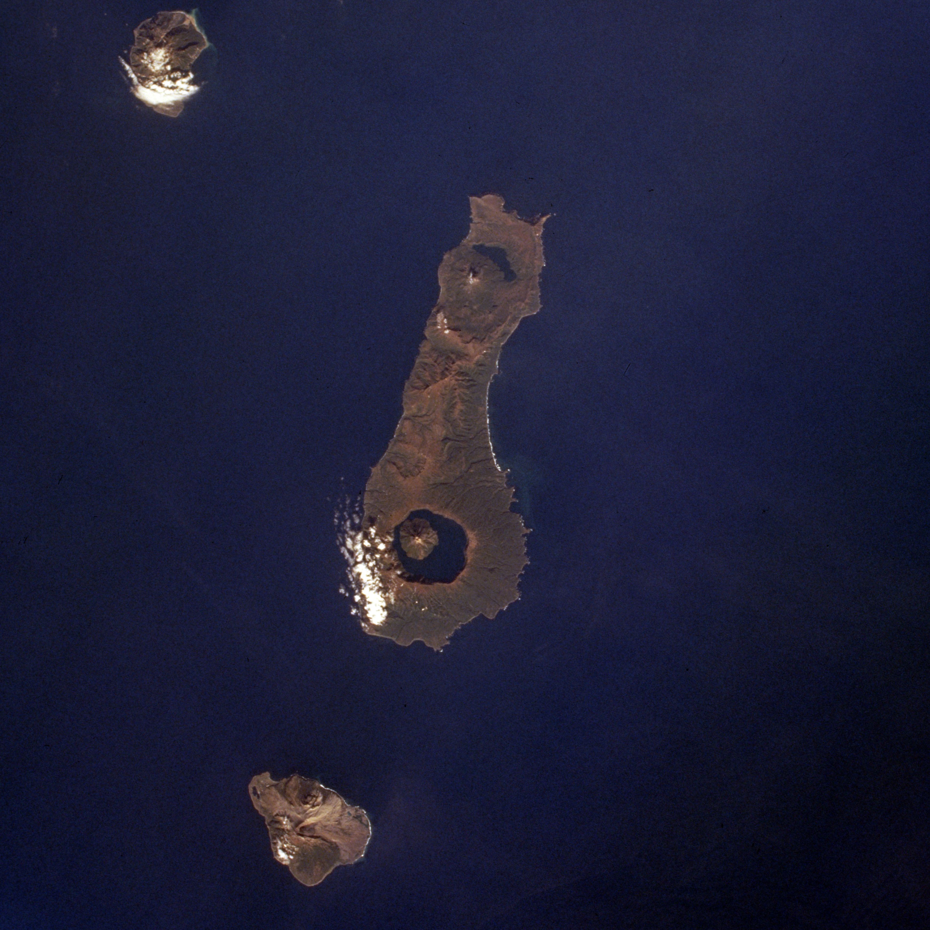
 Wintertime view of Makanrushi Island, January 2001. North at top. | |
 | |
| Geography | |
| Location | Sea of Okhotsk |
| Coordinates | 49.78°N 154.43°E |
| Archipelago | Kuril Islands |
| Area | 49 km2 (19 sq mi) |
| Highest elevation | 1,169 m (3835 ft) |
| Highest point | Pik Mitaka |
| Administration | |
Russia | |
| Demographics | |
| Population | 0 |
Geology
Makanrushi is roughly rectangular, with an area of 49 square kilometres (19 sq mi)[1]
The island consists of a dormant or extinct stratovolcano, Pik Mitaka -(Russian: влк.Митака; Japanese 三高山; Mitakayama), which rises to 1,169 m (3,835 ft) above sea level. The island has steep cliff sides and no sandy beaches, making landing very difficult and dangerous even in calm weather. Makanrushi is 28 km away from Onekotan. Makanrushi thus lies behind the main currently-active arc of Kuril Island volcanoes.
History
Makanrushi appears to have never been inhabited. It appears on an official map showing the territories of Matsumae Domain, a feudal domain of Edo period Japan dated 1644, and these holdings were officially confirmed by the Tokugawa shogunate in 1715. Subsequently, claimed by the Empire of Russia, sovereignty initially passed to Russia under the terms of the Treaty of Shimoda, but was returned to the Empire of Japan per the Treaty of Saint Petersburg (1875) along with the rest of the Kuril islands. The island was formerly administered as part of Shimushu District of Nemuro Subprefecture of Hokkaidō. After World War II, the island came under the control of the Soviet Union, and is now administered as part of the Sakhalin Oblast of the Russian Federation.
On 10 August 1856, the ship Alexander Coffin (381 tons), Capt. Isaiah Purrington, of New Bedford, ran aground the island during a fog. The ship was lighted and sailed jury-rigged to Ayan, where she was condemned and sold at auction for $300.[2][3][4][5]
See also
Notes
- "International Kuril Island Project(IKIP)". University of Washington Fish Collection or the respective authors. Archived from the original on 2012-10-06. Retrieved 2010-05-23.
- Whalemen's Shipping List and Merchants' Transcript (Vol. XIV, No. 41, Dec. 16, 1856, New Bedford).
- Whalemen's Shipping List and Merchants' Transcript (Vol. XIV, No. 42, Dec. 23, 1856, New Bedford).
- The Friend (Vol. V, No. 12, Dec. 11, 1856, p. 93, Honolulu).
- Frances Henrietta, of New Bedford, Sept. 9, 1856, Nicholson Whaling Collection.
References
- Oceandots: Makanrushi at the Wayback Machine (archived December 23, 2010)
Further reading
- Gorshkov, G. S. Volcanism and the Upper Mantle Investigations in the Kurile Island Arc. Monographs in geoscience. New York: Plenum Press, 1970. ISBN 0-306-30407-4
- Krasheninnikov, Stepan Petrovich, and James Greive. The History of Kamtschatka and the Kurilski Islands, with the Countries Adjacent. Chicago: Quadrangle Books, 1963.
- Rees, David. The Soviet Seizure of the Kuriles. New York: Praeger, 1985. ISBN 0-03-002552-4
- Takahashi, Hideki, and Masahiro Ōhara. Biodiversity and Biogeography of the Kuril Islands and Sakhalin. Bulletin of the Hokkaido University Museum, no. 2-. Sapporo, Japan: Hokkaido University Museum, 2004.
External links
This Sakhalin Oblast location article is a stub. You can help Wikipedia by expanding it. |
На других языках
[de] Makanruschi
Makanruschi (russisch Остров Маканруши; jap. .mw-parser-output .Hani{font-size:110%}磨勘留島, Makanrushi-tō) ist eine unbewohnte Vulkaninsel im nördlichen Teil der Kurilen. Sie liegt 28 Kilometer nordwestlich der Insel Onekotan und befindet sich somit etwas außerhalb des eigentlichen, vulkanisch aktiven Inselbogens der Kurilen. Die Insel gehört administrativ zur russischen Oblast Sachalin.- [en] Makanrushi
[es] Makanrushi
Makanrushi (en ruso, Маканруши) es una isla rusa en el archipiélago de las Kuriles. Tiene una superficie de 49 km². Pertenece al grupo de las Kuriles septentrionales.[fr] Makanrushi
Makanrushi (russe : Маканруши ; japonais : 磨勘留島 ; Makanru-tō) est une île volcanique inhabitée de Russie, située près de la frontière nord des îles Kouriles, dans la mer d'Okhotsk, à environ 28 km de l'île d'Onekotan. Son nom provient de la langue aïnou.[it] Makanruši
Makanruši (in russo Маканруши; conosciuta anche come Makanru o Macansu; in giapponese 磨勘留島, Makanru-tō) è un'isola russa che fa parte dell'arcipelago delle Isole Curili ed è situata nel Mare di Ochotsk. Amministrativamente fa parte del Severo-Kuril'skij rajon dell'oblast' di Sachalin, nel Circondario federale dell'Estremo Oriente. Il suo nome viene dalla lingua ainu. L'isola è disabitata.[ru] Маканруши
Маканруши (от айнского Маканру, Макансу; яп. 磨勘留島 маканру-то; на российской карте 1745 года — Ілїя[2]) — остров северной группы Большой гряды Курильских островов. Административно входит в Северо-Курильский городской округ Сахалинской области. В настоящее время остров необитаем, хотя в прошлом определённую хозяйственную деятельность на нём осуществляли айны,[3] в переводе с языка которых фраза «макан ру сири» означает «остров на пути к северу», отражая древний торговый путь, который пролегал вдоль Курильской гряды.[4]Другой контент может иметь иную лицензию. Перед использованием материалов сайта WikiSort.org внимательно изучите правила лицензирования конкретных элементов наполнения сайта.
WikiSort.org - проект по пересортировке и дополнению контента Википедии