geo.wikisort.org - Island
Konus Island is an island in Shelikhov Bay, Sea of Okhotsk.[2]
Konus
Конус | |
|---|---|
Island | |
 Konus | |
| Coordinates: 60°32′40″N 162°9′15″E[1] | |
| Country | Russian Federation |
| Federal subject | Far Eastern Federal District |
| Krai | Kamchatka Krai |
| Elevation | 258 m (846 ft) |
Geography
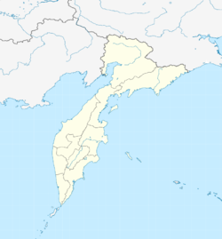
Konus Island is 1.3 km long and 0.7 km wide. It is located off the eastern coast of Penzhina Bay, separated from the continental shore by a 3 km-wide sound. Administratively, it belongs to the Kamchatka Krai.[3] Ivyinichaman Island (Ивиньичаман) is located 7 km to the southwest.
History
American whaleships cruised for bowhead whales off the island from 1860 to 1889. They called it Shag Rock.[4][5][6] Ships also anchored off the island to get coal[7][8] and to trade with the natives for deer, fish, and berries.[9]
References
- GoogleEarth
- Prostar Sailing Directions 2004 East Coast of Russia
- Ostrov Konus - Kamtchatski Kray
- Othello, of New Bedford, July 17, 1860, Peabody Essex Museum #751.
- Milton, of New Bedford, July 9, 1863, July 16, 1863, East Hampton Library.
- E. F. Herriman, of San Francisco, June 20-21, 1889, July 9, 1889, George Blunt White Library #761.
- Josephine, of New Bedford, June 26, 1865, Kendall Whaling Museum (KWM) #122C.
- Mary and Helen, of San Francisco, May 14-17, 1885, July 21-23, 1885, KWM #937.
- Sea Breeze, of New Bedford, August 18, 1866, Old Dartmouth Historical Society #490A.
|
This Kamchatka Krai location article is a stub. You can help Wikipedia by expanding it. |
На других языках
- [en] Konus Island
[it] Konus (isola)
L'isola Konus (in russo: остров Конус?; in italiano "cono") è un'isola della Russia nel mare di Ochotsk. Amministrativamente appartiene al Karaginskij rajon del Territorio della Kamčatka, nel Circondario federale dell'Estremo Oriente. L'isola si trova vicino alla costa occidentale della Kamčatka, nella baia della Penžina, a nord-ovest di capo Kingi. L'isola ha un'altezza di 258 m. In direzione sud-ovest, vicina alla costa, è situata l'isola Ivin'ičaman.[ru] Конус (остров)
Ко́нус[1][2] — остров в России, расположенный в 3 километрах северо-западнее мыса Кинги[2], в 7 километрах северо-восточнее острова Ивиньичаман и северо-восточнее устья реки Подкагерная, в восточной части Пенжинской губы в заливе Шелихова в Охотском море, у северной части западного побережья полуострова Камчатка[3][4]. Относится к Карагинскому району Камчатского края.Текст в блоке "Читать" взят с сайта "Википедия" и доступен по лицензии Creative Commons Attribution-ShareAlike; в отдельных случаях могут действовать дополнительные условия.
Другой контент может иметь иную лицензию. Перед использованием материалов сайта WikiSort.org внимательно изучите правила лицензирования конкретных элементов наполнения сайта.
Другой контент может иметь иную лицензию. Перед использованием материалов сайта WikiSort.org внимательно изучите правила лицензирования конкретных элементов наполнения сайта.
2019-2026
WikiSort.org - проект по пересортировке и дополнению контента Википедии
WikiSort.org - проект по пересортировке и дополнению контента Википедии