geo.wikisort.org - Coast
Luitpold Coast (German: Prinzregent-Luitpold-Land) is that portion of the coast of Coats Land extending from the vicinity of Hayes Glacier, at 27°54′W, to 36°W, which is regarded as the eastern limit of the Filchner Ice Shelf. It was discovered by Wilhelm Filchner, leader of the Second German Antarctic Expedition, 1911–12, and named after Luitpold, Prince Regent of Bavaria.[1]

Antarctica
Important Bird Area
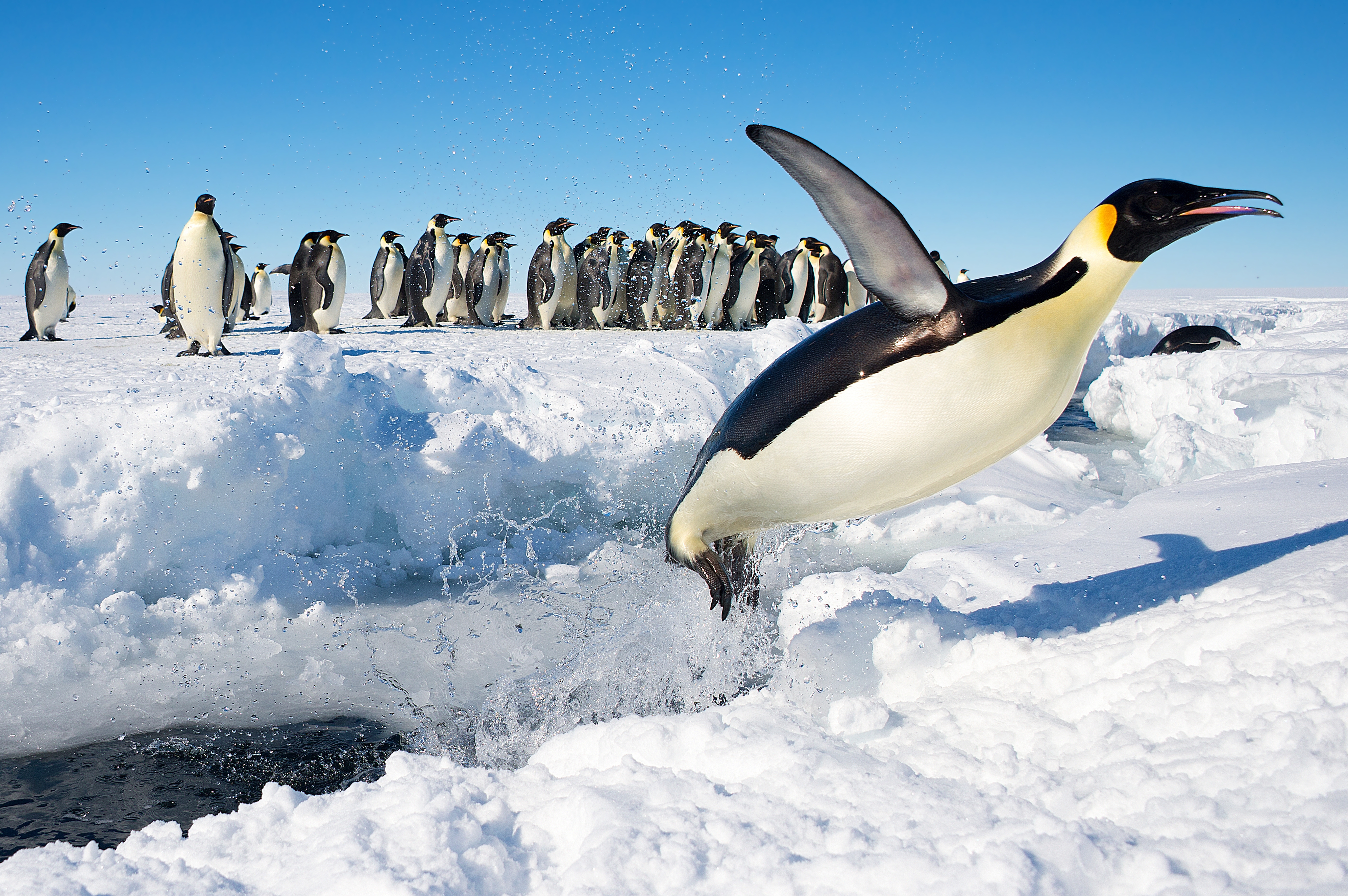
A 500 ha site on fast ice some 50 km north-east of the Filchner Ice Shelf, where icebergs regularly calve from the continental margin, has also been designated an Important Bird Area (IBA) by BirdLife International because it supports a breeding colony of about 6,500 emperor penguins, an estimate based on 2009 satellite imagery.[2]
Virgen de las Nieves Refuge
Virgen de las Nieves Refuge (79°10′00″S 38°53′00″W) is an Argentine Antarctic refuge located on the Filchner-Ronne Ice Shelf on the Luitpold Coast 150 kilometres south of the Belgrano I Base. The refuge is administered by the Argentine Army and was opened on 2 December 1958 and is under the base Belgrano II.
The refuge was built in the Argentine Antarctic campaign of 1958–1959 under the supervision of Lieutenant Colonel Jorge De Marzi and Major Pedro Arcondo. At the time, it was the southernmost Antarctic refuge of Argentina, more to the south of Refuge Santa Bárbara and the old Sobral Base. The name of the refuge refers to Our Lady of the Snows.[3][circular reference]
See also
- List of Antarctic field camps
References
- "Luitpold Coast". Geographic Names Information System. United States Geological Survey, United States Department of the Interior. Retrieved 8 July 2013.
- "Luitpold Coast". BirdLife Data Zone. BirdLife International. 2015. Retrieved 14 November 2020.
- "Refugio Virgen de las Nieves". Wikipedia Espanol. Wikimedia Foundation Inc. Retrieved 1 October 2018.
External links
 This article incorporates public domain material from the United States Geological Survey document: "Luitpold Coast". (content from the Geographic Names Information System)
Antarctica | ||||||||
|---|---|---|---|---|---|---|---|---|
| Geography |
|  | ||||||
| History |
| |||||||
| Politics |
| |||||||
| Society |
| |||||||
| Famous explorers |
| |||||||
| ||||||||
This Coats Land location article is a stub. You can help Wikipedia by expanding it. |
На других языках
- [en] Luitpold Coast
[it] Costa di Luitpold
La costa di Luitpold (centrata alle coordinate .mw-parser-output .geo-default,.mw-parser-output .geo-dms,.mw-parser-output .geo-dec{display:inline}.mw-parser-output .geo-nondefault,.mw-parser-output .geo-multi-punct{display:none}.mw-parser-output .latitude,.mw-parser-output .longitude{white-space:nowrap}.mw-parser-output .geo{}body.skin-vector .mw-parser-output #coordinates{font-size:85%;line-height:1.5em;position:absolute;right:0;top:0;white-space:nowrap}77°00′S 33°00′W), conosciuta anche come costa di Confín, è una parte della costa della Terra di Coats, in Antartide. In particolare, la costa di Luitpold si estende tra il ghiacciaio Hayes (76°16′S 27°54′W), a est, e il meridiano 36°W, considerato il limite orientale della piattaforma di ghiaccio Filchner-Ronne, a ovest, e confina quindi a est con la costa di Caird e a ovest con la costa della Terra di Edith Ronne.[1]Другой контент может иметь иную лицензию. Перед использованием материалов сайта WikiSort.org внимательно изучите правила лицензирования конкретных элементов наполнения сайта.
WikiSort.org - проект по пересортировке и дополнению контента Википедии