geo.wikisort.org - Island
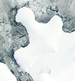
Smyley Island is an Antarctic island lying off the Antarctic Peninsula. The island is 61 km (38 mi) long and from 13 to 34 km (8 to 21 mi) wide, and lies about 20 km (12 mi) north of Case Island. It connects to the Stange Ice Shelf and is separated from Alexander Island by the Ronne Entrance. Smyley Island is one of the 27 islands of Palmer Land, Antarctica.[1]
 | |
 Smyley Island Location in Antarctica | |
| Geography | |
|---|---|
| Location | Palmer Land, Antarctica |
| Coordinates | 72°55′S 78°0′W |
| Length | 61 km (37.9 mi) |
| Width | 34 km (21.1 mi) |
| Administration | |
| Administered under the Antarctic Treaty System | |
| Demographics | |
| Population | Uninhabited |
Discovery and naming
In 1939–1941 Smyley Island was first identified as a peninsula of mainland Antarctica by the United States Antarctic Service and was named Cape Smyley. In 1968 it was identified as an island on a U.S. Geological Survey map.[1] The island is named after Captain William H. Smyley, the American master of the sealing vessel Ohio during 1841–42.[1]
Important Bird Area
A 497 ha site on fast ice near Scorseby Head, on the northern shore of the island, has been designated an Important Bird Area (IBA) by BirdLife International because it supports a breeding colony of some 6,000 emperor penguins, based on 2009 satellite imagery.[2]
See also
- Composite Antarctic Gazetteer
- List of Antarctic and Subantarctic islands
- List of Antarctic islands south of 60° S
- Scientific Committee on Antarctic Research
- Territorial claims in Antarctica
References
- "Smyley Island". Geographic Names Information System. US Geological Survey. Retrieved 18 July 2018.
- "Scorseby Head, Smyley Island". BirdLife Data Zone. BirdLife International. 2015. Retrieved 27 November 2020.
![]() This article incorporates public domain material from the United States Geological Survey document: "Smyley Island". (content from the Geographic Names Information System)
This article incorporates public domain material from the United States Geological Survey document: "Smyley Island". (content from the Geographic Names Information System)
External links
На других языках
[de] Smyley-Insel
Die Smyley-Insel (englisch Smyley Island, spanisch Isla Smyley) ist eine eisbedeckte antarktische Insel in der Bellingshausensee zwischen dem Carroll Inlet und dem Stange-Sund. Sie grenzt an das Stange-Schelfeis, einen Teil des George-VI-Schelfeises, und liegt vor der Küste des Ellsworthlandes.- [en] Smyley Island
[es] Isla Smyley
La isla Smyley es una isla de la Antártida en la Tierra de Ellsworth a 72°50′31″S 77°50′00″O. Se encuentra ubicada al sur de la bahía Ronne y al noreste de la península de Rydberg.[fr] Île Smyley
L'île Smyley est une île de l'Antarctique au large de la péninsule Antarctique. Elle est l'une des 27 îles de la Terre Palmer. Elle se trouve à environ 20 kilomètres au nord de l'île Case et l'île est au contact de la barrière de glace Stange. Smyley est séparée de l'île Alexandre-Ier par l'entrée Ronne et est baignée au nord par la mer de Bellingshausen.[it] Isola Smyley
L'isola Smyley è un'isola antartica.Другой контент может иметь иную лицензию. Перед использованием материалов сайта WikiSort.org внимательно изучите правила лицензирования конкретных элементов наполнения сайта.
WikiSort.org - проект по пересортировке и дополнению контента Википедии