geo.wikisort.org - Coast
Princess Ragnhild Coast is the portion of the coast of Queen Maud Land in Antarctica lying between 20° E and the Riiser-Larsen Peninsula, at 34° E. All but the eastern end of the coast is fringed by ice shelves. It was discovered by Capt. Hjalmar Riiser-Larsen and Capt. Nils Larsen in aerial flights from the ship Norvegia on February 16, 1931, and named for Princess Ragnhild of Norway.[1] Vestvika Bay is a large bay on the west side of Riiser-Larsen Peninsula; it was mapped from air photos taken by the Lars Christensen Expedition, 1936–37, and named Vestvika, meaning "west bay."[2]
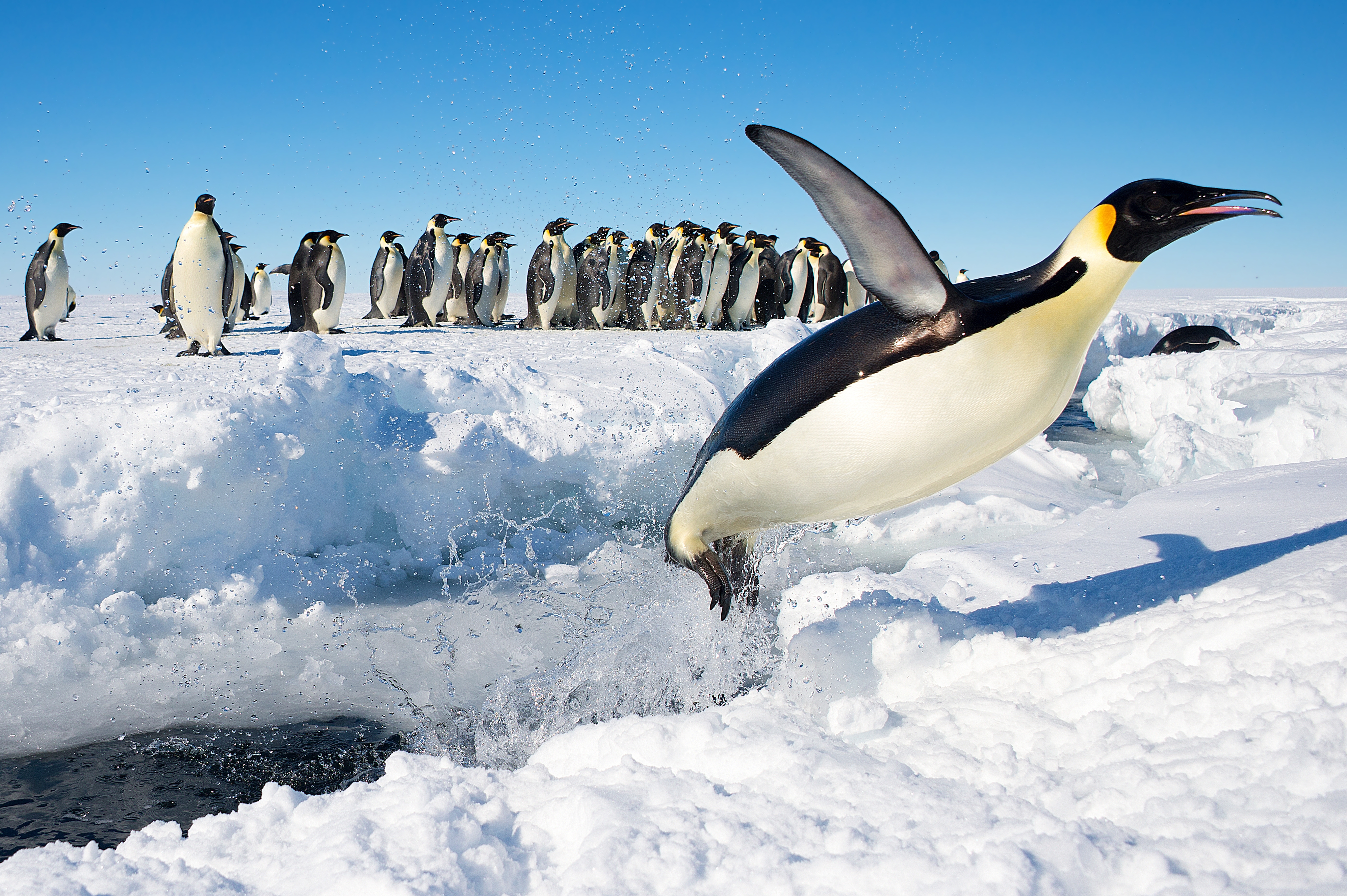
Important Bird Area
A 379 ha site on fast ice, within a crack in the ice shelf some 230 km west of the Riiser-Larsen Peninsula, has been designated an Important Bird Area (IBA) by BirdLife International because it supports a breeding colony of emperor penguins, initially discovered on 2009 satellite imagery and subsequently visited, with about 20,000 adults and chicks estimated in 2014.[3]
References
- "Princess Ragnhild Coast". Geographic Names Information System. United States Geological Survey. Retrieved 2019-05-02.
- "Vestvika Bay". Geographic Names Information System. United States Geological Survey. Retrieved 2019-05-02.
- "Princess Ragnhild Coast". BirdLife Data Zone. BirdLife International. 2015. Retrieved 21 November 2020.
External links
 This article incorporates public domain material from websites or documents of the United States Geological Survey.
This Queen Maud Land location article is a stub. You can help Wikipedia by expanding it. |
На других языках
- [en] Princess Ragnhild Coast
[it] Costa della Principessa Ragnhild
La costa della Principessa Ragnhild (centrata alle coordinate .mw-parser-output .geo-default,.mw-parser-output .geo-dms,.mw-parser-output .geo-dec{display:inline}.mw-parser-output .geo-nondefault,.mw-parser-output .geo-multi-punct{display:none}.mw-parser-output .latitude,.mw-parser-output .longitude{white-space:nowrap}.mw-parser-output .geo{}body.skin-vector .mw-parser-output #coordinates{font-size:85%;line-height:1.5em;position:absolute;right:0;top:0;white-space:nowrap}70°30′S 27°00′E) è una parte della costa della Terra della Regina Maud, in Antartide. In particolare, la costa della Principessa Ragnhild si estende tra il limite orientale tra la penisola di Riiser-Larsen (68°55′S 34°00′E), a est, e il meridiano 20°E, a ovest, e confina quindi a est con la costa del Principe Harald e a ovest con la costa della Principessa Astrid.[1]Другой контент может иметь иную лицензию. Перед использованием материалов сайта WikiSort.org внимательно изучите правила лицензирования конкретных элементов наполнения сайта.
WikiSort.org - проект по пересортировке и дополнению контента Википедии