geo.wikisort.org - Coast
Hummer Point is the eastern point of the ice-covered Gurnon Peninsula, an eastern arm of Bear Peninsula, on the Walgreen Coast of Marie Byrd Land, Antarctica,[1] extending into the Amundsen Sea.[2]
Discovery and naming
The headland was mapped by the United States Geological Survey from surveys and U.S. Navy aerial photographs from 1959 to 1966, and was named by the Advisory Committee on Antarctic Names in 1977 after Dr Michael G. Hummer.[1]
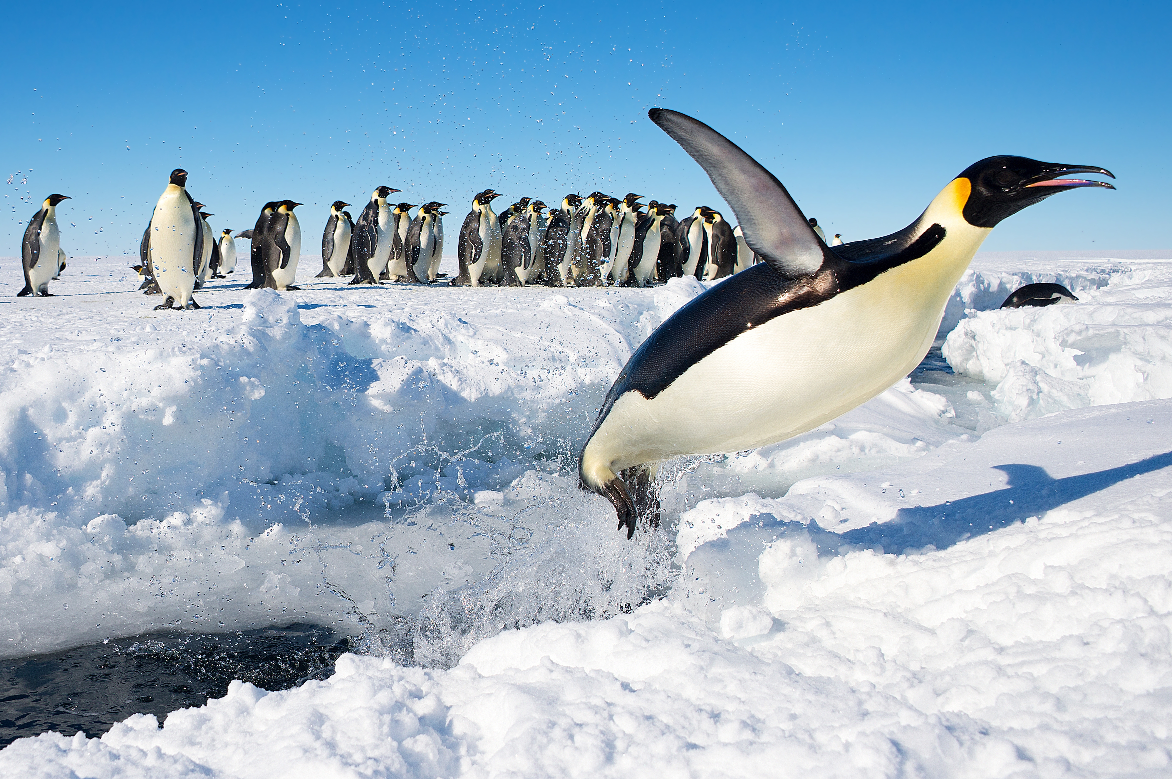
Important Bird Area
A 490 ha site on fast ice east of the headland has been designated an Important Bird Area (IBA) by BirdLife International because it supports a breeding colony of about 9,500 emperor penguinss, estimated from 2009 satellite imagery.[2]
References
- "Hummer Point". Geographic Names Information System. United States Geological Survey. Retrieved 2012-07-03.
- "Hummer Point, Bear Peninsula". BirdLife Data Zone. BirdLife International. 2015. Retrieved 10 November 2020.
![]() This article incorporates public domain material from the United States Geological Survey document: "Hummer Point". (content from the Geographic Names Information System)
This article incorporates public domain material from the United States Geological Survey document: "Hummer Point". (content from the Geographic Names Information System)
This Marie Byrd Land location article is a stub. You can help Wikipedia by expanding it. |
На других языках
[de] Hummer Point
Der Hummer Point ist eine Landspitze an der Walgreen-Küste des westantarktischen Marie-Byrd-Lands. Sie bildet das Ostkap der Gurnon-Halbinsel, des östlichen Teils der Bear-Halbinsel. Südlich von ihr mündet der Bunner-Gletscher in die Amundsen-See.- [en] Hummer Point
Другой контент может иметь иную лицензию. Перед использованием материалов сайта WikiSort.org внимательно изучите правила лицензирования конкретных элементов наполнения сайта.
WikiSort.org - проект по пересортировке и дополнению контента Википедии