geo.wikisort.org - Mountains
Saka Haphong (Bengali: সাকা হাফং, Burmese: ဆကးအဖောင် တောင်) is a peak in Southeast Asia and South Asia which was founded by A.K.M Shahidullah Kaiser. Situated in Bangladesh & Myanmar it is often considered the highest point of the country (Bangladesh), with an elevation of 1,025 metres (3,363 ft).[3][4] Located on the Bangladesh–Myanmar border, it is situated between Thanchi, Bandarban, Bangladesh and the Chin State of Myanmar.
| Saka Haphong | |
|---|---|
| Mayung Hills, Saka Hafong Tlang | |
 Saka Haphong | |
| Highest point | |
| Elevation | 1,185 m (3,888 ft)[1] |
| Prominence | 820 m (2,690 ft)[2] |
| Isolation | 42 km (26 mi) |
| Listing |
|
| Coordinates | 21°47′19″N 92°36′31″E |
| Naming | |
| Native name | |
| Geography | |
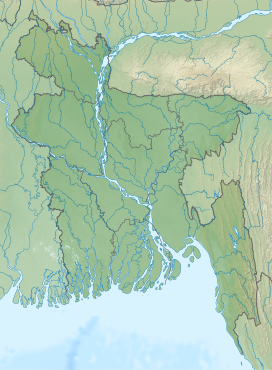 Saka Haphong Location in Bangladesh (on the border with Myanmar) | |
| Location | Bangladesh–Myanmar border |
| Country | Bangladesh and Myanmar |
Saka Haphong was believed to be the highest peak of Bangladesh,[5][6] but recent calculations have shown the highest peak of Bangladesh to be Tazing Dong, which is officially recognized as such.[1] In February 2006 a GPS reading of 1,185 metres was recorded on this summit by Nature And Adventure Club Ginge Fullen.[7][failed verification] The location he recorded, 21°47′11″N 92°36′36″E / 21.78639°N 92.61°E, accurately matches the location given by Russian topographic mapping[8][failed verification] and SRTM data, although these sources show its height to be slightly lower, at 1,052 metres. Recently two trekking clubs counted the height of Saka Haphong as 3,488 and 3,461 feet respectively,[9] both of which exceeds the height of Keokradong which is 3,172 feet high.
See also
- Geography of Bangladesh
- Geography of Myanmar
- List of elevation extremes by country
References
- "Mowdok Mual, Bangladesh". Peakbagger.com. Retrieved 2014-07-28.[self-published source]
- SRTM data in agreement with 1:200,000 Soviet topographic mapping
- Bao-Rong Lu, General information of the areas visited and the collecting routes, A Report On BRRI-IRRI Cooperative Collection of Wild Oryza Species In Bangladesh[permanent dead link], page 5, International Rice Research Institute, October 1529, 1998[dead link]
- Country-wise highest points, HighPoint.com[dead link]
- Chowdhury, Masud Hasan (2012). "Physiography". In Islam, Sirajul; Jamal, Ahmed A. (eds.). Banglapedia: National Encyclopedia of Bangladesh (Second ed.). Asiatic Society of Bangladesh.
- "Bangladesh". The World Factbook. CIA.
- "World peaks climbed". Ginge Fullen. Archived from the original on 29 July 2014.[self-published source]
- "Relevant section of the Topographic Map". Топографическая карта Украины, России, Беларуси. 1965. Archived from the original on 1 May 2013.
- "'Second highest hill' spotted by 4 youths". The Daily Star. 28 February 2011.
This Chittagong Division location article is a stub. You can help Wikipedia by expanding it. |
This Myanmar location article is a stub. You can help Wikipedia by expanding it. |
На других языках
[de] Mowdok Mual
Der Mowdok Mual, auch Saka Haphong genannt, ist ein Berg in Bangladesch an der Grenze zu Myanmar.- [en] Saka Haphong
[fr] Mowdok Mual
Le Mowdok Mual ou Saka Haphong est une montagne située à la frontière entre le Bangladesh et la Birmanie[1]. Culminant à une altitude de 1 052 mètres[1], elle est parfois considérée comme le point culminant du Bangladesh en compétition avec le Keokradong qui s'élèverait à 986[2] ou 1 230 mètres d'altitude.Другой контент может иметь иную лицензию. Перед использованием материалов сайта WikiSort.org внимательно изучите правила лицензирования конкретных элементов наполнения сайта.
WikiSort.org - проект по пересортировке и дополнению контента Википедии