geo.wikisort.org - Mountains
Phou Bia (Lao: ພູເບັ້ຍ) is the highest mountain in Laos. It is in the Annamese Cordillera, at the southern limit of the Xiangkhoang Plateau in Xiangkhouang Province. Owing to its elevation—2,819 m (9,249 ft), the highest terrestrial point in Laos, the climate is cold and the area around the mountain is mostly cloudy.
| Phou Bia | |
|---|---|
 Phou Bia from Nam Ngum Reservoir | |
| Highest point | |
| Elevation | 2,819 m (9,249 ft) |
| Prominence | 2,079 m (6,821 ft)[1] |
| Listing | Country high point Ultra |
| Coordinates | 18°58′54″N 103°09′07″E |
| Naming | |
| Native name | ພູເບັ້ຍ (Lao) |
| Geography | |
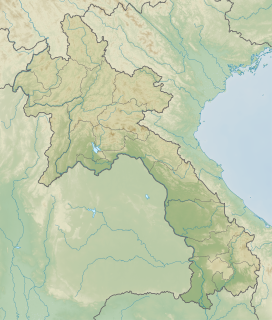 Phou Bia Location of Phou Bia in Laos | |
| Location | Laos |
| Parent range | Annamite Range |
History
Although no snow has been reported for decades, it is claimed that as late as the first years of the 20th century, snow fell occasionally on its summit.[citation needed]
On 10 April 1970, an Air America C-130A aircraft crashed into the mountain.[2]
The area is remote, covered with jungle, and has been used by Hmong guerilla soldiers. In the 1970s, c. 60,000 Hmong supporting FAC operations took refuge at the Phou Bia massif.[3] There have been reports of smaller Hmong hideouts in the area as recently as 2006.[4]
Phou Bia rises in a restricted military area near the abandoned Long Chen air base, and for this reason sees few outside visitors. Unexploded ordnance further complicates access. As of July 2008, there had been no known ascent by a non-Lao person for at least 30 years.[citation needed]
In 2021, Xaisomboun Province officials announced the development of Phou Bia Mountain as a "sustainable development tourism site", valued at some US$500 million. The development will center on Phou Houa Xang Village, in Anouvong District, Xaisomboun, under a 99 year concession.[5]
See also
References
- Phou Bia at Peakbagger.com
- Lee, Thomas E. (25 June 2011). "Laos Incident List 1970-1973 (Incidents, Casualties, Rescues, Captures and Unknowns)". Angel Fire.
- Christopher Robbins, The Ravens: Pilots of the Secret War in Laos. Asia Books 2000.
- "Hmong Women, Children Leave Hiding Place in Laos Special Zone; Call US for Help by Cell Phone". Huntington News Network. Archived from the original on 2007-10-10. Retrieved 2008-07-07.
- Thanabouasy, Phayboune (22 January 2021). "Unrest in Xaysomboun Province Now Resolved". The Laotian Times. Retrieved 25 January 2021.
External links
На других языках
[de] Phu Bia
Der Phu Bia (laotisch: .mw-parser-output .Laoo{font-size:120%}ພູເບັ້ຍ, auch Phou Bia geschrieben) ist mit ca. 2.850 Metern Höhe der höchste Berg im südostasiatischen Laos. Er befindet sich im Truong-Song-Gebirge und liegt am Südrand des Xieng Khouang-Plateaus mit der Ebene der Tonkrüge. Die Gegend um den Berg liegt in einem dichten Dschungelgebiet und ist schwer zu erreichen.- [en] Phou Bia
[fr] Phou Bia
Le Phou Bia (lao : ພູ ເບຍ ; « montagne d'Argent ») est une montagne située dans la cordillère annamitique, dans la province de Xaisomboun. Avec ses 2 819 m d'altitude, c'est le point culminant du Laos.[it] Phou Bia
Il Phou Bia (Lao: ພູ ເບຍ; letteralmente, "montagna di birra") è una montagna del Laos, situata all'interno della Catena Annamita, nella Provincia di Xiangkhoang. Con 2.819 metri sul livello del mare è la cima più elevata del paese.[ru] Пхубиа
Пхубиа, Гора Биа (лаос. ພູເບັ້ຍ) — самая высокая гора Лаоса[2].Другой контент может иметь иную лицензию. Перед использованием материалов сайта WikiSort.org внимательно изучите правила лицензирования конкретных элементов наполнения сайта.
WikiSort.org - проект по пересортировке и дополнению контента Википедии