geo.wikisort.org - Mountains
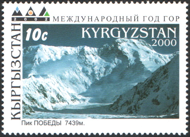
Jengish Chokusu (Kyrgyz: Жеңиш чокусу, جەڭىش چوقۇسۇ, [dʒeŋiʃ tʃoqusú]; English: Tomur Peak, simplified Chinese: 托木尔峰; traditional Chinese: 托木爾峰; Russian: Пик Победы, Pik Pobedy, [pʲik pɐˈbʲɛdɨ]) is the highest mountain in the Tian Shan mountain system at 7,439 metres (24,406 ft). It lies on the Kyrgyzstan–China border between the Ak-Suu District, in the Issyk-Kul Region of far Eastern Kyrgyzstan and Wensu County, Xinjiang, China. It is part of the Kakshaal Too, the highest part of the Tian Shan and located southeast of lake Issyk Kul.
| Jengish Chokusu | |
|---|---|
| Tomur Peak / Pobeda Peak / Victory Peak | |
 Jengish Chokusu from the basecamp in Kyrgyzstan | |
| Highest point | |
| Elevation | 7,439 m (24,406 ft)[1] Ranked 60th |
| Prominence | 4,148 m (13,609 ft)[1] Ranked 16th |
| Isolation | 560 km (350 mi) |
| Listing | Country high point Ultra |
| Coordinates | 42°02′15″N 80°07′30″E[1] |
| Naming | |
| Native name | |
| Geography | |
 Jengish Chokusu  Jengish Chokusu Jengish Chokusu (Kyrgyzstan) | |
| Parent range | Kakshaal Too, Tian Shan |
| Climbing | |
| First ascent | 1956 by Vitaly Abalakov |
| Easiest route | Snow/ice climb |
Names
The mountain's official name in Kyrgyz is Jengish Chokusu, which means "Victory Peak"; its Russian name is Pik Pobedy (or Pobeda Peak) meaning the same. In Uyghur, it is called Tömür, which is also the official name of the mountain in China. The Chinese name Tuōmù'ěr Fēng (simplified Chinese: 托木尔峰; traditional Chinese: 托木爾峰) is a combination of the Uighur tomur, meaning 'iron' and Chinese feng meaning 'peak'.
Description
Jengish Chokusu is a massif, with several summits along its lengthy ridge. Only its main summit breaks 7,000 m. It is located 16 km (9.9 mi) southwest of Khan Tengri (7,010 m / 22,998 ft), separated by the South Engilchek glacier, where base camps for both mountains are usually located.
The massif runs at right angles to the glaciers which flow from it into three alpine valleys in Kyrgyzstan on the north, all eventually running to the Engilchek Glacier, the largest in the Tian Shan. Its main summit is usually approached from the Zvozdochka (Russian for "little star") glacier, which is coloured red with rocks from Jengish Chokusu.
Administratively, the Kyrgyzstan side of the mountain is in the Ak-Suu District of Issyk-Kul Region and the Chinese side, in Wensu County of the Aksu Prefecture of Xinjiang Uyghur Autonomous Region.
Records
Jengish Chokusu is the highest mountain in Kyrgyzstan. Jengish Chokusu is considered the most northerly 7,000-metre mountain in the world by geologists; the actual rock summit of Khan Tengri, the Tian Shan's third highest peak, is 6,995m above sea level, though a thick layer of ice adds another 15m to its altitude, such that mountaineers classify it as a 7,000m peak.
The South Engilchek Glacier and its side glaciers occupy the entire north side of Peak Jengish Chokusu. This glacier, currently at 60.5 km in length, is the sixth longest outside of the world's polar regions.[2]
History

Although Jengish Chokusu is over 400 metres higher, Khan Tengri was believed to be the highest peak in the range until Jengish Chokusu's survey in 1943.[4]
A Soviet expedition mounted in 1938 to mark the 20th anniversary of the founding of the Communist Youth movement Komsomol claimed to have climbed the highest peak in the area, the summit being reached on 19 September by L. Gutman, E. Ivanov and A. Sidorenko. They measured the altitude as 6,900 metres, and named the peak Pik 20-ti letiya Komsomola (Peak of the 20th Anniversary of Komsomol).
A survey by another team in 1943 found the peak to be 7,439 metres high. The peak was renamed as Pik Pobedy (Victory's Peak) in 1946 to commemorate the Soviet victory in World War II. The significant difference in altitude led to the 1938 ascent being called into question, although the official Soviet stand was to uphold the 1938 ascent.[3]
A large-scale attempt on the peak in 1955 was disastrous, when 11 expedition members were killed in a blizzard.[4] Jengish Chokusu's first indisputably verified ascent was in 1956 by Vitaly Abalakov's party.[5]
A Chinese expedition climbed the peak from the Chinese side in 1977: the expedition book makes no mention of the Russian first ascent and gives the impression that the Chinese ascent was the first climb.[6]
The first winter ascent of Peak Pobeda was made by Valery Khrichtchatyi (team leader), S. Ovcharenko, G. Mikhailov, and brothers G. Bogomolov and S. Bogomolov on February 2, 1990.[7]
The first solo speed ascent was made by Anatoli Boukreev in August 1990.[citation needed]
References
- "The Central Asian Republics: Ultra-Prominence Page". Peaklist.org. Retrieved 2014-05-26.
- Tajikistan's Fedchenko Glacier is 77 km long, and the Karakoram's Siachen and Biafo Glaciers are 70 and 67 km long respectively. Measurements are from recent imagery, with Russian 1:200,000 scale topographic mapping for reference as well as the 1990 ‘’Orographic Sketch Map: Karakoram: Sheets 1 & 2’’, Swiss Foundation for Alpine Research, Zurich.
- The Great Soviet Encyclopedia , 1979
- William Garner, 'High Road to 'Victory'" Soviet and U.S. Climbers conquer Pik Pobedy, National Geographic Magazine, August 1986 (p.258)
- "Pik Pobeda". SummitPost.org.
- Planting the Five-Star Flag on Mount Tomur, Foreign Languages Press, Beijing, 1979
- Chris Bonington, “Great Climbs”, p.206, ISBN 1-85732-573-7
Further reading
- Garner, William (August 1986). "High Road to "Victory"". National Geographic. Vol. 170, no. 2. pp. 256–271. ISSN 0027-9358. OCLC 643483454.
External links
Authority control | |
|---|---|
| General |
|
| National libraries | |
На других языках
[de] Dschengisch Tschokusu
Der Dschengisch Tschokusu; kirgisisch Жеңиш Чокусу; in China: Tomur Feng (chinesisch .mw-parser-output .Hant{font-size:110%}托木爾峰 / .mw-parser-output .Hans{font-size:110%}托木尔峰, Pinyin Tuōmù’ěr Fēng); auch: Pik Pobedy bzw. Pik Pobeda (russisch für „Sieges-Gipfel“ in Anlehnung an den sowjetischen Sieg im Zweiten Weltkrieg), ist mit 7439 m der höchste Berg im Tian Shan und auch der höchste Berg Kirgisistans.[1]- [en] Jengish Chokusu
[es] Pico Jengish Chokusu
El pico Jengish Chokusu (también conocido por su nombre en ruso como Pico Pobedy) es la montaña más alta de los montes Tian Shan con 7439 msnm y una prominencia de 4148 m.[1] Está situado en la frontera entre China y Kirguistán, siendo el punto más alto de este último y el segundo más alto de la antigua Unión Soviética.[fr] Jengish Chokusu
Le Jengish Chokusu, également connu sous son ancien nom pic Pobedy, est une montagne qui culmine à 7 439 mètres d'altitude, point culminant du massif du Tian Shan et du Kirghizistan, à la frontière avec la Chine. Il constitue un symbole historique pour différents pays. Il est gravi pour la première fois en 1956 par Vitaly Abalakov. Sommet particulièrement dangereux, son ascension est principalement tentée par des alpinistes russes.[it] Pik Pobedy
Il Pik Pobedy[3][4] (in russo Пик Победы) o Žeņiš Čokusu (in kirghiso Жеңиш Чокусу), entrambi nomi traducibili con "picco della vittoria", è la più alta montagna nel Tian Shan con 7 439 m[1][2]. Si trova sul confine tra il Kirghizistan e la Repubblica Popolare Cinese, tra il distretto di Ak-Suu della regione di Ysyk-Köl e la contea di Wensu dello Xinjiang. Fa parte della catena montuosa Kakšaal-Too, la parte più alta del Tian Shan, ed è situata 16 km a sud-est del Khan Tengri, da cui è divisa dal ghiacciaio Inyl'ček. È posta a sud-est del lago Ysyk-Köl.[ru] Пик Победы
Пик Побе́ды (кирг. Жеңиш чокусу, кит. 托木尔峰, уйг. Томур) — горная вершина высотой 7439 метров, хребта Какшаал-Тоо, высшая точка Тянь-Шаня и Киргизии.Другой контент может иметь иную лицензию. Перед использованием материалов сайта WikiSort.org внимательно изучите правила лицензирования конкретных элементов наполнения сайта.
WikiSort.org - проект по пересортировке и дополнению контента Википедии