geo.wikisort.org - Mountains
Keokradong (Bengali: কেওক্রাডং) is a peak located in Bandarban, Bangladesh, with an elevation of 986 metres (3,235 ft).[2] Some sources claim it as the highest point of Bangladesh.
| Keokradong | |
|---|---|
 Keokradong | |
| Highest point | |
| Elevation | 986 m (3,235 ft) |
| Prominence | 400 m (1,300 ft)[1] |
| Isolation | 13 km (8.1 mi) |
| Listing | List of mountains of Bangladesh |
| Coordinates | 21°56′59″N 92°30′51″E |
| Geography | |
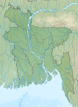 Keokradong Location in Bangladesh, near the border with Myanmar | |
| Location | Ruma Upazila, Bandarban |
| Geology | |
| Mountain type | Mountain |
On the top of Keokradong there is a small shelter and a signboard put up by Bangladesh Army proclaiming the elevation to be 967 metres (3,173 ft).
Height measured by handheld GPS shows it is 986 metres (3,235 ft) with 3m accuracy.[3]
There is a controversy about the highest point of Bangladesh, and some sources indicate Saka Haphong as the most elevated peak of the country.[4] However, Tazing Dong is officially recognized as the highest point of Bangladesh.
Keokradong is a popular tourist attraction in Bangladesh for mountaineers.[5] Keokradong is one of the cloudiest places in Bangladesh.
Gallery
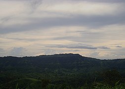 Eastern face of Keokradong
 Panorama from the top of Keokradong.
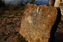 Keokradong Milestone


See also
- Geography of Bangladesh
- List of mountains of Bangladesh
Notes
- SRTM data
- Elevation extremes, CIA: the World Factbook.
- Keokradong, Banglatrek Archived 2011-07-25 at the Wayback Machine, Banglatrek.org.
- "Mowdok Mual, Bangladesh". Peakbagger.com.
- "A Hiker's Guide to Keokradong". The Daily Star. 2016-03-17. Retrieved 2020-08-21.
This Chittagong Division location article is a stub. You can help Wikipedia by expanding it. |
На других языках
[de] Keokradong
Der Keokradong (auch: Keokradang) ist ein Berg in Bangladesch.- [en] Keokradong
[fr] Keokradong
Le Keokradong ou Keokaradong est un sommet du Bangladesh dont l'altitude, sujette à débat, serait de 986 mètres d'altitude d'après une mesure GPS précise à trois mètres[1]. Avec une altitude officielle donnée à 1 230 mètres[2], il constituerait le point culminant du Bangladesh ; toutefois, s'il s'agit vraisemblablement du plus haut sommet situé entièrement au Bangladesh, cette altitude paraît improbable et quatre autres sommets sur la frontière avec la Birmanie seraient plus élevés, dont le Mowdok Mual à 1 052 mètres d'altitude[1],[2],[3].Другой контент может иметь иную лицензию. Перед использованием материалов сайта WikiSort.org внимательно изучите правила лицензирования конкретных элементов наполнения сайта.
WikiSort.org - проект по пересортировке и дополнению контента Википедии