geo.wikisort.org - River
The Pripyat or Prypiat (/ˈpriːpjət, ˈprɪp-/ PREE-pyət, PRIP-yət, Ukrainian: Прип'ять, pronounced [ˈprɪpjɐtʲ]; Belarusian: Прыпяць, romanized: Prypiać, pronounced [ˈprɨpʲat͡sʲ]; Polish: Prypeć, pronounced [ˈprɨpɛtɕ]; Russian: Припять, pronounced [ˈprʲipʲɪtʲ] (![]() listen)) is a river in Eastern Europe, approximately 761 km (473 mi) long.[1] It flows east through Ukraine, Belarus, and Ukraine again, draining into the Dnieper.
listen)) is a river in Eastern Europe, approximately 761 km (473 mi) long.[1] It flows east through Ukraine, Belarus, and Ukraine again, draining into the Dnieper.
| Pripyat Prypiat, Prypiać, Prypeć | |
|---|---|
 Pripyat River | |
 Course of the Pripyat River | |
| Location | |
| Country | Ukraine, Belarus |
| Physical characteristics | |
| Source | |
| • location | Volyn Oblast, Ukraine |
| • coordinates | 51.468°N 24.315°E |
| Mouth | Dnieper |
• location | Kyiv Reservoir |
• coordinates | 51°09′31″N 30°29′27″E |
| Length | 761 km (473 mi) |
| Basin size | 121,000 km2 (47,000 sq mi) |
| Discharge | |
| • average | 377 m3/s (13,300 cu ft/s) |
| Basin features | |
| Progression | Dnieper→ Dnieper–Bug estuary→ Black Sea |
| Tributaries | |
| • left | Pina, Yaselda, Tsna, Lan, Sluch, Ptsich, Brahinka |
| • right | Turiya, Stokhid, Styr, Horyn, Stsviha, Ubort, Zhelon, Slovechna, Uzh |


Overview
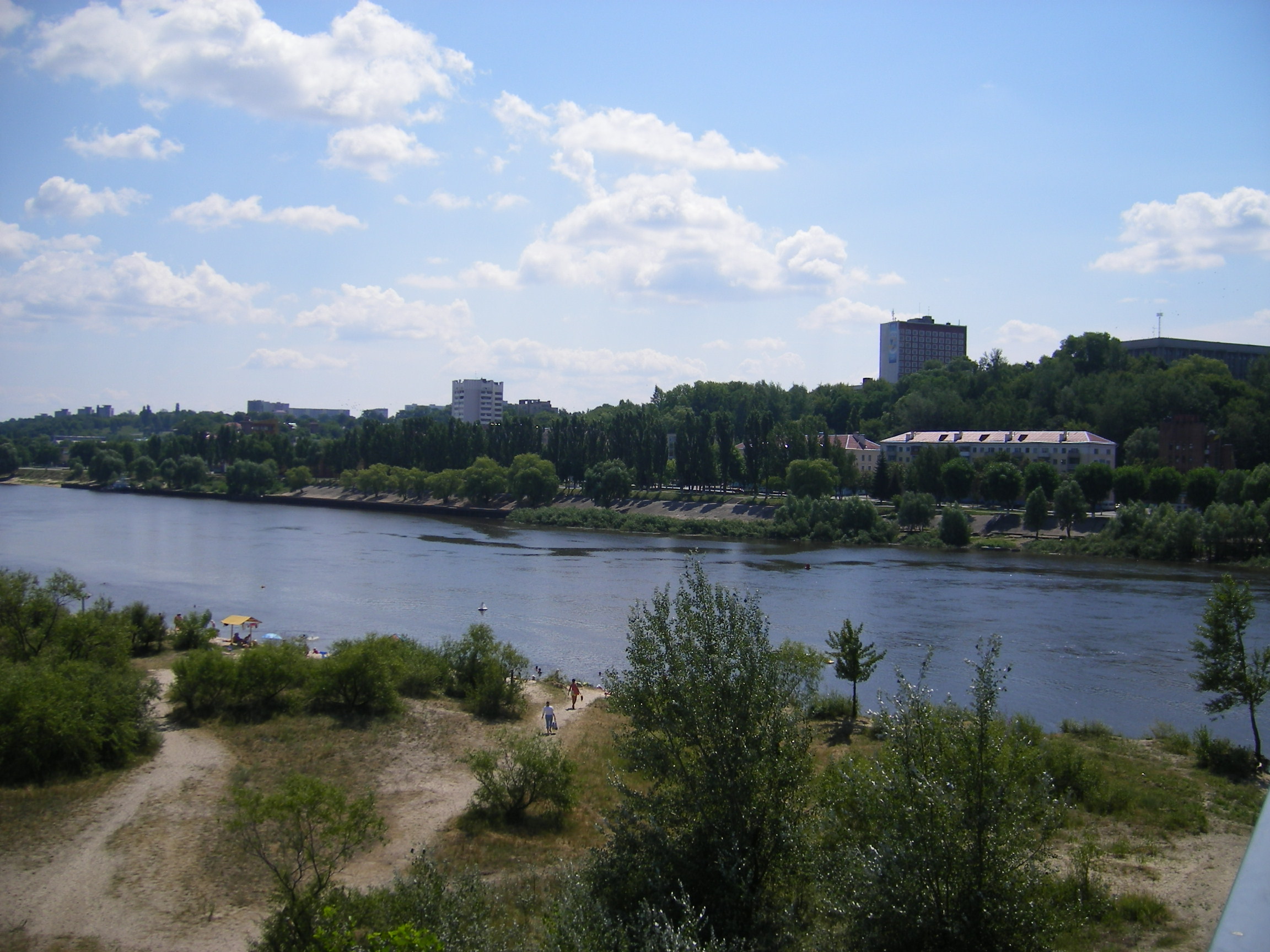
The Pripyat passes through the exclusion zone established around the site of the Chernobyl nuclear disaster. The city of Pripyat, Ukraine (population 45,000) was completely evacuated after the Chernobyl disaster.
Pripyat has a catchment area of 121,000 km2 (47,000 sq mi), 50,900 km2 (19,700 sq mi) of which are in Belarus. 495 km (308 mi) of the whole river length lies within Belarus.[1]
As of 2020, it is being dredged to enable the E40 waterway.[2]
Location
The Pripyat begins on the Volyn Hill, between the villages of Budnik and Horn Smolars of Lyubomlsky District in Ukraine. After 204 km downstream, it crosses the border of Belarus, where it travels 500 km through Polesia, Europe's largest wilderness, within which lie the vast sandy wetlands known as the Pinsk marshes, a dense network of swamps, bogs, rivers and rivulets within a forested basin. For the last 50 kilometers the Pripyat flows again in Ukraine and flows several kilometers south of Chernobyl into the Kyiv reservoir.
Geography
The length of the river is 775 kilometers. The area of the watershed is 114,300 km2. The Pripyat valley in the upper reaches is weak, in the lower reaches it is clearer. The cave is developed all along, allocating two super-floodplain terraces. The width of the floodplain in the upper course of 2–4 km and more, in some years, is flooded for several months. In the lower reaches, the width of the floodplain reaches 10–15 km. The channel in the upper canalized; below - winding, forms meanders, elders, many ducts (one of them is combined with the lake Nobel); there are sandy islands. The width of the river in the upper reaches is up to 40 m, on the average - 50–70 m, in the lower reaches 100 - predominantly 250 m, with the entrance to the Kyiv reservoir - 4–5 km. The bottom is sandy and sandy-spruce. The slope of the river is 0.08 m / km
Name etymology
Max Vasmer in his etymological dictionary notes that the historical name of the river mentioned in the earliest East Slavic document, Primary Chronicle is Pripet' (Припеть) and cites the opinion of other linguists that the name meant "tributary", comparing with Greek and Latin roots. He also rejects some opinions which were improperly based on the stem -пять -pjat', rather than original -петь.[3]
It might also derive from the local word pripech used for a river with sandy banks.[4]
See also
- Pripyat (city)
- Chernobyl disaster
- Chernobyl Exclusion Zone
- Dnieper–Bug Canal
Books
- (in Russian, English and Polish) Ye.N.Meshechko, A.A.Gorbatsky (2005) Belarusian Polesye: Tourist Transeuropean Water Mains, Minsk, Four Quarters,
- (in Belorussian, Russian and English) T.A.Khvagina (2005) POLESYE from the Bug to the Ubort, Minsk Vysheysha shkola, ISBN 985-06-1153-7.
Notes
References
- Припять, Great Soviet Encyclopedia
- Pripyat // Dictionary of Contemporary Geographical Names / Rus. geogr. oh Moscow center; By common. Ed. acad. V. M. Kotlyakova. Institute of Geography, Russian Academy of Sciences. - Yekaterinburg: U-Factorium, 2006.
- Joint River Management Program. Final Report: River Pripyat Basin (February 2004)
- "Main Geographic Characteristics of the Republic of Belarus. Main characteristics of the largest rivers of Belarus". Land of Ancestors. Data of the Ministry of Natural Resources and Environmental Protection of the Republic of Belarus. 2011. Archived from the original on 15 January 2014. Retrieved 27 September 2013.
- "Chernobyl fears resurface as river dredging begins in exclusion zone". The Guardian. Retrieved 2020-12-28.
- Max Vasmer, Etymological dictionary of the Russian language, article "Припять" in Russian translation
- Room, Adrian (1997). Placenames of the World. Jefferson, North Carolina: McFarland.
External links
![]() Media related to Pripyat River at Wikimedia Commons
Media related to Pripyat River at Wikimedia Commons
| Tributaries1 |  | |
|---|---|---|
| Reservoirs | ||
| Hydroelectric stations | ||
| Canals |
| |
| Cities |
| |
| Crossings |
| |
| ||
| Black Sea | |
|---|---|
| Bug | |
| Danube | |
| Dnieper (Rapids) | |
| Dniester | |
| Don | |
| Prypiat | |
| San | |
| Sea of Azov | |
| Southern Bug | |
| Syvash |
|
Authority control | |
|---|---|
| General |
|
| National libraries | |
]
На других языках
[de] Prypjat (Fluss)
Der Prypjat (ukrainisch Прип'ять, belarussisch Прыпяць .mw-parser-output .Latn{font-family:"Akzidenz Grotesk","Arial","Avant Garde Gothic","Calibri","Futura","Geneva","Gill Sans","Helvetica","Lucida Grande","Lucida Sans Unicode","Lucida Grande","Stone Sans","Tahoma","Trebuchet","Univers","Verdana"}Prypjaz, russisch Припять Pripjat, polnisch Prypeć, litauisch Pripetė, veraltet deutsch Pripetz[2][3]) ist einer der größten Nebenflüsse des Dnepr in Belarus und in der Ukraine (Osteuropa).- [en] Pripyat (river)
[es] Río Prípiat
El río Prípiat, también transcrito a veces como Prypiat o Pripyat (en bielorruso, Прыпяць, Prypiać; en ucraniano, Прип’ять; en ruso, Припять; en polaco, Prypeć) es uno de los principales afluentes del río Dniéper, el más importante por cuenca, que discurre generalmente en dirección este a través de Bielorrusia y Ucrania. Tiene una longitud de 710 km y una cuenca hidrográfica de 121 000 km².[it] Pryp"jat' (fiume)
Il Pryp"jat' (in ucraino: Прип’ять?, traslitterato: Pryp"jat'; in bielorusso: Прыпяць?, traslitterato: Prypjac') è un fiume dell'Europa orientale lungo circa 710 km, affluente di destra del Dnepr. Nasce in Ucraina, dove attraversa la parte settentrionale della regione della Volinia, dopodiché entra in Bielorussia; infine rientra nel territorio ucraino e sfocia nel Dnepr.[ru] Припять (река)
При́пять (белор. Прыпяць, укр. Прип’ять) — река в Белоруссии (Брестская и Гомельская области) и на Украине (Волынская, Ровненская, Киевская области). Крупнейший по площади бассейна, длине и водности правый приток Днепра[1], впадает в Киевское водохранилище[2].Другой контент может иметь иную лицензию. Перед использованием материалов сайта WikiSort.org внимательно изучите правила лицензирования конкретных элементов наполнения сайта.
WikiSort.org - проект по пересортировке и дополнению контента Википедии