geo.wikisort.org - Mountains
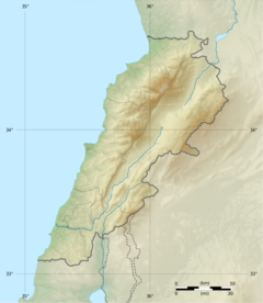
Qurnat as Sawdā (Arabic: القرنة السوداء), is the highest point in Lebanon and the Levant, at 3,088 meters above sea level. It is found at the peak of Jabal al Makmel, a mountain range in the Doniyeh
| Qurnat as Sawdā | |
|---|---|
 Qurnat As Sawda | |
| Highest point | |
| Elevation | 3,088 m (10,131 ft) |
| Prominence | 2,393 m (7,851 ft) |
| Listing | Country high point Ultra |
| Coordinates | 34°18′00″N 36°07′00″E |
| Naming | |
| Native name | القرنة السوداء (Arabic) |
| Geography | |
 Qurnat as Sawdā | |
| Parent range | Jabal Al-Makmel North Lebanon |
district , North Lebanon.
Name
The mountain's name derives from the Classical Syriac ܩܪܢܬ ܣܗܕ̈ܐ (Qornet Sohde), for "Martyrs' Mountain". This, in turn, refers to late-13th century campaigns in the region by the Muslim Mamluk Sultanate during its conquest of the Christian Crusader states. Its name, like many other local toponyms, was retained even after the decline of Syriac as a vernacular tongue in the region.
References in medieval religious literature
In Jacobus de Voragine's Golden Legend, the summit of Mount Lebanon (Qurnat as Sawda') is the site on which Noah, after having survived the flood, replanted a sacred tree. Voragine states that the tree's seeds were given to Seth by an angel in the Garden of Eden and placed in Adam's mouth upon his passing such that his blood could feed its growth.[1]
References
This Lebanon location article is a stub. You can help Wikipedia by expanding it. |
На других языках
[de] Al-Qurnat as-Sauda
Der Berg al-Qurnat as-Sauda (auch Qurnat as-Sawda', Qurnat as Sawda', Qornet es Saouda oder Karnat as Sauda; arabisch القرنة السوداء, DMG al-Qurnat as-saudāʾ für Schwarzes Horn) ist 3088 m hoch und bildet den höchsten Punkt des Libanon-Gebirges und damit auch des Staates Libanon. Der Berg liegt auf der Grenze zwischen dem Gouvernement Nord-Libanon und dem Gouvernement Baalbek-Hermel. Nebst dem eigentlichen Qurnat as-Sauda gibt es im Umkreis von 15 km mindestens drei weitere gleich benannte Nebengipfel.[1]- [en] Qurnat as Sawda'
[es] Qurnat as Sawdā'
El Qurnat as Sawdā' (en árabe: القرنة السوداء) es la mayor montaña del Líbano.[1] Situada en la cordillera del Líbano tiene una altitud de 3.088 m, con una prominencia desde su base de 2.392 m.[fr] Qurnat as Sawda'
Le Qurnat as Sawda' (ou Qornet es Saouda, en arabe : القرنة السوداء, ou Qornet Sodé en syriaque) est une montagne du Liban, point culminant du pays et du Levant avec 3 088 m d'altitude.[it] Qurnat al-Sawda'
Qurnat as Sawda', detta anche l'angolo nero, è la montagna più alta del Libano con i suoi 3.088 m. Fa parte della catena montuosa del Monte Libano e si trova nel nord del paese tra le provincie di Bsharri. La sua cima è coperta dalla neve per circa 6 mesi l'anno. Si trova a circa 30 km a sud-est della città di Tripoli.[ru] Курнет-эс-Сауда
Ку́рнет-эс-Са́уда[1] (араб. القرنة السوداء) — гора, высочайшая точка хребта Ливан, а также во всём Ливане. Высота — 3087 м[2]. Расположена примерно в 30 км к юго-востоку от Триполи.Другой контент может иметь иную лицензию. Перед использованием материалов сайта WikiSort.org внимательно изучите правила лицензирования конкретных элементов наполнения сайта.
WikiSort.org - проект по пересортировке и дополнению контента Википедии