geo.wikisort.org - River
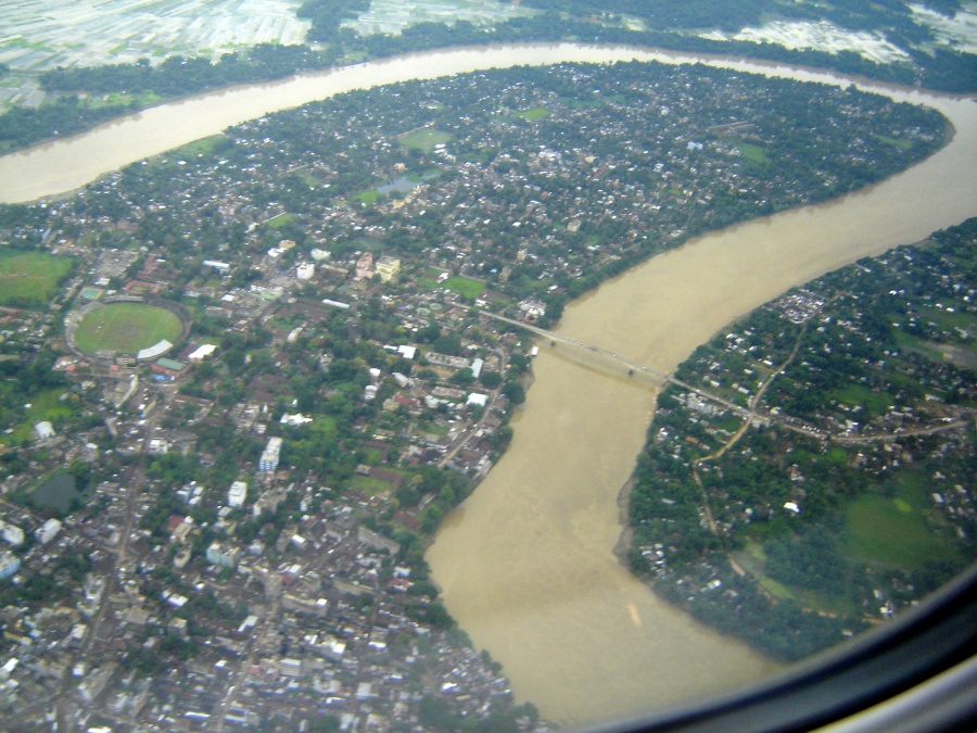
The Barak River flows 900 kilometres (560 mi)[1][2] through the states of Manipur, Nagaland, Mizoram and Assam in India. Further it enters Bangladesh where it is known by the name of the Surma and the Kushiyara and later called the Meghna before receiving the combined flow of the Ganga and the Brahmaputra. It flows into the Bay of Bengal via Bangladesh. Of its length 524 km (326 mi) is in India, 31 km (19 mi) on the Indo–Bangladesh border and the rest is in Bangladesh. The upper part of its navigable part is in India — 121 km (75 mi) between Lakhipur and Bhanga, declared as National Waterway 6, (NW-6) since the year 2016.[3][4] It drains a basin of 52,000 km2 (20,000 sq mi),[1] of which 41,723 km2 (16,109 sq mi) lies in India, 1.38% (rounded) of the country.[5] The water and banks host or are visited by a wide variety of flora and fauna.
| Barak River | |
|---|---|
 | |
| Location | |
| Countries | India and Bangladesh |
| Physical characteristics | |
| Source | |
| • location | Liyai Kullen Village |
| Mouth | |
• location | Bay of Bengal |
| Length | 900 km (560 mi) |
| Basin size | 52,000 km2 (20,000 sq mi) |
The principal tributaries are all in India: the Sonai (or Tuirial), the Jiri, the Tlawng (or Dhaleswari, or Katakal), the Jatinga, the Longai and the Madhura.
Tipaimukh Dam is a proposed dam on the river itself.[6]
Sources

From its source at Liyai Kullen Village in Manipur state where most people are of the Poumai Naga tribe, the river is known as Vourei. Near its source, the river receives streams such as the Vehrei originating from Phuba Village, the Gumti, Howrah, Kagni, Senai Buri, Hari Mangal, Kakrai, Kurulia, Balujhuri, Shonaichhari and Durduria.
It flows west in Manipur, and borders Nagaland, then southwest to Assam where it leaves India and enters Bangladesh at Bhanga Bazar.
Main tributaries
The local rainfall run off of the valley along with that of adjacent hilly areas flows through river Barak and its various tributaries and is drained out to Bangladesh. The Katakhal, Jiri, Chiri, Modhura, Longai, Sonai, Rukni and Singla are the main tributaries of the valley. The tributaries are mainly rain-fed and cause flood problems when precipitation occurs. The Barak sub-basin drains areas in India, Bangladesh and Burma. The drainage area lying in India is 41723 km2 which is nearly 1.38% of the total geographical area of the country. It is on the north by the Barail range separating it from the Brahmaputra sub-basin, on the east by the Na Lushai hills and on the south and west by Bangladesh. The sub-basin lies in the States of Meghalaya, Manipur, Mizoram, Assam, Tripura and Nagaland.[7]
In Manipur, in its flow south-west to Tipaimukh, it is joined by the Tuivai, and then flows northward to Jirimukh where it is joined by the Jiri river from the north. From here the flow is westward into Cachar, then Karimganj District of Assam, then to Sylhet in Bangladesh having a co-distributary the Surma River, the other later becoming the Meghna before the Ganga-Brahmaputra delta. The Padma joins it to become the Meghna.
Wildlife
The Barak is among the richest rivers in the world as to aquatic biodiversity, as it contains more than 2,000 species of fish. Other creatures include River Barak or Siamese crocodile (a rare and endangered crocodilian), the susu dolphin, smooth-coated otter and black mugger crocodile. From its origin to its bifurcation at the border of Nagaland producing the Surma River the Barak is 564 kilometres (350 mi) long.[8] The biomes are extremely rich in wildlife and also very diverse in the entire stretch of the river including:
- Varzea forest (flooded rainforest)
- Los llamjao (flooded grassland and Savannah)
- Tidal forest (mangroves in vast Delta Avourei)
- Flora or vegetation of the Pats (flat-topped table mountains in India and western Cambodia)
- Very large tropical swamps.
Environmental concerns
Environmentalists have expressed concern over the way aquatic creatures and their habitats are being destroyed in the upper reaches of river in southern Assam. Prominent nature conservation NGO Society for Activists for Forest and Environment (SAFE) has pointed out that the tribals living on both banks of Barak have developed the harmful practice of blasting small gelatin sticks smuggled from Mizoram to kill fish. In the process, thousands of fish, young and mature, along with turtles, dolphins and other aquatic life organisms are killed.[9]
The Ganges river dolphin is endangered. The proposed Tipaimukh Dam on the river in northeast India – a political controversy between India and Bangladesh – could hasten its extinction, researchers warn.[10] Making a plea for conservation, researchers from Assam state in a study that the dolphin, India's national aquatic animal is heading towards “local extinction” in the river system of the state. “Factors like poaching (for oil and meat) and accidental mortalities in fishing gear, gradual habitat degradation by sluice gates, embankments, disturbances like motorboats and aquatic pollution have resulted in the extirpation of the resident dolphin population from the Barak river system of Assam,” M.K. Mazumder, corresponding author of the study, wrote.[10]
See also
References
- "Rivers". asmenvis.nic.in. Retrieved 25 August 2019.
- "Surma River | river, Asia". Encyclopedia Britannica. Retrieved 25 August 2019.
- "Rajya Sabha passes Bill to declare Assam river as National Waterway". The Economic Times. 14 August 2013. Retrieved 25 August 2019.
- "National Waterways 16 | Inland Waterways Authority of India, Government of India". iwai.npglobal.in. Retrieved 25 August 2019.
- "Barak River System | Water Resources | Government Of Assam, India". waterresources.assam.gov.in. Retrieved 25 August 2019.
- "Tipaimukh Dam Controversy". GKToday. Retrieved 20 December 2019.
- "Barak River System". Water Resources Department, Govt. of Assam.
- "Barak and others". nrsc.gov.in. Water Resources Information System of India. 27 October 2015. Archived from the original on 4 April 2019. Retrieved 11 November 2017.
- "Concern over destruction of aquatic creatures in river Barak in Assam". The Economic Times. 3 February 2013. Retrieved 25 August 2019.
- "Is the Endgame Inevitable for the Ganges River Dolphin in Assam's Barak River?". The Wire. Retrieved 25 August 2019.
External links
- "Barak Basin". National Institute of Hydrology, Roorkee, India. Archived from the original on 15 May 2017.
| Authority control: National libraries |
|---|
На других языках
- [en] Barak River
[es] Río Barak
El río Barak es un largo río del Asia meridional, un río de India que es una de las fuentes del río Meghna, uno de los tres ríos principales que desaguan en el delta del Ganges. El río es uno de los principales ríos de Assam del Sur y es parte del sistema fluvial Surma-Meghna. Nace como río Barak en la región montañosa del estado de Manipur, [1] siendo el más grande y el más importante de los ríos del país de las colinas.[1] Después de Manipur, fluye a través del estado de Mizoram y luego en Assam, terminando justo en la frontera con Bangladés, donde se divide en dos ramales: el río Surma (en bengalí, সুরমা নদী Shurma Nodi) y el río Kushiyara.[ru] Барак (река)
Барак[1] (в верхнем течении — Сангу-Лок[2][3], бенг. বরাক নদী) — крупная река в Северо-Восточной Индии и Бангладеш, часть системы Сурма-Мегхна.Другой контент может иметь иную лицензию. Перед использованием материалов сайта WikiSort.org внимательно изучите правила лицензирования конкретных элементов наполнения сайта.
WikiSort.org - проект по пересортировке и дополнению контента Википедии