geo.wikisort.org - River
The Mrežnica (pronounced [mreʒnit͡sa]) is a river in Karlovac County, Croatia. It is 63 kilometres (39 mi) long and its basin covers an area of 64 square kilometres (25 sq mi).[1]
| Mrežnica | |
|---|---|
 | |
| Location | |
| Country | Croatia |
| Physical characteristics | |
| Source | |
| • coordinates | 45.0902°N 15.4959°E |
| Mouth | |
• location | Korana |
• coordinates | 45.4657°N 15.5654°E |
| Length | 63 km (39 mi)[1] |
| Basin size | 64 km2 (25 sq mi)[1] |
| Basin features | |
| Progression | Korana→ Kupa→ Sava→ Danube→ Black Sea |
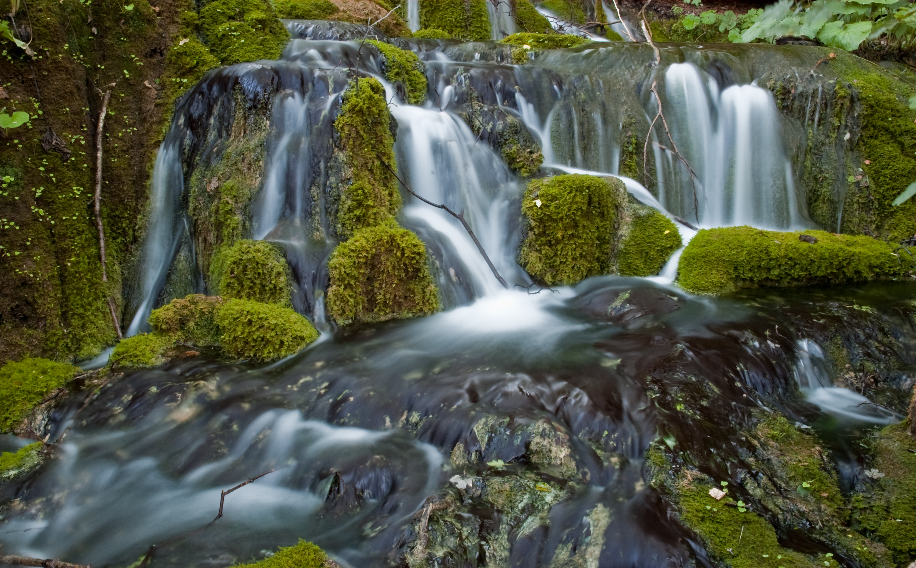
Mrežnica is considered special due to its large number of waterfalls, totalling 93. It rises in Kordun, west of Slunj, and flows northwards, in parallel to Dobra and Korana, through Generalski Stol and Duga Resa, when it finally flows into the Korana in the south of Karlovac (at Mostanje/Turanj).
The Gojak Hydroelectric Power Plant is a high pressure diversion plant which harnesses the river power of the Ogulinska Dobra and Mrežnica rivers.[2]
References
- Statistical Yearbook of the Republic of Croatia 2017 (PDF) (in Croatian and English). Zagreb: Croatian Bureau of Statistics. December 2017. p. 47. ISSN 1333-3305. Retrieved 23 May 2018.
- "HE Gojak". Hrvatska elektroprivreda. Archived from the original on 2011-09-07. Retrieved 2011-07-10.
External links
Wikimedia Commons has media related to Mrežnica.
Hydrography of Croatia | ||||||
|---|---|---|---|---|---|---|
| Rivers |
|  | ||||
| Lakes | ||||||
| Valleys, estuaries, canyons, wetlands |
| |||||
| Waterfalls |
| |||||
| Canals |
| |||||
| Adriatic Sea |
| |||||
| Authority control |
|
|---|
This Central Croatian geography article is a stub. You can help Wikipedia by expanding it. |
На других языках
[de] Mrežnica
Die Mrežnica ist ein Karstfluss in Mittelkroatien. Sie entspringt westlich des Ortes Slunj in der Gespanschaft Lika-Senj und mündet nach insgesamt 63 Kilometern nahe Karlovac in die Korana. Ihr Hauptzufluss ist die Tounjčica.- [en] Mrežnica
[it] Mrežnica
La Mrežnica è un fiume nella Regione di Karlovac, in Croazia.[ru] Мрежница
Мре́жница (хорв. Mrežnica) — река в Хорватии, левый приток Кораны. Длина реки — 63 км, площадь водосборного бассейна — 64 км²[1]. Принадлежит бассейну Савы и Дуная.Текст в блоке "Читать" взят с сайта "Википедия" и доступен по лицензии Creative Commons Attribution-ShareAlike; в отдельных случаях могут действовать дополнительные условия.
Другой контент может иметь иную лицензию. Перед использованием материалов сайта WikiSort.org внимательно изучите правила лицензирования конкретных элементов наполнения сайта.
Другой контент может иметь иную лицензию. Перед использованием материалов сайта WikiSort.org внимательно изучите правила лицензирования конкретных элементов наполнения сайта.
2019-2026
WikiSort.org - проект по пересортировке и дополнению контента Википедии
WikiSort.org - проект по пересортировке и дополнению контента Википедии