geo.wikisort.org - Mountains
A' Chralaig (Scottish Gaelic: A' Chràileag)[3] is a mountain in the Northwest Highlands of Scotland, north of Loch Cluanie and south of Glen Affric. It is a Munro with a height of 1,120 metres (3,670 ft). It is the highest peak along Glen Shiel and can be easily climbed from the Cluanie Inn on the A87.[4] The eastern slopes of the mountain, are owned by the Forestry Commission and are part of the Kintail National Scenic Area.
| A' Chralaig | |
|---|---|
| A' Chràileag | |
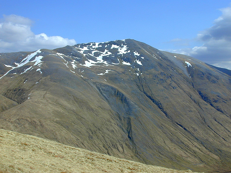 A' Chralaig from the northwest | |
| Highest point | |
| Elevation | 1,120 m (3,670 ft)[1] |
| Prominence | 786 m (2,579 ft) Ranked 38th in British Isles |
| Parent peak | Carn Eige |
| Listing | Munro, Marilyn |
| Coordinates | 57°11′5″N 05°09′16″W |
| Naming | |
| English translation | the basket [2] |
| Language of name | Gaelic |
| Pronunciation | Scottish Gaelic: [əˈxɾaːl̪ˠɛkʲ] English approximation: ə-KHRAH-lek |
| Geography | |
| Parent range | Northwest Highlands |
| OS grid | NH094148 |
| Topo map | OS Landranger 33 / 34 |
| Geology | |
| Mountain type | mountain |

Despite being the highest peak on the ridge, it is considered less interesting than the route over Stob Coire na Cràlaig to the nearby Mullach Fraoch-choire.[5] These two peaks may be combined with the neighbouring peaks of Sgurr nan Conbhairean and Sail Chaorainn to make the so-called "Cluanie Horseshoe", although no path connects A' Chràlaig with the peaks to the east.[6]


See also
References
- "walkhighlands A' Chralaig". walkhighlands.co.uk. 2014. Retrieved 9 January 2014.
- "A' Chralaig". MunroMagic.com.
- "A' Chralaig". Ainmean-Àite na h-Alba: Gaelic Place-Names of Scotland.
- David Jarman (Autumn 2006). "On Diurnal Variations in the Remoteness and Tranquillity of the Highlands". Wild Land News. 67. Archived from the original on 11 October 2008.
- "Scotland's Munros: A' Chralaig". Walking Scotland.
- Anthony Dyer. "The Cluanie Horseshoe". Archived from the original on 5 March 2016.
Munros of Scotland: Loch Duich to Loch Ness | |||
|---|---|---|---|
 |
|  | |
List of Munros | |||
Most prominent mountains of Britain and Ireland (the P600s) | ||
|---|---|---|
| Northern Highlands (20) |    | |
| Western Highlands (20) | ||
| Central and Eastern Highlands (13) | ||
| Southern Highlands (15) |
| |
| Islands (13) | ||
| Scottish Lowlands, England and Wales (13) | ||
| Republic of Ireland, Northern Ireland (25) | ||
This Highland location article is a stub. You can help Wikipedia by expanding it. |
На других языках
[de] A’ Chràlaig
Der A’ Chràlaig ist ein 1.120 m (3.675 ft) hoher, als Munro und Marilyn eingestufter Berg in Schottland. Sein gälischer Name A’ Chràileag kann in etwa mit Der Korb oder Die Reuse übersetzt werden.[1] Der Berg liegt östlich der historischen Region Kintail in der Council Area Highland, etwa 35 Kilometer südöstlich von Kyle of Lochalsh und knapp 40 Kilometer nördlich von Fort William. Er ist Teil einer Bergkette zwischen dem Glen Affric und Loch Cluanie, die insgesamt fünf Munros aufweist.- [en] A' Chràlaig
Другой контент может иметь иную лицензию. Перед использованием материалов сайта WikiSort.org внимательно изучите правила лицензирования конкретных элементов наполнения сайта.
WikiSort.org - проект по пересортировке и дополнению контента Википедии