geo.wikisort.org - River
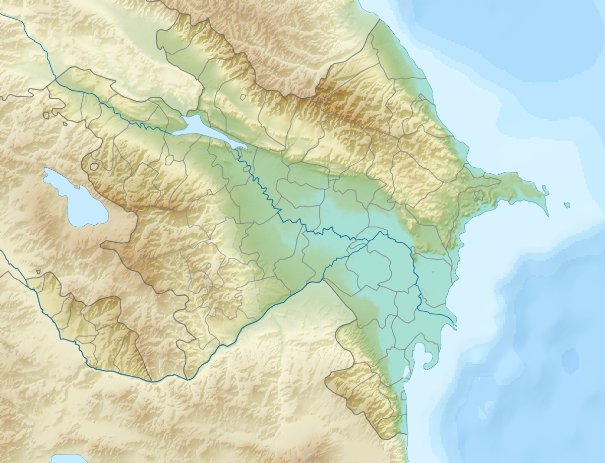
The Iori (Georgian: იორი, Azerbaijani: Qabırrı) is a river in the South Caucasus that originates in the Greater Caucasus Mountains in eastern Georgia and continues into Azerbaijan, where it is also known as Gabirry (Qabirry) and flows into the Mingachevir reservoir, which is drained by the river Kura. It is 320 km (200 mi) long, and has a drainage basin of 4,650 km2 (1,800 sq mi).[1][2] It starts in the mountains northeast of Tianeti, flows through that town, swings east and flows through the lowlands parallel to and between the Alazani (north) and the Kura (south).
| Iori | |
|---|---|
 The Iori in Tianeti. | |
  | |
| Native name |
|
| Location | |
| Country | Georgia, Azerbaijan |
| Physical characteristics | |
| Source | Greater Caucasus |
| Mouth | Mingachevir reservoir |
• coordinates | 41.0324°N 46.5022°E |
| Length | 320 km (200 mi) |
| Basin size | 4,650 km2 (1,800 sq mi) |
| Basin features | |
| Progression | Kura→ Caspian Sea |
In Antiquity, the river was known as the Cambyses river.[3] This ancient name of the river was also lent to the ancient region of Cambysene.[3]
References
- Statistical Yearbook of Georgia: 2020, National Statistics Office of Georgia, Tbilisi, 2020, p. 12.
- Иори, Great Soviet Encyclopedia
- Chaumont, Marie Louise (1990). "CAMBYSENE". In Yarshater, Ehsan (ed.). Encyclopædia Iranica, Volume IV/7: Calendars II–Cappadocia. London and New York: Routledge & Kegan Paul. p. 726. ISBN 978-0-71009-130-7.
| Rivers | |
|---|---|
| Lakes | |
| Reservoirs |
|
Authority control | |
|---|---|
| General |
|
| National libraries | |
На других языках
[de] Iori
Der Iori (georgisch იორი; aserbaidschanisch Qabırrıçay, auch Qabırlı oder Gabirry) ist ein 320 Kilometer langer linker Nebenfluss der Kura im Osten Georgiens und Westen Aserbaidschans. In der Antike war der Fluss als Kambyses bekannt.- [en] Iori (river)
[it] Iori
Lo Iori (georgiano: იორი, azero: Qabırlı) è un fiume del Caucaso del Sud.[ru] Иори
Иори[1] (устар. Ио́ра[2]) (груз. იორი, азерб. Qabırrı, цахур. Къарби[3][4]) — река в Закавказье (в восточной Грузии и Азербайджане), текущая с южных склонов Большого Кавказского хребта через Иорское плоскогорье и впадающая в Мингечевирское водохранилище (до появления водохранилища река впадала в Алазани справа). Длина — 320 км, площадь водосборного бассейна — 4650 км². Средний годовой расход у села Юхары-Салахлы (43 км от устья) 11,6 м³/с.Текст в блоке "Читать" взят с сайта "Википедия" и доступен по лицензии Creative Commons Attribution-ShareAlike; в отдельных случаях могут действовать дополнительные условия.
Другой контент может иметь иную лицензию. Перед использованием материалов сайта WikiSort.org внимательно изучите правила лицензирования конкретных элементов наполнения сайта.
Другой контент может иметь иную лицензию. Перед использованием материалов сайта WikiSort.org внимательно изучите правила лицензирования конкретных элементов наполнения сайта.
2019-2026
WikiSort.org - проект по пересортировке и дополнению контента Википедии
WikiSort.org - проект по пересортировке и дополнению контента Википедии