geo.wikisort.org - River
The Astarachay (Talysh: Ostororü, Persian: آستاراچای, Azerbaijani: Astaraçay), is a small river that defines the eastern border between Iran and Azerbaijan in Western Asia.[1]
| Astarachay Astaraçay, آستاراچای | |
|---|---|
| Location | |
| Countries | Iran and Azerbaijan |
| Province | Gilan, Iran |
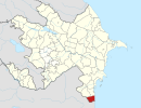
| District | Astara, Azerbaijan |
| Cities | Astara, Iran Astara Azerbaijan |
| Physical characteristics | |
| Mouth | Caspian Sea |
| Length | 38 km (24 mi) |
| Basin size | 242 km2 (93 sq mi) |
It is a tributary of the Caspian Sea. After flowing in a canyon through the Alborz mountain range, it reaches its river mouth on the southwestern Caspian coast.
It is partially in Gilan Province of far northwestern Iran.
See also
- Tributaries of the Caspian Sea
- Alborz mountain range topics
- Landforms of Gilan Province
External links
- Aerial Map: Astarachay
- Astarachay Archived 2013-07-22 at the Wayback Machine
References
| Lake Urmia basin | |
|---|---|
| Persian Gulf basin | |
| Oman sea basin | |
| Caspian basin |
|
| Gavkhouni basin | |
| Namak Lake basin |
|
| Hamun-e Jaz Murian basin | |
| Other | |
| Capital |  | |
|---|---|---|
| Counties and cities | ||
| Sights |
| |
| Populated places |
| |
Capital: Astara | ||
|  | |
This Astara Rayon location article is a stub. You can help Wikipedia by expanding it. |
This Astara County location article is a stub. You can help Wikipedia by expanding it. |
На других языках
- [en] Astarachay
[ru] Астарачай
Астара́чай[1][2] (азерб. Astaraçay, тал. Осторо ру; устар. Астара[3]) — река на границе Астаринского района Азербайджана и остана Гилян Ирана, самая южная река Закавказья[3]. Длина реки — 38 км[4]. Впадает в Каспийское море[5].Текст в блоке "Читать" взят с сайта "Википедия" и доступен по лицензии Creative Commons Attribution-ShareAlike; в отдельных случаях могут действовать дополнительные условия.
Другой контент может иметь иную лицензию. Перед использованием материалов сайта WikiSort.org внимательно изучите правила лицензирования конкретных элементов наполнения сайта.
Другой контент может иметь иную лицензию. Перед использованием материалов сайта WikiSort.org внимательно изучите правила лицензирования конкретных элементов наполнения сайта.
2019-2026
WikiSort.org - проект по пересортировке и дополнению контента Википедии
WikiSort.org - проект по пересортировке и дополнению контента Википедии