geo.wikisort.org - Reservoir
Lake Urmia[lower-alpha 1] is an endorheic salt lake in Iran.[5][6] The lake is located between the provinces of East Azerbaijan and West Azerbaijan in Iran, and west of the southern portion of the Caspian Sea. At its greatest extent, it was the largest lake in the Middle East and the sixth-largest saltwater lake on Earth, with a surface area of approximately 5,200 km2 (2,000 sq mi), a length of 140 km (87 mi), a width of 55 km (34 mi), and a maximum depth of 16 m (52 ft).[7]
| Lake Urmia | |
|---|---|
 Lake Urmia from space in 1984 | |
 Lake Urmia | |
| Coordinates | 37°42′N 45°22′E |
| Type | salt (hypersaline) lake |
| Primary inflows | Zarriné-Rūd, Simineh-Rūd, Mahabad River, Gadar River, Barandouz River, Shahar River, Nazlou River, Zola River, Kaftar Ali Chay, Aji Chay, Boyuk Chay, Rudkhaneh-ye Qal'eh Chay, Qobi Chay, Rudkhaneh-ye Mordaq, Leylan River; diversion from the Zab River |
| Primary outflows | none: all water entering the lake is lost through evaporation |
| Basin countries | Iran |
| Max. length | 140 km (87 mi) [1995] |
| Max. width | 55 km (34 mi) [1995] |
| Surface area | 2,917 km2 (1,126 sq mi) [2021-april] |
| Max. depth | 16 m (52 ft) [1995] |
| Water volume | 1.14 km3 (0.27 cu mi) [2013] |
| Salinity | 217–235 g L−1 Na–(Mg)–Cl–(SO4) brine [20th c.][1] 8–11% in spring, 26–28% in late autumn[2] |
| Islands | 102 [1995] (see list) |
| References | [3] |
Ramsar Wetland | |
| Official name | Lake Urmia [or Orumiyeh] |
| Designated | 23 June 1975 |
| Reference no. | 38[4] |


By late 2017, the lake had shrunk to 10% of its former size (and 1/60 of water volume in 1998) due to persistent general drought in Iran, but also the damming of the local rivers that flow into it, and the pumping of groundwater from the surrounding area.[8] This dry spell was broken in 2019 and the lake is now filling up once again, due to both increased rain and water diversion from the Zab River by the Lake Urmia Restoration Program.[9]
Lake Urmia, along with its approximately 102 (former) islands, is protected as a national park by the Iranian Department of Environment.
Names and etymologies
Richard Nelson Frye suggested an Urartian origin for the name[10] while T. Burrow connected the origin of the name Urmia to Indo-Iranian urmi- "wave" and urmya- "undulating, wavy".[11] A more likely etymology would be from Neo-Aramaic Assyrian-Chaldean spoken by the shrinking number of the ancient Christian population of the nearby city of Urmia, consisting of ur meaning "city," and mia meaning "water." Together, the "water city", what Urmia city is: a city on the waters of the eponymous lake.
Locally, the lake is referred to in Persian as Daryāče-ye Orumiye (دریاچهٔ ارومیه), in Azerbaijani as Urmu Gölü, and in Kurdish as Deryaçeya Wirmê. The traditional Armenian name is Kaputan tsov (Կապուտան ծով), literally "blue sea". Residents of Shahi Island refer to the lake in Azerbaijani as Daryā meaning Sea.[12][13][14]
Its Old Persian name was Chichast, meaning "glittering", a reference to the glittering mineral particles suspended in the water of the lake and found along its shores.[citation needed] In medieval times it came to be known as Lake Spauta or Lake Kabuda (Kabodan) in Armenian geography,[15] from the word for "azure" in Persian, or kapuyt ('կապույտ') in Armenian.

Archaeology and history
The Lake Urmia region has a wealth of archaeological sites going back to the Neolithic period. Archaeological excavations of the settlements in the area have found artifacts that date from about 7,000 BCE and later.
Excavations at Teppe Hasanlu archeological site southwest of Lake Urmia also revealed habitations going back to the 6th millennium BCE.
A related site is Yanik Tepe, on the east shore of Lake Urmia, that has been excavated in the 1950s and 60s by C. A. Burney.[16]
Another important site in the area, from about the same era, is Hajji Firuz Tepe, where some of the oldest archaeological evidence of grape-based wine was discovered.
Kul Tepe Jolfa is a site in the Jolfa County about 10 km south from the Araxes River. It dates to Chalcolithic period (5000–4500 BCE).
Se Girdan kurgans are located on the south shore of Lake Urmia. Some of them were excavated in 1968 and 1970 by O. Muscarella. They have now been redated to the second half of the 4th millennium, although originally they were thought to be much younger.[17]
One of the early mentions of Lake Urmia is from Assyrian records of the 9th century BCE. There, in the records from the reign of Shalmaneser III (858–824 BCE), two names are mentioned in the area of Lake Urmia: Parsuwaš (i.e. the Persians) and Matai (i.e. the Mitanni). It is not completely clear whether these referred to places or tribes, or what their relationship was to the subsequent list of personal names and "kings". But the Matai were Medes and linguistically the name Parsuwaš matches the Old Persian word pārsa, an Achaemenid ethnolinguistic designation.[18]
The lake was the center of the Mannaean Kingdom. A potential Mannaean settlement, represented by the ruin mound of Hasanlu, was on the south side of the lake. Mannae was overrun by the Matiani or Matieni, an Iranian people variously identified as Scythian, Saka, Sarmatian, or Cimmerian. It is not clear whether the lake took its name from the people or the people from the lake, but the country came to be called Matiene or Matiane, and gave the lake its Latin name.
The Battle of Urmia was fought near the lake in 1604, during the Ottoman–Safavid War of 1603–1618.
In the last five hundred years the area around Lake Urmia has been home to Azerbaijanis, Kurds, Iranians, Assyrians, and Armenians.
Chemistry
The main cations in the lake water include Na+, K+, Ca2+, Li+ and Mg2+, while Cl−, SO2−
4, HCO−
3 are the main anions. The Na+ and Cl− concentration is roughly four times the concentration of natural seawater. Sodium ions are at slightly higher concentration in the south compared to the north of the lake, which could result from the shallower depth in the south, and a higher net evaporation rate.
The lake is divided into north and south, separated by the Urmia Lake Bridge and its associated causeway, which was completed in 2008. The bridge provides only a 1.5-kilometre (0.93 mi) gap in the embankment, allowing little exchange of water between the two sections. Due to drought and increased demands for agricultural water in the lake's basin, the salinity of the lake has risen to more than 300 g/l during recent years, and large areas of the lake bed have been desiccated.[19]
Ecology
Palaeoecology
A palynological investigation on long cores from Urmia Lake has revealed a nearly 200 kyr record of vegetation and lake level changes. The vegetation has changed from the Artemisia/grass steppes during the glacial/stadial periods, to oak-juniper steppe-forests during the interglacial/interstadial periods. The lake has had a complex hydrological history and its water levels have fluctuated greatly in geological history. Very high lake levels have been suggested for some time intervals during the two last glacial periods, as well as during both the Last Interglacial as well as the Holocene. The lowest lake levels have occurred during the last glacial periods.
Modern ecology
Based on the latest checklists of biodiversity at Lake Urmia in 2014 and 2016, it is home of 62 species of archaebacteria and bacteria, 42 species of microfungi, 20 species of phytoplankton, 311 species of plants, five species of mollusca, 226 species of birds, 27 species of amphibians and reptiles and 24 species of mammals (47 fossils have been recorded in the area).[21][22]
Lake Urmia is an internationally registered protected area as both a UNESCO Biosphere Reserve[20] and a Ramsar site.[23] The Iranian Dept. of Environment has designated most of the lake as a National Park.[24]
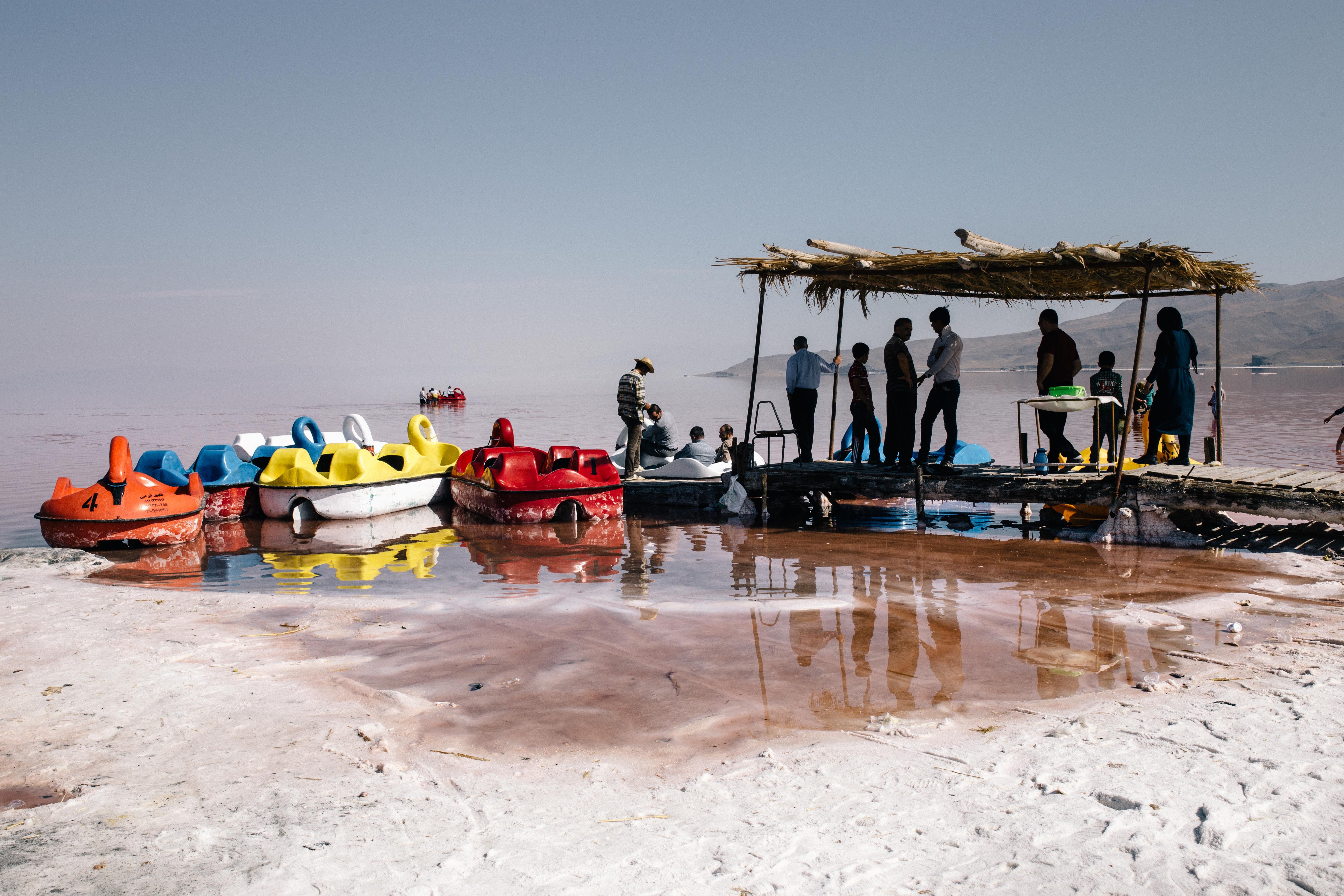
The lake is marked by more than a hundred small, rocky islands, which serve as stopover points during the migrations of a number of bird species, including flamingos, pelicans, spoonbills, ibises, storks, shelducks, avocets, stilts, and gulls. A recent drought has significantly decreased the annual amount of water the lake receives. This in turn has increased the salinity of the lake's water, reducing its viability as home to thousands of migratory birds, including a large flamingo populations. The salinity has particularly increased in the half of the lake north of the Urmia Lake Bridge.
By virtue of its high salinity, the lake no longer sustains any fish species. Nonetheless, Urmia Lake is considered a significant natural habitat of Artemia, which serve as food source for the migratory birds such as flamingos.[25] In early 2013, the then-head of the Iranian Artemia Research Center was quoted that Artemia urmiana had gone extinct due to the drastic increases in salinity. However this assessment has been contradicted,[26] and another population of this species has recently been discovered in the Koyashskoye Salt Lake at the Crimean Peninsula.[27]
Falling level and increasing salinity
The lake is a major barrier between Urmia and Tabriz, two of the most important cities in the provinces of West Azerbaijan and East Azerbaijan. A project to build a highway across the lake was initiated in the 1970s but was abandoned after the Iranian Revolution of 1979, leaving a 15 km (9.3 mi) causeway with an unbridged gap. The project was revived in the early 2000s, and was completed in November 2008 with the opening of the 1.5 km (0.93 mi) Urmia Lake Bridge across the remaining gap.[28] The highly saline environment is already heavily rusting the steel on the bridge despite anti-corrosion treatment. Experts have warned that the construction of the causeway and bridge, together with a series of ecological factors, will eventually lead to the drying up of the lake, turning it into a salt marsh, which will adversely affect the climate of the region.

Lake Urmia has been shrinking for a long time, with an annual evaporation rate of 0.6 to 1 m (24 to 39 in). Although measures are now being taken to reverse the trend[29] the lake has shrunk by 60% and could disappear entirely.[29] Only 5% of the lake's water remains.[30]
On 2 August 2012, Muhammad-Javad Muhammadizadeh, the head of Iran's Environment Protection Organization, announced that Armenia had agreed to transfer water from Armenia to counter the critical fall in Lake Urmia's water level, remarking that "hot weather and a lack of precipitation have brought the lake to its lowest water levels ever recorded". He added that recovery plans for the lake included the transfer of water from Eastern Azerbaijan Province. Previously, Iranian authorities had announced a plan to transfer water from the Aras River, which borders Iran and Azerbaijan, but the 950-billion-toman plan was abandoned due to Azerbaijan's objections.[31]
In July 2014, Iran President Hassan Rouhani approved plans for a 14 trillion rial program (over $500 million) in the first year of a recovery plan. The money is supposed to be used for water management, reducing farmers' water use, and environmental restoration. Several months earlier, in March 2014, Iran's Department of Environment and the United Nations Development Programme (UNDP) issued a plan to save the lake and the nearby wetland, which called for spending $225 million in the first year and $1.3 billion overall for restoration.[32]
Starting in 2016, Food and Agriculture Organization of the United Nations (FAO) and Urmia Lake Restoration Program (ULRP) signed up to a project funded by the Government of Japan entitled "An Integrated Programme for Sustainable Water Resources Management in the Lake Urmia Basin" to support ULRP in its goal to restore Lake Urmia. The project set out a multi-disciplinary framework covering several key interrelated areas and aims to have five outputs: 1. An advanced water accounting (WA) system for the entire Lake Urmia basin; 2. A drought management system based on risk/vulnerability assessment and preparedness response for the basin; 3. A socio-economic livelihood programme with viable and sustainable alternatives to current agricultural activities upstream of the lake to reduce water consumption significantly while maintaining the income and livelihood of affected communities; 4. An integrated watershed management (WM) programme; A capacity development programme to strengthen stakeholders at different levels.
The Silveh Dam in Piranshahr County should be complete in 2015. Through a tunnel and canals it will transfer up to 121,700,000 m3 (98,700 acre⋅ft) of water annually from the Lavin River in the Little Zab basin to Lake Urmia basin.[33][34]
In 2015, president Hassan Rouhani's cabinet approved $660 million for improving irrigation systems, and steps to combat desertification.[8]
In September 2018, A working group tasked with reviving Lake Urmia has started to grow two types of plants to save the region from salt particles. The two plants are Nitraria or Karadagh and Tamarix or Shoorgaz, which are planted on the land of Jabal Kandi village in Urmia County, to slow down the wind that brings with itself the salt particles.[35]
Environmental protests
The prospect that Lake Urmia might dry up entirely has drawn protests in Iran and abroad, directed at both the regional and national governments. Protests flared in late August 2011 after the Iranian parliament voted not to provide funds to channel water from the Aras River to raise the lake level.[36][37] Apparently, parliament proposed instead to relocate people living around Urmia Lake.[37]
More than 30 activists were detained on 24 August 2011 during an iftar meal.[37] In the absence of a right to protest publicly in Iran, protesters have incorporated their messages into chants at football matches.[36][38] On 25 August, several soccer fans were detained before and after the Tabriz derby match between Tractor Sazi F.C. and Shahrdari Tabriz F.C. for shouting slogans in favor of protecting the lake, including "Urmia Lake is dying, the Majlis [parliament] orders its execution".[36][37][39][40]
Further demonstrations took place in the streets of Tabriz and Urmia on 27 August and 3 September 2011.[36][38][41] Amateur video from these events showed riot police on motorcycles attacking apparently peaceful protesters.[38][42] According to the governor of West Azerbaijan, at least 60 supporters of the lake were arrested in Urmia, and dozens in Tabriz, because they had not applied for a permit to organize a demonstration.[43]
The effect of climate change on the lake, has been extensively covered by an Iranian photojournalist Solmaz Daryani.[44][45][46][47][48]
Islands
Lake Urmia had approximately 102 islands.[49] Shahi Island was historically the lake's largest. However, it became a peninsula connected to the eastern shore when the lake level dropped.[1][50]
Shahi Island is the burial place of both Hulagu Khan (one of Genghis Khan's grandsons) and of Hulagu's son Abaqa. Both khans were buried in a castle above 1,000-foot (300 m) cliffs along the shore of the island.[51]
In 1967, the Iranian Department of Environment sent a team of scientists to study the ecology of Shahi Island. Various results of the study, which included the breeding habits of brine shrimp, were published by Javad Hashemi in the scientific journal, Iranian Scientific Sokhan. A herd of Iranian antelope and gazelle were introduced into the islands, some of which survive to the present day. The Persian leopards that were also introduced to check the number of these antelopes survived for years, going extinct sometime in the early 1980s.
Basin rivers
Lake Urmia is fed by 13 permanent rivers and many small springs, as well as rainfall directly into the lake.[1] Nearly half the inflow comes from the Zarrineh River and Simineh River.[1] There is no outflow from the lake so water is only lost through evaporation.[1]
- Aji Chay
- Alamlou River
- Barandouz River
- Gadar River
- Ghaie River
- Leylan River
- Mahabad River
- Nazlou River
- Rozeh River
- Shahar River
- Simineh River
- Zarrineh River
- Zola River
In popular culture
Lake Urmia was the setting of the Iranian film The White Meadows (2009), which featured fantastic-looking lands adjacent to a salt sea. There are many popular songs about Lake Urmia in Azerbaijani language, such as "Urmu Gölü Lay Lay".[citation needed]
See also
- Urmia Lake Bridge
- List of drying lakes
References
- Persian: دریاچهٔ ارومیه, romanized: Daryâče-ye Orumiye; Kurdish: گۆلائوو رمیەیێ, romanized: Gola Ûrmiyeyê; Azerbaijani: اۇرمۇ گؤلۆ, romanized: Urmu gölü; Armenian: Կապուտան, romanized: Kaputan
- Stevens, Lora R.; Djamali, Morteza; Andrieu-Ponel, Valérie; de Beaulieu, Jacques-Louis (1 April 2012). "Hydroclimatic variations over the last two glacial/interglacial cycles at Urmia Lake, Iran". Journal of Paleolimnology. Springer Netherlands. 47 (4): 647. doi:10.1007/s10933-012-9588-3. S2CID 128970562.
- Urmia Lake. 2012. Encyclopædia Britannica Online. Retrieved 14 August 2015, from https://www.britannica.com/EBchecked/topic/619901/Lake-Urmia
- "Lake Urmia's surface increased by over 1500 km²". Tehran Times. 11 April 2021.
- "Lake Urmia [or Orumiyeh]". Ramsar Sites Information Service. Retrieved 25 April 2018.
- Henry, Roger (2003) Synchronized chronology: Rethinking Middle East Antiquity: A Simple Correction to Egyptian Chronology Resolves the Major Problems in Biblical and Greek Archaeology Algora Publishing, New York, p. 138, ISBN 0-87586-191-1
- E. J. Brill's first encyclopaedia of Islam, 1913–1936, vol. 7, page 1037 citing Strabo and Ptolemy.
- "Britanica". Britannica.com. Retrieved 4 September 2011.
- Stone, Richard (2 September 2015). "Saving Iran's great salt lake". Science. 349 (6252): 1044–5, 1047. Bibcode:2015Sci...349.1044S. doi:10.1126/science.aad1702. PMID 26339009.
- Dudley, Dominic. "Iran's Lake Urmia: How A Dying Salt Lake Is Being Brought Back From The Brink". Forbes. Retrieved 29 May 2020.
- Richard Nelson Frye, The history of ancient Iran, München (1984), 48–49
- The Proto-Indoaryans, by T. Burrow, The Journal of the Royal Asiatic Society of Great Britain and Ireland, No. 2 (1973), pp. 123–140, published by: Cambridge University Press, see 139
- Amurian, A.; Kasheff, M. (15 December 1986). "Armenians of modern Iran". Encyclopædia Iranica. Archived from the original on 26 October 2018. Retrieved 2 May 2016.
Urmia (class. Arm. Kaputan) ...
- Russell, James R. (1987). Zoroastrianism in Armenia. Harvard University. p. 430.
Urmia Lake, called Kaputan cov by Arm. geographers...
- "Armenian Highland". armin.am. Institute for Armenian Studies of Yerevan State University.
In the Armenian Highland there are numerous lakes and ponds. The most majors are Kaputan (Urmia), Van and Sevan.
- See, e.g. the Shahnama.
- C. A. Burney, Excavations at Yanik Tepe, North-West-Iran, Iraq 23, 1961, pp. 138ff.
- O. W. Muscarella, "The Chronology and Culture of Se Girdan: Phase III", Ancient Civilizations from Scythia to Siberia 9/1-2, 2003, pp. 117-31
- cf. Skjærvø, Prods Oktor (2006), "Iran, vi(1). Earliest Evidence", Encyclopaedia Iranica, Vol. 13
- Alireza Asem; Fereidun Mohebbi; Reza Ahmadi (2012). "Drought in Urmia Lake, the largest natural habitat of brine shrimp Artemia" (PDF). World Aquaculture. 43: 36–38. Archived from the original (PDF) on 1 April 2016. Retrieved 17 May 2013.
- "UNESCO Biosphere Reserve Directory".
- Asem, A.; Eimanifar, A.; Djamal, M.; De; Rios, P.; Wink, M. (2014). "Biodiversity of the Hypersaline Urmia Lake National Park (NW Iran)". Diversity. 6: 102–132. doi:10.3390/d6010102.
- Asem, A.; Eimanifar, A.; Wink, M. (2016). ""Update of "Biodiversity of the Hypersaline Urmia Lake National Park (NW Iran)". Diversity. 8 (4): 6. doi:10.3390/d8010006.
- Ramsar Sites Information Service
- "ProtectedPlanet - Urumieh lake". Archived from the original on 23 March 2019. Retrieved 24 March 2015.
- C. Michael Hogan. 2011. Urmia Lake. Eds. P. Saundry & C. J.Cleveland. Encyclopedia of Earth. National Council for Science and the Environment. Washington, D.C.
- Critical condition of Artemia urmiana and possibility of extinction
- Eimanifar A; Asem A; Djamali M; Wink M (2016). "A note on the biogeographical origin of the brine shrimp Artemia urmiana Günther, 1899 from Urmia Lake, Iran". Zootaxa. 4097 (2): 294–300. doi:10.11646/zootaxa.4097.2.12. PMID 27394547. S2CID 25998873.
- "Iran's East and West Azerbaijan Provinces Connected by Lake Orumiyeh Bridge". Payvand.com. Retrieved 4 September 2011.
- Karmi N. Iran's largest lake turning to salt. Associated Press 25 May 2011. https://news.yahoo.com/s/ap/20110525/ap_on_re_mi_ea/ml_iran_environmental_disaster/print
- Erdbrink, Thomas (30 January 2014). "Its Great Lake Shriveled, Iran Confronts Crisis of Water Supply". The New York Times. Archived from the original on 31 January 2014. Retrieved 11 May 2017.
{{cite news}}: CS1 maint: bot: original URL status unknown (link) - "Armenia to help Iran save drying lake Oroumiyeh".
- "Iran to spend $500 million to save shrunken Lake Urmia".
- "Completed by the end of the 94 dams Silveh Piranshahr" (in Persian). Kurd Press. 23 August 2014. Archived from the original on 20 January 2015. Retrieved 20 January 2015.
- "Silveh Dam and Irrigation and Drainage" (in Persian). Omran Iran - Deputy Governor of West Azerbaijan. Archived from the original on 20 January 2015. Retrieved 20 January 2015.
- "Iran Using Plants to Fight Dust Pollution in Lake Urmia". 28 September 2018.
- Mackey, Robert (30 August 2011). "Protests in Iran Over Disappearing Lake". The New York Times. Iran. Retrieved 4 September 2011.
- "Azeri Activists Detained in Iran For Environmental Protests". RFE/RL. 26 August 2011. Retrieved 12 November 2015.
- "Iranian greens fear disaster as Lake Orumieh shrinks". The Guardian. London. 5 September 2011.
- "Rally protesting Iran over Urmia Lake turns violent". Hurriyet Daily News. 1 September 2011. Retrieved 4 September 2011.
- "Iranian Protest Urges Help for Shrinking Lake". San Francisco Chronicle. 30 August 2011. Retrieved 4 September 2011.
- "Azeri Turks in Ankara protest Urmia Lake drying up". todayszaman.com. Archived from the original on 6 September 2011. Retrieved 4 September 2011.
- "Iran police break up environmental protests". euronews.net. 4 September 2011. Retrieved 4 September 2011.
- "Iran arrests saltwater lake protesters". BBC. 4 September 2011. Retrieved 4 September 2011.
- Daryani, Solmaz. "A reflection on how climate change altered Lake Urmia". The Caravan. Retrieved 7 December 2019.
- "Final winners of IdeasTap and Magnum Photos documentary photography award announced". British Journal of Photography. 22 December 2015. Retrieved 7 December 2019.
- Daryani, Solmaz. "Troubled Waters". Foreign Policy. Retrieved 27 February 2020.
- "The Eyes of Earth". emerge - Magazin für jungen Fotojournalismus (in German). 11 June 2018. Retrieved 27 February 2020.
- "Why is the largest lake in the Middle East drying up?". english.alarabiya.net. 17 March 2018. Retrieved 27 February 2020.
- List from: Farahang-e Joghrafiyayi-e shahrestânhâ-ye Keshvar (Shahrestân-e Orumiyeh), Tehran 1379 Hs.
- Asem, Alireza; Eimanifar, Amin; Djamali, Morteza; De los Rios, Patricio; Wink, Michael (2014). "Biodiversity of the Hypersaline Urmia Lake National Park (NW Iran)". Diversity. 6: 102–132. doi:10.3390/d6010102.
- Boyle, John Andrew (1974). "The Thirteenth-Century Mongols' Conception of the After Life: The Evidence of their Funerary Practices". Mongolian Studies. Mongolia Society. 1: 7. ISSN 0190-3667. JSTOR 43193015.
External links
- Iranica Encyclopedia: Eckhart Ehlers, "Lake Urmia", 2013
- Encyclopedia of Earth: C. Michael Hogan, "Lake Urmia", 2011
- Saline Systems; Urmia Salt Lake, Iran
- Profile at UNESCO Biosphere Reserve Directory
- Iran's Environmental Ticking Bomb Archived 29 November 2011 at the Wayback Machine
- Landsat - Drying of Lake Urmia, Iran, Google Earth Engine
- Aerial view of Lake Urmia
На других языках
[de] Urmiasee
Der Urmiasee oder Urmia-See (persisch درياچهٔ اروميه, DMG Daryāče-ye Orūmīye; mittelpersisch Čēčast;[1] aserbaidschanisch Urmiye Gölü; kurdisch Gola Urmiyê), zur Zeit der Pahlavi-Dynastie Rezaiye-See nach Reza Schah, ist der größte Binnensee in Iran und befindet sich im Grenzgebiet der iranischen Provinzen West-Aserbaidschan und Ost-Aserbaidschan. An dem See liegt die Stadt Urmia. Deren Name leitet sich von den syrisch-aramäischen Wörtern ur für „Stadt“ und mia für „Wasser“ ab und bedeutet „Stadt am Wasser“.- [en] Lake Urmia
[es] Lago Urmía
El lago Urmía (en persa, دریاچه ارومیه, Дарйаче-йе Орумийе; en azerí, Urmiya gölü; en kurdo, Gola Urmiyê, en armenio, Ուրմիա լիճ, Урмия лич или Կապուտան - Капутан, o lago Azul) es un lago salado del Azerbaiyán iraní, al noroeste de Irán. Su superficie es de 5200 km²; tiene una longitud máxima de 140 km y una anchura máxima de 55 km. La profundidad máxima es de 16 m.[fr] Lac d'Ourmia
Le lac d'Oroumieh[1] (en persan دریاچه ارومیه - Daryācheh-ye Oroumieh ; en arménien Կապուտան լիճ / Kapoutan litch ; en azéri اورمیه ﮔﺆﻟﻮ Urmu gölü) est un lac salé dans le nord-ouest de l’Iran, dans l’Azerbaïdjan iranien (entre les provinces d’Azerbaïdjan oriental et d’Azerbaïdjan occidental). Plus grand lac d’Iran, il fait partie du parc national du même nom.[it] Lago di Urmia
Il lago di Urmia (persiano: دریاچه ارومیه) era un lago salato endoreico situato tra le province iraniane dell'Azerbaigian Orientale e dell'Azerbaigian Occidentale, a occidente del Mar Caspio. Il lago di Urmia era stato dichiarato dall'UNESCO riserva della biosfera nel 1976.[ru] Урмия (озеро)
У́рмия[1] (перс. دریاچه ارومیه — Дерьячейе-Орумие — озеро Орумие[2], азерб. Urmiya gölü, арм. Ուրմիա լիճ[3][4]) — бессточное солёное озеро, расположенное на Армянском нагорье[5] между останами Восточный и Западный Азербайджан, на северо-западе Ирана.Другой контент может иметь иную лицензию. Перед использованием материалов сайта WikiSort.org внимательно изучите правила лицензирования конкретных элементов наполнения сайта.
WikiSort.org - проект по пересортировке и дополнению контента Википедии