geo.wikisort.org - Mountains
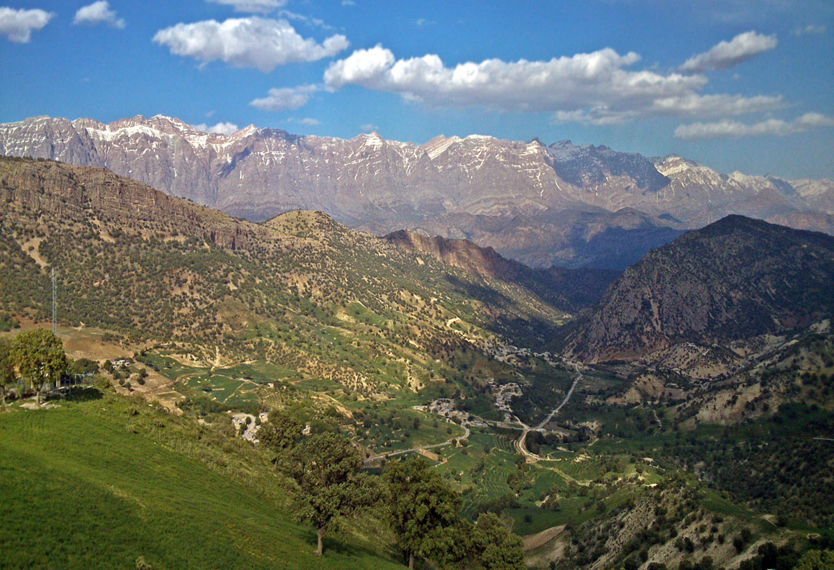
Dena (in Luri and Persian: دنا) is the name for a sub-range within the Zagros Mountains, Iran. Mount Dena, with 80 km (50 mi) length and 15 km (49,000 ft) average width, is situated on the boundary of the Isfahan, Kohgiluyeh and Boyer-Ahmad and Chaharmahal and Bakhtiari Provinces of Iran.[1]
| Mount Dena | |
|---|---|
| دنا | |
 | |
| Highest point | |
| Peak | Qash-Mastan |
| Elevation | 4,409 m (14,465 ft) |
| Prominence | 2,604 m (8,543 ft) |
| Coordinates | 30°57′N 51°26′E |
| Dimensions | |
| Length | 80 km (50 mi) |
| Width | 15 km (9.3 mi) |
| Naming | |
| Language of name | Persian and Luri |
| Geography | |
 Mount Dena  Mount Dena | |

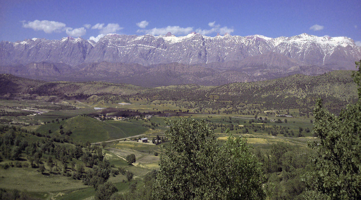
Mount Dena has more than 40 peaks higher than 4,000 metres (13,000 feet). With an elevation of 4,409 metres above sea level, Qash-Mastan is the highest peak in the Dena Range and in the Zagros Mountains in general. Another known peak in this range is Hose-Daal close to the city of Sisakht, 30 km (19 mi) to the north of Yasuj.
Annual precipitation in Mount Dena ranges from 600 to 1,800 mm (24 to 71 in) and various rivers including a branch of the Karun rise in this range.
Geologically, Mount Dena is located in the Sanandaj-Sirjan geologic and structural zone of Iran and is mainly made of Cretaceous limestone.[2]
On 18 February 2018, Iran Aseman Airlines Flight 3704 crashed into Mount Dena, killing all 65 people on board.[3][4]
Gallery


See also
References
- Microsoft Encarta World Atlas, 2001, Microsoft Corporation
- Geological Map of Iran, National Geoscience Database of Iran, www.ngdir.ir
- "Passenger plane crashes in southern Iran, killing 65 on board". NBC News. Retrieved 2018-02-18.
- "Agonising wait for Iran crash relatives". BBC News. 19 February 2018.
На других языках
[de] Dena (Berg)
Das Dena-Massiv ist ein Teil des sich über 1500 km erstreckenden Zāgros-Gebirges im Iran. Es ist im mittleren Zāgros in der Nähe der Stadt Yasudsch gelegen. Der höchste Gipfel des Massivs ist der 4409 m hohe Qash Mastan, der zugleich auch die höchste Erhebung des gesamten Zāgros-Gebirges ist.- [en] Dena
[fr] Dena (massif)
Le Dena est un massif des monts Zagros en Iran situé au carrefour des provinces de Kohkiluyeh et Buyer Ahmad, d'Ispahan et de Chahar Mahaal et Bakhtiari.[ru] Динар (хребет)
Динар[1] (Кухе-Динар[2][3], перс. دنا) — горный хребет на западе Ирана, к северу от Ясуджа, часть гор Загрос. Высочайшая вершина — 4525 м над уровнем моря[1][2][3]. По хребту граничат останы (провинции) Кохгилуйе и Бойерахмед, Исфахан, Фарс и Чехармехаль и Бахтиария[2].Другой контент может иметь иную лицензию. Перед использованием материалов сайта WikiSort.org внимательно изучите правила лицензирования конкретных элементов наполнения сайта.
WikiSort.org - проект по пересортировке и дополнению контента Википедии