geo.wikisort.org - River
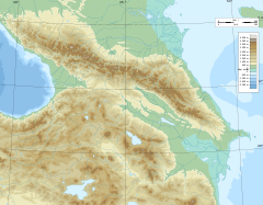
The Ksani (Georgian: ქსანი, Ossetian: Чысандон, Ĉysandon) is a river in central Georgia, which rises on the southern slopes of the Greater Caucasus Mountain Range in South Ossetia and flows into the Kura (Mtkvari). It is 84 km (52 mi) long, and has a drainage basin of 885 km2 (342 sq mi).[2] Ksani (both the river and the name) is often associated with the Medieval Georgian Ksani fortress which lies near the confluence of the Ksani and the Mtkvari.
| Ksani | |
|---|---|
 Ravine of Ksani | |
  | |
| Native name | |
| Location | |
| Country | Georgia (South Ossetia)[1] |
| Physical characteristics | |
| Source | Greater Caucasus |
| Mouth | Kura |
• coordinates | 41.8546°N 44.5626°E |
| Length | 84 km (52 mi) |
| Basin size | 885 km2 (342 sq mi) |
| Basin features | |
| Progression | Kura→ Caspian Sea |
See also
- Duchy of Ksani
References
- South Ossetia's status is disputed. It considers itself to be an independent state, but this is recognised by only a few other countries. The Georgian government and most of the world's other states consider South Ossetia de jure a part of Georgia's territory.
- Statistical Yearbook of Georgia: 2020, National Statistics Office of Georgia, Tbilisi, 2020, p. 12.
На других языках
[de] Ksani
Der Ksani (georgisch ქსანი; ossetisch Чысандон/ Čysandon) ist ein Fluss in Zentralgeorgien und in Südossetien.- [en] Ksani
[ru] Ксани
Кса́ни (груз. ქსანი) или Чисандон (осет. Чысандон) — река в Южной Осетии и Грузии, левый приток Куры. Протекает в пределах Ленингорского района Южной Осетии (верхнее и среднее течение) и Грузии (нижнее течение).Текст в блоке "Читать" взят с сайта "Википедия" и доступен по лицензии Creative Commons Attribution-ShareAlike; в отдельных случаях могут действовать дополнительные условия.
Другой контент может иметь иную лицензию. Перед использованием материалов сайта WikiSort.org внимательно изучите правила лицензирования конкретных элементов наполнения сайта.
Другой контент может иметь иную лицензию. Перед использованием материалов сайта WikiSort.org внимательно изучите правила лицензирования конкретных элементов наполнения сайта.
2019-2025
WikiSort.org - проект по пересортировке и дополнению контента Википедии
WikiSort.org - проект по пересортировке и дополнению контента Википедии