geo.wikisort.org - River
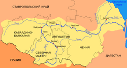
The Terek (Russian: Те́рек, IPA: [ˈtʲerʲɪk]; Ingush: Тийрк, Tiyrk; Kabardian: Тэрч, Tərč; Karachay-Balkar: Терк, Terk; Georgian: თერგი, Tergi; Ossetian: Терк, Terk; Kumyk: Терек-сув, Terek-suv; Chechen: Теркa, Terka) is a major river in the Northern Caucasus. It originates in the Mtskheta-Mtianeti region of Georgia and flows through North Caucasus region of Russia into the Caspian Sea. It rises near the juncture of the Greater Caucasus Mountain Range and the Khokh Range, to the southwest of Mount Kazbek, winding north in a white torrent between the town of Stepantsminda and the village of Gergeti toward the Russian region North Ossetia and the city of Vladikavkaz. It turns east to flow through Chechnya and Dagestan before dividing into two branches which empty into the Caspian Sea. Below the city of Kizlyar it forms a swampy river delta around 100 kilometres (62 mi) wide. The river is a key natural asset in the region, providing irrigation and hydroelectric power in its upper reaches.
| Terek | |
|---|---|
 Map of Terek river | |
| Location | |
| Countries | Georgia and Russia |
| Region | Mtskheta-Mtianeti |
| Federal subjects |
|
| Physical characteristics | |
| Source | Mount Zilga-Khokh |
| • location | Main Caucasian Range Greater Caucasus, Georgia |
| • coordinates | 42.6159°N 44.2395°E |
| • elevation | 2,700 m (8,900 ft) |
| Mouth | Caspian Sea |
• coordinates | 43.595278°N 47.561667°E |
• elevation | −28 m (−92 ft) |
| Length | 623 km (387 mi) |
| Basin size | 43,200 km2 (16,700 sq mi) |
| Discharge | |
| • average | 305 m3 (10,800 cu ft) per second |
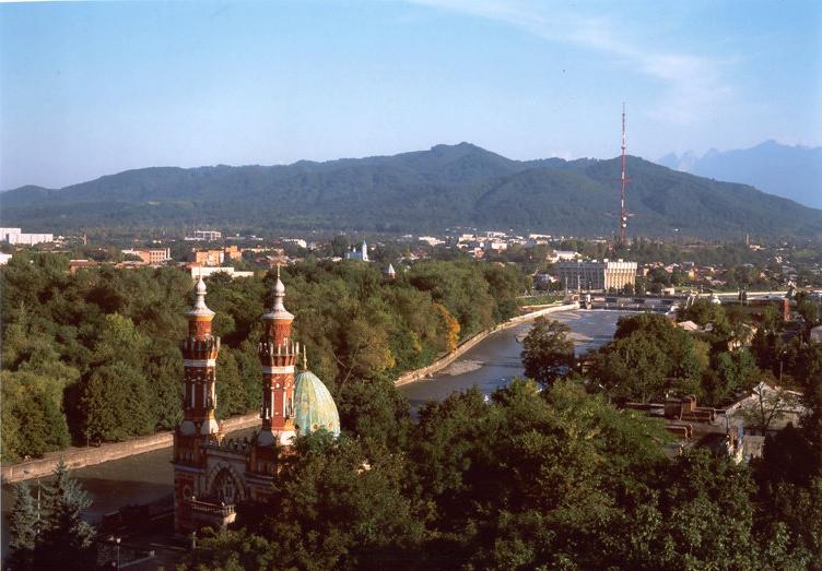


The main cities on the Terek include Vladikavkaz, Mozdok, and Kizlyar. Several minor hydroelectric power stations dam the Terek: Dzau electrostation (in Vladikavkaz), Bekanskaya, and Pavlodolskaya.
The construction of the Dariali Hydropower Plant with a planned installed capacity of 108 MW started in 2011 on the territory of Kazbegi municipality near the Russia–Georgia border.[1]
Leo Tolstoy's novel The Cossacks is set on the Terek and amongst its Cossacks.
Tributaries
The Terek drains most of the northeast Caucasus east into the Caspian just as its sister, the Kuban, drains the northwest Caucasus west into the Black Sea. Its major tributaries are the following. In the west a fan of rivers flows east and northeast into the Terek. These are the east-flowing Malka, the Baksan, the Chegem and the Cherek with its two branches. These three join the Malka just before it reaches the Terek. The Liashen, Urukh, Duradur and Duradon flow northeast, the Ardon and its tributary, the Fiagdon flow north and the Gizeldon drains the north slope of Mount Kazbek and reaches the Terek near the mouth of the Ardon. Then there is the north-flowing part of the Terek with the Darial Pass. The great northwest bend of the Terek is cut off by the northeast-flowing Sunzha which catches most of the north-flowing rivers. These are the north-flowing upper Sunzha, the Assa, the Argun and Khukhulau. East of these are the Aksay and the Aktash which formerly dried up in the lowlands between the Sulak and the Terek. In the east the Sulak drains most of interior Dagestan and turns east to the Caspian before it reaches the Terek.
Human history
The capital of Khazaria, Samandar, may have stood on the banks of the river Terek.
The Terek river was the site of the final defeat of the army of Hulagu, khan of the Ilkhanate, at the hands of the army of Berke, khan of the Golden Horde, led by Berke's nephew, Nogai Khan, in the first civil war of the Mongol Empire, the Berke–Hulagu war of 1262. Also on the river Timur defeated Tokhtamysh in 1395.
The Terek Cossack Host (1577–1832 and 1860– ) had its base in the Terek basin. During the Russian conquest of the Caucasus it was part of the North Caucasus Line.
During World War II, German forces at the end of August 1942 reached the Terek near Mozdok – the farthest extent of German conquests in the Soviet Union – but aside from a small bridgehead were unable to forge further toward the oil fields of Baku, Hitler's objective.[2] The Germans penetrated the left bank of the Terek reaching Vladikavkaz suburbs and West Gizel, near the now built weather station.
See also
- Terek Cossacks
References
- Dariali Hydro Power Plant Construction and Operation Project (Environmental and Social Impact Assessment Reportt). Darial Energy LLC. Issued in 2011. Retrieved on 2014-16-07.
- Schramm, Percy Ernst (1963). Kriegstagebuch des Oberkommandos der Wehrmacht, 1940–1945 Teilband II. Bonn: Bernard & Graefe Verlag für Wehrwesen, p.583.
| Authority control: National libraries |
|---|
На других языках
[de] Terek
Der Terek (russisch Терек; georgisch თერგი/Tergi; ossetisch Терк/Terk; kabardinisch Тэрч/Tartsch; inguschisch Тийрк/Tijrk; tschetschenisch Терка/Terka) ist ein 623 km langer Zufluss des Kaspischen Meeres im Kaukasus. Er entwässert ein 43.200 km² großes Einzugsgebiet an der Nordflanke des Großen Kaukasus.- [en] Terek (river)
[es] Río Térek
El río Térek (en ruso: Те́рек); en georgiano, თერგი, Tergi; en osetio: Терк; en avar, Терек, Térek; en checheno, Теркa, Terka es uno de los principales ríos del norte del Cáucaso. Nace en un glaciar en la montaña del monte Kazbek, en Georgia, discurriendo hacia el norte por el territorio de la Federación Rusa, atravesando las repúblicas autónomas de Osetia del Norte-Alania, y girando luego hacia el este, por Chechenia y el Daguestán y desembocando finalmente en el mar Caspio, donde forma un gran delta de más de 100 km². Las ciudades más importantes a lo largo de su curso son Vladikavkaz, Mozdok y Kizlyar. La capital de Jazaria (véase jázaros), Samandar, se encontraba, probablemente, en las márgenes del río.[it] Terek (fiume)
Il Terek (in georgiano: თერგი?, traslitterato: Tergi; in russo: Терек?) è un fiume del Caucaso, di cui drena una parte del versante nordorientale.[ru] Терек
Те́рек (в низовье Новый Терек и Аликазган[2].mw-parser-output .ts-Переход img{margin-left:.285714em}[⇨], груз. თერგი (Тэрги); ингуш. Тийрк[3], осет. Терк[4]; кабард.-черк. Тэрч[5]; карач.-балк. Терк суу; чечен. Терк[6]; кум. Терек-сув, ног. Терк сув) — река на Северном Кавказе. Терек протекает по территории двух государств — Грузии (верховье) и Российской Федерации, в том числе в последней по территории 6 субъектов. Имеет важное водохозяйственное значение. Дельта Терека представляет собой самостоятельный обширный массив площадью около 4000 км², из которых более 500 км² заняты ирригационными площадями[7].Другой контент может иметь иную лицензию. Перед использованием материалов сайта WikiSort.org внимательно изучите правила лицензирования конкретных элементов наполнения сайта.
WikiSort.org - проект по пересортировке и дополнению контента Википедии