geo.wikisort.org - Reservoir
Dams and reservoirs in Australia is a link page for any dam or reservoir in Australia.
Australian Capital Territory
There are three key water storage facilities located in the Australian Capital Territory. The fourth source of water for Canberra, Googong Dam, is in NSW. In addition, there are four smaller man-made reservoirs used for recreation and as traps for sediment and fertilizers .
This list is incomplete; you can help by adding missing items. (July 2014) |
| Image | Dam name (where appropriate) |
Reservoir name[1] (where appropriate) |
Region(s) | Waterway(s) impounded[1] |
Dam type[1] | Purpose(s)[1] | Reservoir capacity[1] | Coordinates[2] | ||
|---|---|---|---|---|---|---|---|---|---|---|
| ML | Gal (Imp.) | Gal (US) | ||||||||
 | Bendora Dam | Bendora Reservoir | Namadgi National Park | Cotter River | Arch | Water supply | 11,540 | 2.54×10⁹ | 3.05×10⁹ | 35°26′49″S 148°49′41″E |
 | Corin Dam | Corin Reservoir | Namadgi National Park | Cotter River | Embankment | Water supply | 75,500 | 16.6×10⁹ | 19.9×10⁹ | 35°33′55″S 148°49′52″E |
 | Cotter Dam | Cotter Reservoir | Cotter River | Gravity | Water supply | 78,000 | 17×109 | 21×109 | 35°19′10″S 148°56′19″E | |
 | Ginninderra Weir | Lake Ginninderra | Belconnen | Ginninderra Creek | Artificial lake | Recreation | 35°14′S 149°04′E | |||
 | Scrivener Dam | Lake Burley Griffin | Yarralumla | Molonglo River | Gravity | Recreation | 27,740 | 6.10×10⁹ | 7.33×10⁹ | 35°17′59″S 149°04′20″E |
 | n/a | Stranger Pond | Bonython | Off-stream | Artificial lake | Recreation | 35°25′47″S 149°4′11″E | |||
 | n/a | Lake Tuggeranong | Tuggeranong | Tuggeranong Creek | Artificial lake | Recreation | 35°24′30″S 149°04′00″E | |||
New South Wales
There are 2,250 dams, weirs, catchments, and barrages in New South Wales.[2] Of these, 135 facilities are considered major dams according to the Australian National Committee on Large Dams.[1]
Dams and reservoirs
The largest reservoir in New South Wales is the 4,798,000-megalitre (1.055×10¹² imp gal; 1.267×10¹² US gal) Lake Eucumbene in the Snowy Mountains, formed by the Eucumbene Dam.[3]
This list is incomplete; you can help by adding missing items. (July 2014) |
| Image | Dam name (where appropriate) |
Reservoir name[1] (where appropriate) |
Region(s) | Waterway(s) impounded[1] |
Dam type[1] | Purpose(s)[1] | Reservoir capacity[1] | Coordinates[2] | ||
|---|---|---|---|---|---|---|---|---|---|---|
| ML | Gal (Imp.) | Gal (US) | ||||||||
 | Avon Dam | Avon Storage Reservoir | Sydney – Macarthur – Illawarra | Avon River | Gravity | Water supply | 214,360 | 4.715×10¹⁰ | 5.663×10¹⁰ | 34°21′05″S 150°38′28″E |
 | Bankstown Reservoir | Sydney – South-western Sydney | Water tower | Water supply | 4.4 | 970,000 | 1,200,000 | 33°54′20″S 151°02′23″E | ||
| Bendeela Pondage | Bendeela Pondage | South Coast | Kangaroo River | Embankment | Water supply | 1,200 | 260×106 | 320×106 | 34°43′30″S 150°28′47″E | |
| Ben Boyd Dam | South Coast | Water Supply | 800 | 180×106 | 210×106 | 37°07′14″S 149°51′18″E | ||||
 | Ben Chifley Dam | Central West | Campbells River | Embankment | Water supply | 30,800 | 6.8×10⁹ | 8.1×10⁹ | 33°32′54″S 149°38′05″E | |
 | Blowering Dam | Blowering Reservoir | Snowy Mountains | Tumut River | Embankment | Flood mitigation Hydroelectricity Irrigation Water supply Conservation | 1,628,000 | 3.58×10¹¹ | 4.30×10¹¹ | 35°24′05″S 148°14′52″E |
| Brogo Dam | South Coast | Brogo River | Embankment | Environmental flows Hydroelectricity Irrigation Water supply | 8,980 | 1.98×10⁹ | 2.37×10⁹ | 36°29′24″S 149°44′30″E | ||
 | Burrendong Dam | Lake Burrendong | Orana | Macquarie River | Embankment | Flood mitigation Hydroelectricity Irrigation Water supply | 1,188,000 | 2.61×10¹¹ | 3.14×10¹¹ | 32°40′04″S 149°06′25″E |
 | Burrinjuck Dam | Lake Burrinjuck | Riverina | Murrumbidgee River | Gravity | Hydroelectricity Irrigation | 1,026,000 | 2.26×10¹¹ | 2.71×10¹¹ | 35°00′10″S 148°35′02″E |
 | Carcoar Dam | Central West | Belubula River | Arch | Irrigation Water supply Water conservation | 36,400 | 8.0×10⁹ | 9.6×10⁹ | 33°37′00″S 149°10′45″E | |
| Cascade Creek Dams | Cascade Dam | Blue Mountains | Cascade Creek | Embankment | Water supply | 1,704 | 375×106 | 450×106 | 33°41′29″S 150°18′05″E | |
 | Cataract Dam | Cataract Reservoir | Sydney – Macarthur – Illawarra | Cararact River | Gravity | Water supply | 94,300 | 2.07×10¹⁰ | 2.49×10¹⁰ | 34°15′56″S 150°48′11″E |
 | Chaffey Dam | Chaffey Dam | New England | Peel River | Embankment | Irrigation Water supply | 102,868 | 2.2628×10¹⁰ | 2.7175×10¹⁰ | 31°20′45″S 151°08′19″E |
 | Chichester Dam | Lake Chichester | Hunter | Chichester River Wangat River | 21,500 | 4.7×10⁹ | 5.7×10⁹ | 32°14′15″S 151°41′22″E | ||
| Clarrie Hall Dam | Lake Clarrie Hall | Northern Rivers | Doon Doon Creek | 16,000 | 3.5×10⁹ | 4.2×10⁹ | 28°26′16″S 153°18′19″E | |||
| Cochrane Dam | Cochrane Lake | South Coast | Georges Creek | 385 | 85×106 | 102×106 | 36°33′54″S 149°27′04″E | |||
 | Copeton Dam | Lake Copeton | New England | Gwydir River | Embankment | 1,364,000 | 3.00×10¹¹ | 3.60×10¹¹ | 29°54′23″S 150°55′38″E | |
 | Cordeaux Dam | Sydney – Macarthur – Illawarra | Cordeaux River | Gravity | Water supply | 93,600 | 2.06×10¹⁰ | 2.47×10¹⁰ | 34°20′25″S 150°44′35″E | |
| Deep Creek Dam | Deep Creek Reservoir | Snowy Mountains | Deep Creek | 11 | 2.4×10⁶ | 2.9×10⁶ | 36°00′35.7″S 148°20′37.2″E | |||
 | Eucumbene Dam | Lake Eucumbene | Snowy Mountains | Eucumbene River | Embankment | 4,798,000 | 1.055×10¹² | 1.267×10¹² | ||
 | Fitzroy Falls Dam | Fitzroy Falls Reservoir | South Coast | Yarrunga Creek | Embankment | Water supply | 9,950 | 2.19×10⁹ | 2.63×10⁹ | |
| Geehi Dam | Geehi Reservoir | Snowy Mountains | Geehi River | Embankment | 21,093 | 4.640×10⁹ | 5.572×10⁹ | |||
| Glenbawn Dam | Lake Glenbawn | Hunter | Hunter River | 750,000 | 1.6×10¹¹ | 2.0×10¹¹ | ||||
| Glennies Creek Dam | Lake St Clair | Hunter | Hunter River | 283,000 | 6.2×10¹⁰ | 7.5×10¹⁰ | ||||
 | Googong Dam | Googong Reservoir | Capital Country | Queanbeyan River | 121,083 | 2.6635×10¹⁰ | 3.1987×10¹⁰ | |||
| Grahamstown Dam | Hunter Mid North Coast | Williams River | Water Supply | 190,000 | 4.2×10¹⁰ | 5.0×10¹⁰ | ||||
 | Guthega Dam | Guthega Pondage | Snowy Mountains | Snowy River | Gravity | Hydroelectricity | 1,604 | 353×106 | 424×106 | |
| Happy Jacks Dam | Happy Jacks Pondage | Snowy Mountains | Tumut River | Gravity | Hydroelectricity | 271 | 60×106 | 72×106 | ||
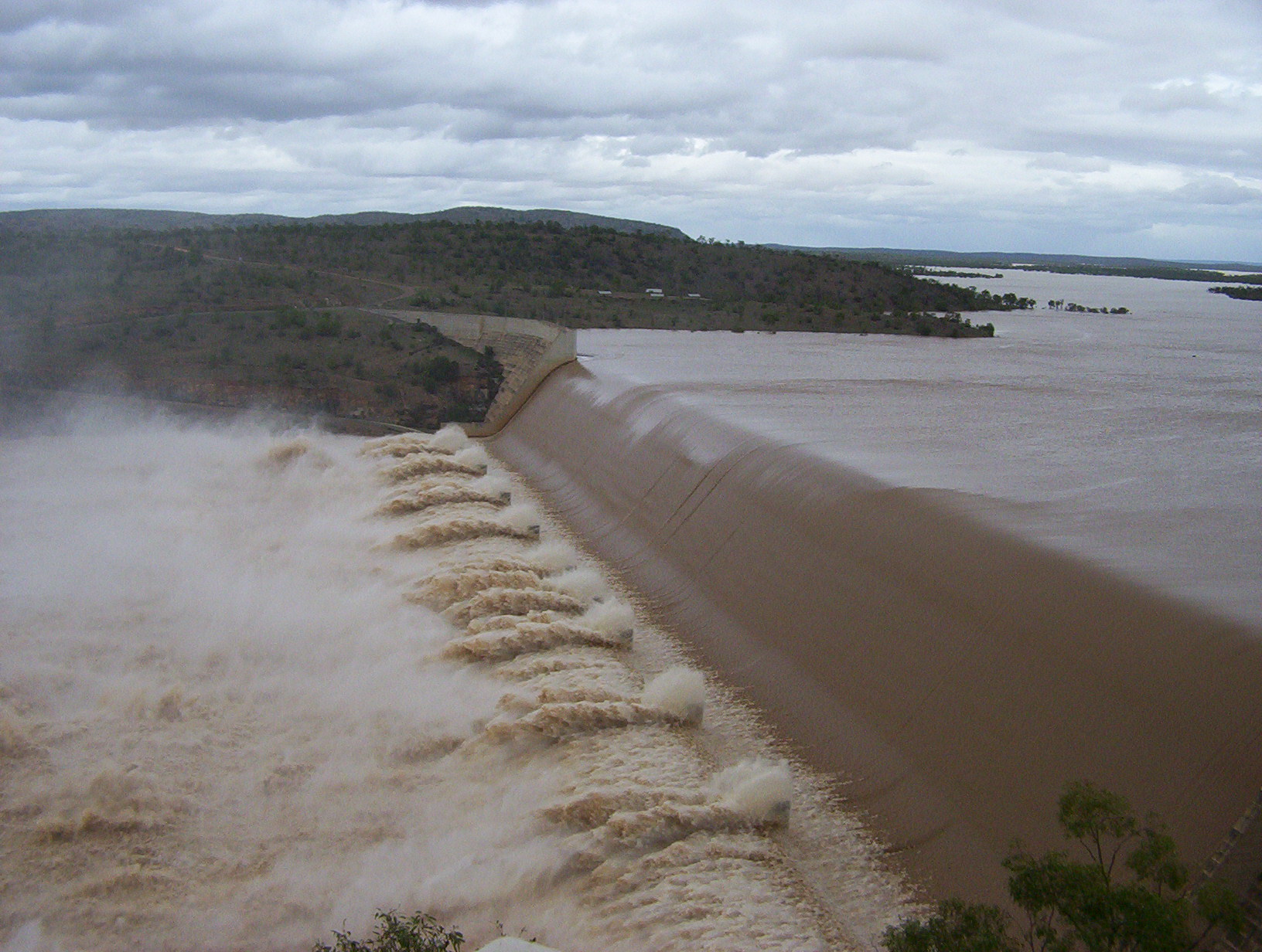
 | Hume Dam | Lake Hume (on border with Victoria) | Riverina | Murray River | Embankment Gravity | Hydroelectricity Irrigation | 3,038,000 | 6.68×10¹¹ | 8.03×10¹¹ | |
| Island Bend Dam | Island Bend Pondage | Snowy Mountains | Snowy River | Gravity | Hydroelectricity | 3,084 | 678×106 | 815×106 | ||
| Jindabyne Dam | Lake Jindabyne | Snowy Mountains | Snowy River | Embankment | Hydroelectricity | 688,000 | 1.51×10¹¹ | 1.82×10¹¹ | ||
| Jounama Dam | Jounama Pondage | Snowy Mountains | Tumut River | Embankment | Hydroelectricity | 43,542 | 9.578×10⁹ | 1.1503×10¹⁰ | ||
| Keepit Dam | Lake Keepit | New England | Namoi River | Irrigation | 425,510 | 9.360×10¹⁰ | 1.1241×10¹¹ | |||
| Khancoban Dam | Khancoban Reservoir | Snowy Mountains | Swampy Plain River | Embankment | Hydroelectricity | 26,643 | 5.861×10⁹ | 7.038×10⁹ | ||
 | Lake Rowlands Dam | Lake Rowlands | Central West | Coombing Rivulet | Concrete slab and buttress | Water supply | 4,500 | 990×106 | 1,200×106 | 33°40′16″S 149°10′35″E |
| Liverpool Offtake Reservoir | Cecil Hills | South West Sydney | fed from canal | embankment | Water supply | 170 | 37×106 | 45×106 | 33°53′24″S 150°49′36″E | |
| Lostock Dam | Lostock Dam | Hunter | Paterson River | Embankment | Water Supply | 20,220 | 4.45×10⁹ | 5.34×10⁹ | ||
| Lyell Dam | Lake Lyell | Central West | Coxs River | Water Supply | 34,500 | 7.6×10⁹ | 9.1×10⁹ | |||
| Malpas Dam | Malpas Reservoir | New England | Gara River | Water Supply | 13,000 | 2.9×10⁹ | 3.4×10⁹ | |||
| Mangrove Creek Dam | Central Coast | Mangrove Creek | Water Supply | 190,000 | 4.2×10¹⁰ | 5.0×10¹⁰ | ||||
 | Manly Dam | Manly Reservoir | Sydney – Northern Beaches | Curl Curl Creek | Gravity | Flood Mitigation | 2,000 | 440×106 | 530×106 | 33°46′53″S 151°15′21″E |
| Medlow Dam | Medlow Bath Reservoir | Blue Mountains | Adams Creek | Blue Mountains | Water supply | 304.5 | 67,000×103 | 80,400×103 | 33°39′30″S 150°17′57″E | |
| Murray Two Dam | Murray Two Pondage | Snowy Mountains | Khancoban Bank | Arch | Hydroelectricity | 2,344 | 516×106 | 619×106 | ||
 | Nepean Dam | Sydney – Macarthur – Illawarra | Nepean River | Arch gravity | Water supply | 70,170 | 1.544×10¹⁰ | 1.854×10¹⁰ | 34°19′55″S 150°37′05″E | |
| Oberon Dam | Lake Oberon | Central West | Fish River | Water Supply | 45,420 | 9.99×10⁹ | 1.200×10¹⁰ | |||
| Pindari Dam | Lake Pindari | North West Slopes | Hydroelectricity | 312,000 | 6.9×10¹⁰ | 8.2×10¹⁰ | ||||
 | Prospect Dam | Prospect Reservoir | Sydney – Western suburbs | Prospect Creek | Embankment | Water Supply | 50,200 | 1.10×10¹⁰ | 1.33×10¹⁰ | |
| Rocky Creek Dam | Northern Rivers | Rocky Creek | Water supply | 14,000 | 3.1×10⁹ | 3.7×10⁹ | ||||
| Rydal Dam | Central Tablelands | Power station cooling | 370 | 81×106 | 98×106 | |||||
| Split Rock Dam | Split Rock Reservoir | New England | Manilla River | Irrigation | 397,370 | 8.741×10¹⁰ | 1.0497×10¹¹ | |||
| Spring Creek Dam | Central West | Spring Creek | Minor embankment | Water supply | 4,680 | 1.03×10⁹ | 1.24×10⁹ | |||
| Stephens Creek Dam | Stephens Creek Reservoir | Far West | Stephens Creek | Gravity | Water supply | 2,000 | 440×106 | 530×106 | 31°52′42″S 141°35′40″E | |
| Suma Park Dam | Suma Park Reservoir | Central West | Summer Hill Creek | Water Supply | 17,290 | 3.80×10⁹ | 4.57×10⁹ | |||
| Talbingo Dam | Talbingo Reservoir | Snowy Mountains | Tumut River | Embankment | Hydroelectricity | 921,000 | 2.03×10¹¹ | 2.43×10¹¹ | ||
 | Tallowa Dam | Lake Yarrunga | South Coast | Shoalhaven River | Gravity | Water supply | 90,000 | 2.0×10¹⁰ | 2.4×10¹⁰ | 34°46′22″S 150°18′48″E |
| Tantangara Dam | Tantangara Reservoir | Snowy Mountains | Murrumbidge River | Gravity | Hydroelectricity | 254,099 | 5.5894×10¹⁰ | 6.7126×10¹⁰ | ||
| Tilba Dam | South Coast | 90 | 20×106 | 24×106 | ||||||
| Tooma Dam | Tooma Reservoir | Snowy Mountains | Tooma River | Embankment | Hydroelectricity | 28,124 | 6.186×10⁹ | 7.430×10⁹ | 36°03′03.4″S 148°16′30.5″E | |
| Toonumbar Dam | Lake Toonumbar | Northern Rivers | Iron Pot Creek | Water Supply | 1,100 | 240×106 | 290×106 | |||
| Tumut Pond Dam | Tumut Pond Reservoir | Snowy Mountains | Tumut River | 52,793 | 1.1613×10¹⁰ | 1.3946×10¹⁰ | ||||
| Tumut Two Dam | Tumut Two Reservoir | Snowy Mountains | Tumut River | Gravity | Hydroelectricity | 2,677 | 589×106 | 707×106 | ||
| Umberumberka Dam | Umberumberka Reservoir | Far West | Umberumberka Creek | Gravity | Water Supply | 1,950 | 430×106 | 520×106 | 31°48′49″S 141°12′38″E | |
 | Warragamba Dam | Lake Burragorang | Sydney – Macarthur | Coxs River Kowmung River Nattai River Wingecarribee River Wollondilly River Warragamba River | Gravity | Water Supply | 2,027,000 | 4.46×10¹¹ | 5.35×10¹¹ | 33°52′59″S 150°35′44″E |
| Wentworth Falls Lake | Wentworth Falls | Blue Mountains | Jamison Creek | NSWGR | 33°42′13″S 150°22′19″E | |||||
| Wilson Park Dam | Wentworth Falls | Blue Mountains | Jamison Creek | NSWGR | 33°42′40″S 150°22′27″E | |||||
| Windamere Dam | Lake Windamere | Central West | Cudgegong River | Irrigation | 368,120 | 8.098×10¹⁰ | 9.725×10¹⁰ | 32°43′40″S 149°46′25″E | ||
 | Wingecarribee Dam | Wingecarribee Reservoir | South Coast | Wingecarribee River | Embankment | Water supply | 25,875 | 5.692×10⁹ | 6.835×10⁹ | 34°32′29″S 150°28′55″E |
| Woodford Creek Dam | Blue Mountains | Woodford Creek | Water Supply | 1,431 | 315×106 | 378×106 | ||||
| Woronora Dam | Woronora Reservoir | Sydney – Southern Sydney Sutherland Shire | Woronora River | 71,790 | 1.579×10¹⁰ | 1.896×10¹⁰ | ||||
 | Wyangala Dam | Lake Wyangala | Central West | Lachlan River | Embankment | Flood mitigation Hydroelectricity Irrigation Water supply | 1,220,000 | 2.7×10¹¹ | 3.2×10¹¹ | 33°58′23″S 148°57′02″E |
| Yellow Pinch Dam | Yellow Pinch Dam | South Coast | Yellow Pinch Creek | Embankment | Water supply | 3,000 | 660×106 | 790×106 | 36°49′55″S 149°48′04″E | |
Weirs and barrages
| Weir/barrage name | Region(s) | Coordinates |
|---|---|---|
| Bonshaw Weir | North West Slopes | 28.985823°S 151.276757°E |
| Broughtons Pass Weir | Upper Nepean | 34.227666°S 150.742509°E |
| Inverell Weir | North West Slopes | 29.792235°S 151.137205°E |
| Marom Creek Weir | Northern Rivers | 28.849765°S 153.390965°E |
| Penrith Weir | Western Sydney | 33.741337°S 150.684555°E |
| Pheasants Nest Weir | Upper Nepean | 34.245065°S 150.666879°E |
| Tareelaroi Weir | North West Slopes | 29.447109°S 150.038009°E |
Cancelled and decommissioned
| Image | Dam/reservoir name (where appropriate) | Region(s) | Status | Coordinates (where appropriate) |
|---|---|---|---|---|
 | Balmain Reservoir | Sydney – Inner West | Decommissioned | 33°51′32″S 151°10′56″E |
| Centennial Park Reservoir | Sydney | |||
| Gosling Creek Dam | Central West | Decommissioned in 1962 | 33°18′54″S 149°05′04″E | |
 | Paddington Reservoir | Sydney | Decommissioned in 1899 | |
| Tillegra Dam | Hunter | Proposed and cancelled in 2010 | 32°19′13″S 151°41′10″E |
Northern Territory
There are 805 named water storage facilities located in the Northern Territory.[2] Of these, four facilities are considered major dams according to the Australian National Committee on Large Dams.[1]
This list is incomplete; you can help by adding missing items. (July 2014) |
| Image | Dam name (where appropriate) | Reservoir name (where appropriate) | Region(s) | Waterway(s) impounded | Dam type | Purpose(s) | Reservoir capacity[1] | Coordinates[2] |
|---|---|---|---|---|---|---|---|---|
| Copperfield Dam | Copperfield Creek | Embankment | Water supply | 500 ML (110×106 imp gal; 130×106 US gal) | ||||
| Darwin River Dam | Darwin River | Embankment | Water supply | 265,500 ML (58.4×10⁹ imp gal; 70.1×10⁹ US gal) | 12°53′45″S 131°02′20″E | |||
| Manton Dam | Manton River | Arch | Recreation | 15,910 ML (3.50×10⁹ imp gal; 4.20×10⁹ US gal) | 12°51′32″S 131°07′12″E | |||
| Mary Ann Dam | Lake Mary Ann | Tennant Creek | Mary Ann Creek | Embankment | Recreation | 450 ML (99×106 imp gal; 120×106 US gal) | 19°36′36″S 134°12′42″E |
Queensland
Dams and reservoirs
There are 183 key water storage facilities located in Queensland. These facilities represent a total capacity of 13,389 gigalitres (2,945×109 imp gal; 3,537×109 US gal) for Queensland. This does not include privately owned off-stream storage sites used for water harvesting.[4]
This list is incomplete; you can help by adding missing items. (July 2014) |
| Image | Dam name (where appropriate) |
Reservoir name[1] (where appropriate) |
Region(s) | Waterway(s) impounded[1] |
Dam type[1] | Purpose(s)[1] | Reservoir capacity[1] | Coordinates[2] | ||||
|---|---|---|---|---|---|---|---|---|---|---|---|---|
| ML | Gal (Imp.) | Gal (US) | ||||||||||
 | Atkinson Dam | Lake Atkinson | South East – West Moreton | Buaraba Creek | Embankment | Irrigation | 30,500 | 6.7×10⁹ | 8.1×10⁹ | 27°25′42″S 152°26′39″E | ||
 | Awoonga Dam | Lake Awoonga | Fitzroy | Boyne River | Embankment | Water Supply and Recreation | 777,000 | 171×109 | 205×109 | 24°07′53″S 151°30′8″E | ||
| Bamboo Dam | Lake Bamboo | North | Bamboo Creek | Embankment | Recreation | |||||||
 | Baroon Pocket Dam | Lake Baroon | South East – Sunshine Coast | Obi Obi Creek | Embankment | Water supply | 61,000 | 13×109 | 16×109 | 26°42′12″S 152°52′5″E | ||
| Belmore Dam | Lake Belmore | Far North | Belmore Creek | Embankment | Water Supply and Recreation | 5,800 | 1.3×10⁹ | 1.5×10⁹ | 18°10′45″S 142°15′41″E | |||
| Biggera Creek Dam | South East – Gold Coast | Biggera Creek | Embankment | Flood mitigation | 2,980 | 660×106 | 790×106 | 810×106 | 980×106 | 27°56′54″S 153°22′59″E | ||
 | Bill Gunn Dam | Lake Dyer | South East – Lockyer Valley | Off-stream | Embankment | Irrigation | 6,940 | 1,530×106 | 1,830×106 | 27°37′40″S 152°22′37″E | ||
| Bjelke-Petersen Dam | Lake Barambah | South East – South Burnett | Barker Creek | Embankment | Water Supply and Irrigation | 134,900 | 29,700×106 | 35,600×106 | ||||
 | Boondooma Dam | Lake Boondooma | South East – South Burnett | Boyne River | Embankment | Water Supply and Power Station | 134,900 | 29,700×106 | 35,600×106 | |||
| Boobir Dam | South East – South Burnett | Boobir Creek | Embankment | Water Supply | 179 | 39×106 | 47×106 | |||||
| Borumba Dam | Lake Borumba | South East – Gympie | Yabba Creek | Embankment | Irrigation and Water Supply | 33,300 | 7,300×106 | 8,800×106 | ||||
| Bromelton Dam | Bromelton Offstream Storage | South East – Beaudesert | Off-stream | Embankment | Water supply | 8,210 | 1,810×106 | 2,170×106 | 27°56′44″S 152°57′14″E | |||
 | Burdekin Dam | Lake Dalrymple | North | Burdekin River | Gravity | Irrigation & Water supply | 1,860,000 | 410,000×106 | 490,000×106 | |||
| Burton Gorge Dam | Isaac River | RCC Gravity | Water supply | 14,829 | ||||||||
| Callide Dam | Callide Creek | Embankment | Water Supply | 136,370 | ||||||||
| Cania Dam | Three Moon Creek | Embankment | Irrigation and Water Supply | 88,580 | ||||||||
| Cedar Pocket Dam | Deep Creek | Concrete gravity and rock embankment | Irrigation | 730 | ||||||||
| Lake Clarendon Dam | Lake Clarendon | South East – Lockyer Valley | Off-stream | Embankment | Irrigation | 24,330 | 5.35×10⁹ | 6.43×10⁹ | 27°30′56″S 152°21′4″E | |||
| Connolly Dam | Rosenthal Creek | Embankment | Water Supply | 2,157 | ||||||||
| Cooby Dam | Cooby Creek Reservoir | Cooby Creek | Concrete faced rockfill | Water Supply | 23,100 | |||||||
 | Coolmunda Dam | Lake Coolmunda | Macintyre Brook | Ebankment | Irrigation and Water Supply | 69,090 | ||||||
| Cooloolabin Dam | Rocky Creek | Concrete Gravity | Water Supply | 8,183 | ||||||||
| Copperlode Falls Dam | Lake Morris | Freshwater Creek | Earth embankment | Water Supply | 38,475 | |||||||
| Corella Dam | Lake Corella | Corella River | Rockfill Embankment | Water Supply | 10,500 | |||||||
| Cressbrook Dam | Lake Cressbrook | Cressbrook Creek | Earthfill Embankment | Water Supply | 81,800 | |||||||
| East Leichhardt Dam | East Leichhardt River | Water Supply | 12,100 | |||||||||
| E.J. Beardmore Dam | Lake Kajarabie | Balonne River | Earth and rockfill embankment | Irrigation and Water Supply | 81,800 | |||||||
 | Enoggera Dam | Enoggera Reservoir | South East – Brisbane | Enoggera Creek | Earth-fill | Water supply | 4,567 | 1,005×106 | 1,206×106 | 990×106 | 1,200×106 | 27°26′50″S 152°56′37″E |
| Eungella Dam | Broken River | Earth and rockfill | Irrigation and Mining | 112,400 | ||||||||
| Ewen Maddock Dam | South East – Sunshine Coast | Addlington Creek | Embankment | Water supply | 16,587 | 3.649×10⁹ | 4.382×10⁹ | 3.65×10⁹ | 4.38×10⁹ | 26°40′51″S 153°0′22″E | ||
| Fairbairn Dam | Lake Maraboon | Central Queensland | Nogoa River | Embankment | Irrigation Water supply Flood mitigation | 1,301,000 | 286×109 | 344×109 | 23°39′00″S 148°03′56″E | |||
| Fred Haigh Dam | Lake Monduran | Kolan River | Earthfill embankment | Irrigation and Water Supply | 562,045 | |||||||
| Gattonvale Offstream Storage | Water Supply | 5,200 | ||||||||||
 | Glenlyon Dam | Lake Glenlyon | Pike Creek | Earth and rockfill embankment | Irrigation | 254,000 | ||||||
 | Gold Creek Dam | Gold Creek Reservoir | South East – Brisbane | Gold Creek | Embankment | Water supply | 801 | 176×106 | 212×106 | 27°27′39″S 152°52′52″E | ||
| Gordonbrook Dam | Stuart River | Earthfill embankment | Water Supply | 6,800 | ||||||||
| (no dam) | Green Hill Reservoir | Chapel Hill, Queensland | 155 | 34×106 | 41×106 | |||||||
 | Hinze Dam | Advancetown Lake | South East – Gold Coast | Nerang River | Embankment | Water supply Flood mitigation | 310,730 | 68.35×10⁹ | 82.09×10⁹ | 28°3′2″S 153°17′2″E | ||
| Ibis Dam | Ibis Creek | Concrete Gravity | Water Supply | 225 | ||||||||
| Irvinebank Dam | Gibbs Creek | Timber and Concrete Weir | Water Supply | 150 | ||||||||
| Julius Dam | Lake Julius | Leichhardt River | Multiple arch concrete buttress | Industrial and Town Water Supply | 107,500 | |||||||
| Kidston Dam | Copperfield Dam | Copperfield River | Roller compacted concrete | Water Supply, Recreation, Pumped Hydro | 20,600 | |||||||
| Kinchant Dam | Sandy Creek | Earth and rockfill embankment | Irrigation | 72,235 | ||||||||
| Kroombit Dam | Kroombit Creek | Roller Compacted Concrete | Groundwater Recharge | 14,600 | ||||||||
| Koombooloomba Dam | Tully River | Concrete Gravity | Hydroelectricity | 186,750 | ||||||||
| Lake Gregory | Isis Balancing Storage | Earthfill embankment | Irrigation | 6,160 | ||||||||
| Lake Manchester Dam | Lake Manchester | South East – Ipswich | Cabbage Tree Creek | Gravity | Water supply Recreation | 26,000 | 5.7×10⁹ | 6.9×10⁹ | 27°29′17″S 152°45′5″E | |||
| Lenthalls Dam | Lake Lenthall | Burrum River | Earthfill embankment | Water Supply | 28,411 | |||||||
 | Leslie Dam | Lake Leslie | Sandy Creek | Concrete Gravity | Irrigation and Water Supply | 106,250 | ||||||
 | Leslie Harrison Dam | Tingalpa Reservoir | South East – Brisbane | Tingalpa Creek | Embankment | Water supply | 13,206 | 2.905×10⁹ | 3.489×10⁹ | 5.470×10⁹ | 6.569×10⁹ | 27°31′41″S 153°10′49″E |
| Little Nerang Dam | South East – Gold Coast | Little Nerang Creek | Gravity | Water supply | 8,390 | 1.85×10⁹ | 2.22×10⁹ | 28°8′37″S 153°17′8″E | ||||
 | Maroon Dam | South East – Scenic Rim | Burnett Creek | Embankment | Irrigation | 44,300 | 9.7×10⁹ | 11.7×10⁹ | 28°10′51″S 152°39′25″E | |||
| Middle Creek Dam | Plane Creek | Earthfill embankment | Water Supply | 1,120 | ||||||||
 | Moogerah Dam | Lake Moogerah | South East – Fassifern Valley | Reynolds Creek | Arch | Irrigation Water supply | 83,700 | 18.4×10⁹ | 22.1×10⁹ | 28°1′48″S 152°32′56″E | ||
 | Moondarra Dam | Lake Moondarra | ||||||||||
| Meandu Creek Dam | ||||||||||||
 | North Pine Dam | Lake Samsonvale | South East – Moreton Bay | North Pine River | Gravity | Water supply | 214,302 | 47.140×10⁹ | 56.613×10⁹ | 27°15′48″S 152°56′12″E | ||
| Number 7 Dam | Big Dam No 7, Mount Morgan | |||||||||||
 | Paluma Dam | 11,400 | ||||||||||
| Paradise Dam | Wide-Bay | Burnett River | Gravity | Irrigation | 300,000 | 6.6×10¹⁰ | 7.9×10¹⁰ | 25°21′04″S 151°55′10″E | ||||
| Perseverance Dam | Lake Perseverance | Perseverance Creek | ||||||||||
 | Peter Faust Dam | Lake Proserpine | Mackay-Whitsunday | Proserpine River | Embankment | Urban Water Supply, Irrigation & Recreation | 491,400 | 108.1×10⁹ | 129.8×10⁹ | 20.3673°S 148.378°E | ||
| Placer Dam | ||||||||||||
| Poona Dam | South East – Sunshine Coast | South Maroochy River | Embankment | Water storage | 655 | 144×106 | 173×106 | 26°35′46″S 152°54′36″E | ||||
| Return Creek Dam | ||||||||||||
| Rifle Creek Dam | ||||||||||||
| Ross River Dam | North
- Townsville |
Embankment | Water supply
Flood mitigation |
233,187 | ||||||||
| Sideling Creek Dam | Lake Kurwongbah | South East – Moreton Bay | Sideling Creek | Embankment | Water supply Recreation | 14,500 | 3.2×10⁹ | 3.8×10⁹ | 27°15′28″S 152°57′7″E | |||
| Six Mile Creek Dam | Lake Macdonald | South East – Sunshine Coast | Six Mile Creek | Embankment | Water supply Recreation | 8,018 | 1.764×10⁹ | 2.118×10⁹ | 26°22′52″S 152°55′48″E | |||
| Solomon Dam | ||||||||||||
 | Somerset Dam | Lake Somerset | South East – Somerset Region | Stanley River | Gravity | Water supply Flood mitigation Recreation Hydroelectricity | 904,000 | 199×109 | 239×109 | 27°6′52″S 152°33′25″E | ||
| Southedge Dam | ||||||||||||
 | Splityard Creek Dam | South East – Somerset Region | Pryde Creek | Embankment | Hydroelectricity | 28,700 | 6,300×106 | 7,600×106 | 27°22′16″S 152°38′13″E | |||
| Stannary Hills Dam | ||||||||||||
 | Tallebudgera Creek Dam | South East – Gold Coast | ||||||||||
| Teemburra Dam | ||||||||||||
| Theresa Creek Dam | ||||||||||||
| Tinaroo Dam | Lake Tinaroo | |||||||||||
| Teviot Creek Dam | ||||||||||||
 | Wappa Dam | South East – Sunshine Coast | South Maroochy River | Gravity | Water supply | 4,610 | 1,010×106 | 1,220×106 | 26°34′12″S 152°55′19″E | |||
| Wild River Dam | Herberton Dam | |||||||||||
 | Wivenhoe Dam | Lake Wivenhoe | South East – Brisbane/Gold Coast | Brisbane River | Embankment | Water supply Flood mitigation Hydroelectricity Recreation | 1,165,238 | 256.317×10⁹ | 307.823×10⁹ | 27°23′38″S 152°36′28″E | ||
| Wuruma Dam | ||||||||||||
 | Wyaralong Dam | South East – Scenic Rim | Teviot Brook | Gravity | Water supply | 102,883 | 22,631×106 | 27,179×106 | 27°54′33″S 152°52′52″E | |||
Weirs and barrages
South Australia
Adelaide catchment
- Barossa Reservoir - The Whispering Wall
- Clarendon Weir
- Happy Valley Reservoir
- Hope Valley Reservoir
- Kangaroo Creek Reservoir
- Little Para Reservoir
- Millbrook Reservoir
- Mount Bold Reservoir
- Myponga Reservoir
- South Para Reservoir
- Thorndon Park Reservoir (Adelaide's first reservoir, built in 1860, decommissioned and reestablished as a recreational park in 1986)
- Warren Reservoir
Regional South Australia
- Aroona Dam
- Baroota Reservoir
- Beetaloo Reservoir
- Bundaleer Reservoir
- Blue Lake
- Goolwa Barrages
- Hindmarsh Valley
- Middle River Reservoir
- Tod Reservoir
Tasmania
There are 103 dams in Tasmania.[2] Of these, 100 facilities are considered major dams according to the Australian National Committee on Large Dams.[1]
Dams and reservoirs
The largest reservoir in Tasmania is the 12,359-gigalitre (2,719×109 imp gal; 3,265×109 US gal) Lake Gordon in the South West region of the state, formed by the Gordon Dam. As of 2015[update], 44 per cent of all the dams in Tasmania were constructed for the purpose of generating hydro-electricity.[1]
This list is incomplete; you can help by adding missing items. (July 2015) |
| Image | Dam name (where appropriate) |
Reservoir name[1] (where appropriate) |
Region(s) | Waterway(s) impounded[1] |
Dam type[1] | Purpose(s)[1] | Reservoir capacity[1] | Coordinates[2] | ||
|---|---|---|---|---|---|---|---|---|---|---|
| ML | Gal (Imp.) | Gal (US) | ||||||||
| Anthony Dam | Lake Plimsoll | West Coast | Anthony River | Embankment | Hydro-electricity | 36,180 | 7.96×10⁹ | 9.56×10⁹ | ||
| Anthony Levee | off stream | Embankment | Hydro-electricity | 36,180 | 7.96×10⁹ | 9.56×10⁹ | ||||
| Augusta Dam | Lake Augusta | Ouse River | Embankment | Hydro-electricity | 23,450 | 5.16×10⁹ | 6.19×10⁹ | |||
| Bastyan Dam | Lake Rosebery | West Coast | Pieman River | Embankment | Hydro-electricity | 123,520 | 27.17×10⁹ | 32.63×10⁹ | 43°43′48″S 145°31′48″E | |
| Bastyan Levee | off stream | Embankment | Hydro-electricity | 123,520 | 27.17×10⁹ | 32.63×10⁹ | ||||
| Bradys Lake | ||||||||||
| Briseis Dam | North East | |||||||||
| Crotty Dam | Lake Burbury | West Coast | King River | Embankment | Hydro-electricity | 1,081,420 | 237.88×10⁹ | 285.68×10⁹ | 42°09′35″S 145°37′00″E | |
| Cascade Dam | North East | Cascade River | 41°10′14″S 147°49′20″E | |||||||
| Catagunya Dam | Lake Catagunya | Central Highlands | River Derwent | Gravity | Hydro-electricity | 25,640 | 5.64×10⁹ | 6.77×10⁹ | 42°26′24″S 146°35′24″E | |
| Cethana Dam | Lake Cethana | Northern | Forth River | Embankment | Hydro-electricity | 112,210 | 24.68×10⁹ | 29.64×10⁹ | 41°22′47″S 146°08′01″E | |
| Clarence Dam | ||||||||||
 | Clark Dam | Lake King William | Central Highlands | River Derwent | Arch | Hydro-electricity | 539,340 | 118.64×10⁹ | 142.48×10⁹ | 42°15′36″S 146°15′36″E |
| Cluny Dam | Cluny Lagoon | Central Highlands | River Derwent | Gravity | Hydro-electricity | 4,880 | 1.07×10⁹ | 1.29×10⁹ | 42°30′00″S 146°40′48″E | |
| Craigborne Dam | South | Coal River | Irrigation | |||||||
| Curries River Reservoir | ||||||||||
| Darwin Dam | Lake Burbury | West Coast | off stream | Embankment | Hydro-electricity | 1,081,420 | 237.88×10⁹ | 285.68×10⁹ | 42°12′36″S 145°36′36″E | |
 | Devils Gate Dam | Lake Barrington | Northern | Forth River | Arch | Hydro-electricity | 179,940 | 39.58×10⁹ | 47.54×10⁹ | 41°20′24″S 146°15′36″E |
| Edgar Dam | Lake Pedder | South West | off river | Embankment | Hydro-electricity | 2,937,930 | 646.25×10⁹ | 776.12×10⁹ | 43°01′48″S 146°20′24″E | |
| Risdon Zinc Works | ||||||||||
| Flagstaff Gully Dam | ||||||||||
| Ford Dam | ||||||||||
| Frome Dam | North East | Frome River | Embankment | Hydro-electricity | 41°08′41″S 147°54′42″E | |||||
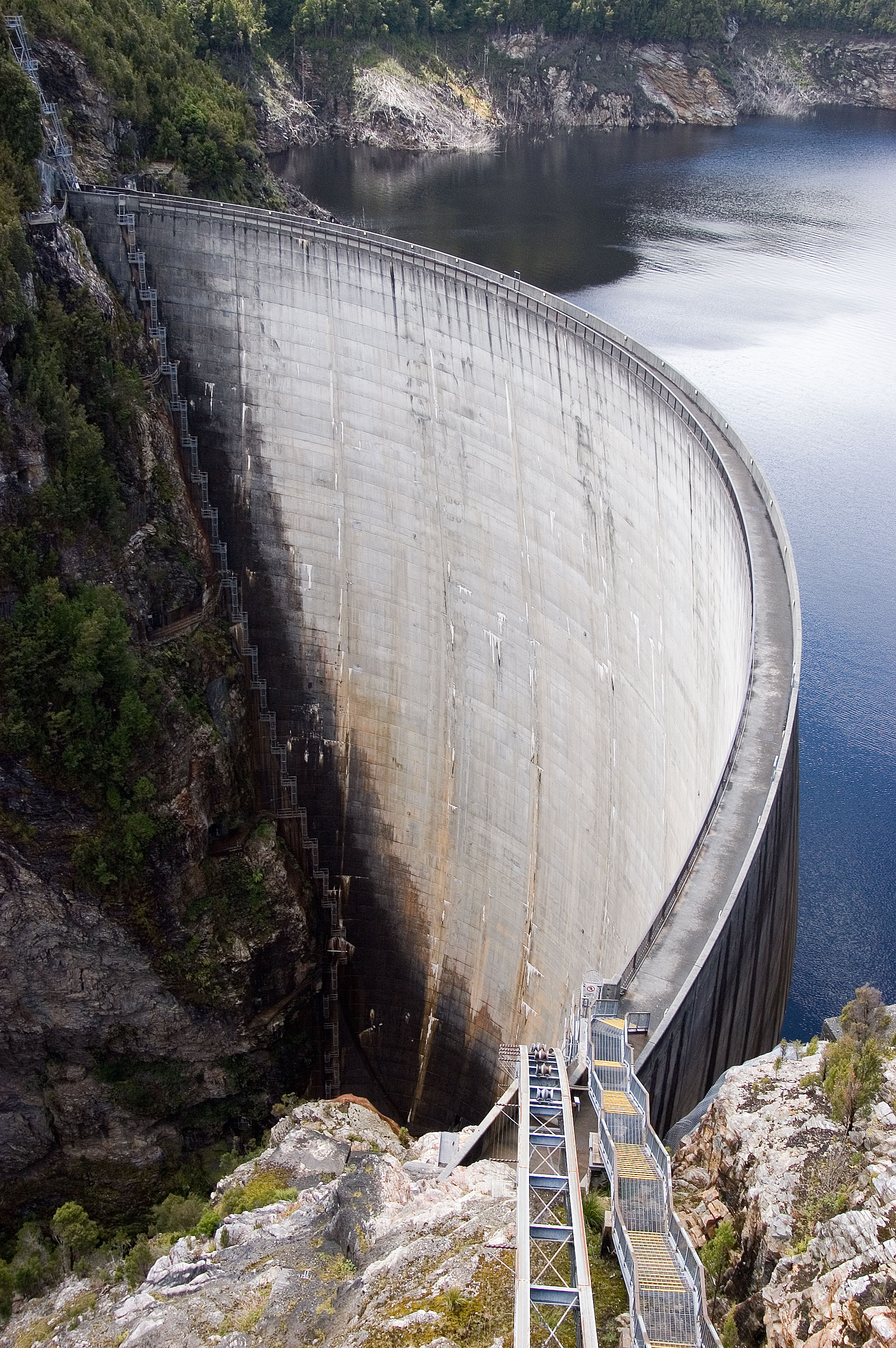
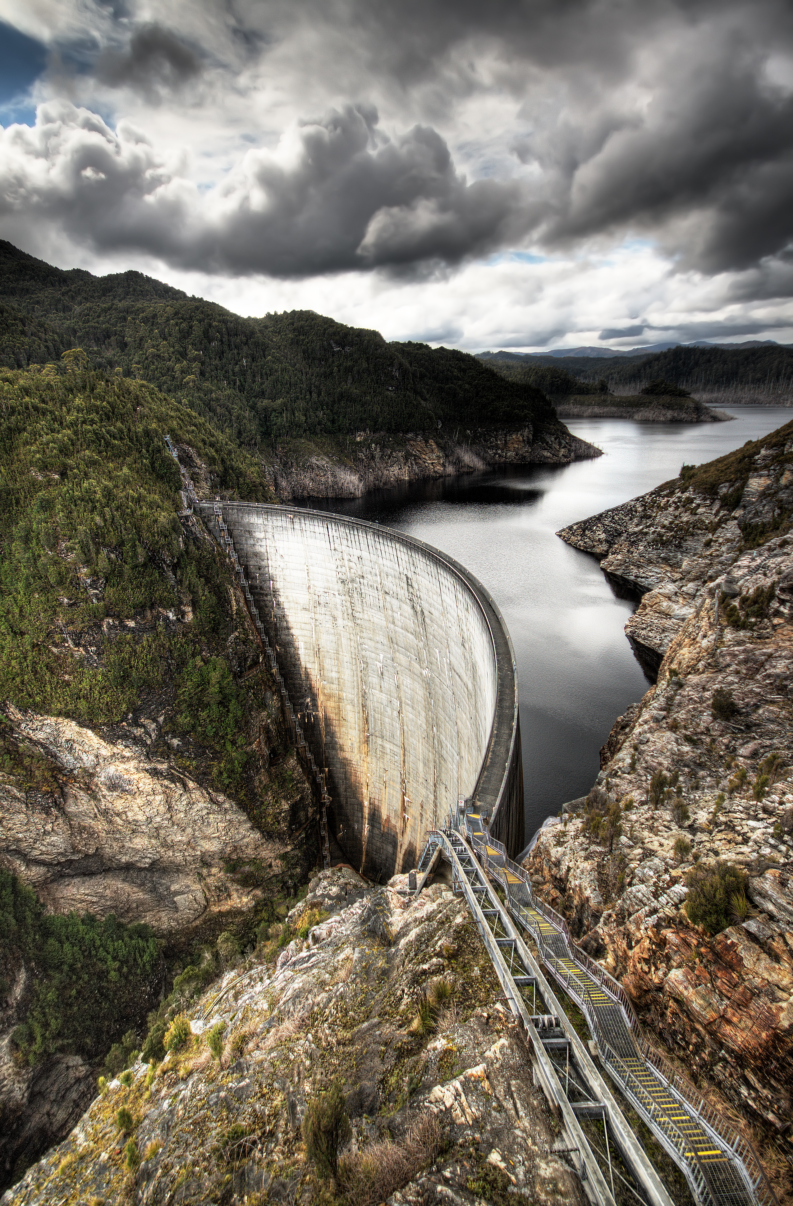 | Gordon Dam | Lake Gordon | South West | Gordon River | Arch | Hydro-electricity | 12,359,040 | 2,718.61×109 | 3,264.91×109 | 42°43′50″S 145°58′35″E |
| Miena Rockfill Dam | Great Lake | Central Northern | Shannon River | Embankment | Hydro-electricity | 3,156,640 | 694.36×10⁹ | 833.90×10⁹ | 41°58′48″S 146°43′48″E | |
| Guide River Reservoir | ||||||||||
| Hall No 2 | ||||||||||
| Henty Dam | North West | Henty River | Gravity | Hydro-electricity | 350 | 0.077×10⁹ | 0.092×10⁹ | 41°52′48″S 145°32′24″E | ||
| Knights Creek Reservoir | ||||||||||
| Lake Echo Dam | Central Highlands | Dee River | Embankment | Hydro-electricity | 725,490 | 159.59×10⁹ | 191.65×10⁹ | 42°15′00″S 146°36′36″E | ||
| Laughing Jack Dam | Laughing Jack Lagoon | 42°10′35.8″S 146°19′51.7″E | ||||||||
| Liapootah Dam | Lake Liapootah | Central Highlands | Nive River | Gravity | Hydro-electricity | 1,880 | 0.41×10⁹ | 0.50×10⁹ | 42°18′36″S 146°28′12″E | |
| Limekiln Gully Reservoir | ||||||||||
| Lower Reservoir | ||||||||||
| Mackintosh Dam | Lake Mackintosh | Western | Mackintosh River | Embankment | Hydro-electricity | 913,690 | 200.98×10⁹ | 241.37×10⁹ | 41°41′24″S 145°38′24″E | |
| Margaret Dam | Lake Margaret | West Coast | Yolande River | Gravity | Hydro-electricity | 15,374 | 3.382×10⁹ | 4.061×10⁹ | 41°59′24″S 145°34′12″E | |
| Meadowbank Dam | Central Highlands | River Derwent | Buttress; Embankment | Hydro-electricity | 59,650 | 13.12×10⁹ | 15.76×10⁹ | 42°36′36″S 146°50′24″E | ||
| Meander Dam | Huntsman Lake | Northern | Meander River | Gravity | Irrigation Hydro-electricity | 36,000 | 7.9×10⁹ | 9.5×10⁹ | 41°41′24″S 146°37′12″E | |
| Monarch Dam | North East | Shallamar Creek | ||||||||
| Mount Paris Dam | North East | 41°13′08.4″S 147°51′14.2″E | ||||||||
| Murchison Dam | Lake Murchison | Western | Murchison River | Embankment | Hydro-electricity | 96,910 | 21.32×10⁹ | 25.60×10⁹ | 41°46′48″S 145°38′24″E | |
| Newton Dam | Western | Newton Creek | Embankment | Hydro-electricity | 6,330 | 1.39×10⁹ | 1.67×10⁹ | 41°54′36″S 145°33′00″E | ||
 | Paloona Dam | Lake Paloona | Northern | Forth River | Embankment | Hydro-electricity | 19,110 | 4.20×10⁹ | 5.05×10⁹ | 41°16′48″S 146°14′24″E |
| Lake Parangana | ||||||||||
| Pet River Scheme | ||||||||||
| Pine Tier Dam | Pine Tier Lagoon | Central Highlands | Nive River | Gravity | Hydro-electricity | 7,420 | 1.63×10⁹ | 1.96×10⁹ | 42°06′00″S 146°28′48″E | |
| Reece Dam | Lake Pieman | West Coast | Pieman River | Embankment | Hydro-electricity | 300,200 | 66.0×10⁹ | 79.3×10⁹ | 41°43′12″S 145°07′48″E | |
| Repulse Dam | Central Highlands | River Derwent | Arch: Embankment | Hydro-electricity | 6,330 | 1.39×10⁹ | 1.67×10⁹ | 42°30′00″S 146°38′24″E | ||
| Ridgeway Reservoir | ||||||||||
| Rileys Creek Reservoir | ||||||||||
| Risdon Brook Dam | ||||||||||
| Rowallan Dam | Lake Rowallan | Northern | Mersey River | Embankment | Hydro-electricity | 130,490 | 28.70×10⁹ | 34.47×10⁹ | 41°43′48″S 146°12′36″E | |
| Lake Samuel | ||||||||||
| Scotts Peak Dam | Lake Pedder | South West | Huon River | Embankment | Hydro-electricity | 2,937,930 | 646.25×10⁹ | 776.12×10⁹ | 43°01′48″S 146°17′24″E | |
| Serpentine Dam | Serpentine River | Embankment | Hydro-electricity | 2,937,930 | 646.25×10⁹ | 776.12×10⁹ | 42°46′12″S 145°58′48″E | |||
| Stanton Dam | ||||||||||
| Taylor No 3 | ||||||||||
| Tolosa Park Reservoir | ||||||||||
| Tullabardine Dam | Lake Mackintosh | |||||||||
| Trevallyn Dam | Lake Trevallyn | Northern | South Esk River | Gravity | Hydro-electricity | 12,330 | 2.71×10⁹ | 3.26×10⁹ | 41°26′24″S 147°04′48″E | |
| Upper Grassy Dam | ||||||||||
| Upper Reservoir | ||||||||||
| Wayatinah Dam | Wayatinah Lagoon | Central Highlands | River Derwent | Embankment | Hydro-electricity | 8,860 | 1.95×10⁹ | 2.34×10⁹ | 42°24′00″S 146°29′24″E | |
| White Spur Dam | White Spur Lake | North West | White Spur Creek | Embankment | Hydro-electricity | 1,750 | 0.38×10⁹ | 0.46×10⁹ | 41°53′24″S 145°31′48″E | |
| Wilmot Dam | Lake Gairdner | Northern | Wilmont River | Embankment | Hydro-electricity | 8,820 | 1.94×10⁹ | 2.33×10⁹ | 41°28′12″S 146°04′12″E | |
Victoria
Melbourne Water area
|
Regional Victoria
|
Barwon Water area
|
Western Australia
Metropolitan Supply
|
|
|
Goldfields Water Supply
|
Mid West Region
|
North West Region
|
Great Southern Region
|
|
|
South West Region
|
|
|
See also
- List of dams and reservoirs
- Lakes of Australia
- Lakes and Reservoirs in Melbourne
References
- "Register of Large Dams in Australia" (Excel (requires download)). Dams information. Australian National Committee on Large Dams. 2010. Retrieved 17 April 2013.
- "Place name search". Gazetteer of Australia. Geoscience Australia. Retrieved 8 July 2014.
- "Largest constructed reservoirs by State/Territory". Geoscience Australia: Geographic Information. Australian Government. Retrieved 8 July 2014.
- "Water resources: Availability: Queensland". Australian Government. Archived from the original on 17 December 2007.
External links
- Melbourne Water Reservoirs
- Sydney Dam levels and statistics
- Dams of Western Australia
- SE Queensland Dam Levels
- Lake Awoonga, Via Benaraby near Gladstone in Central Queensland
| Africa |
| |
|---|---|---|
| Asia |
| |
| Australasia |
| |
| Europe |
| |
| North America |
| |
| South America |
| |
| ||
Другой контент может иметь иную лицензию. Перед использованием материалов сайта WikiSort.org внимательно изучите правила лицензирования конкретных элементов наполнения сайта.
WikiSort.org - проект по пересортировке и дополнению контента Википедии