geo.wikisort.org - Reservoir
Hindmarsh Valley Reservoir is a reservoir in the Australian state of South Australia located in the gazetted locality of Hindmarsh Valley about 11 kilometres (7 mi) north of the municipal seat in Victor Harbor.[7]
| Hindmarsh Valley Reservoir | |
|---|---|
 Wall at Hindmarsh Valley Reservoir | |
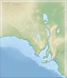 Location of Hindmarsh Valley Reservoir in South Australia | |
| Official name | Hindmarsh Valley Reservoir |
| Country | Australia |
| Location | Hindmarsh Valley[1] |
| Coordinates | 35°28′16″S 138°36′05″E[1] |
| Purpose | potable water supply[2] |
| Status | recycled water storage[3] |
| Construction began | November 1914[4] |
| Opening date | 25 June 1917[5] |
| Construction cost | A£69,000[2] |
| Built by | Government of South Australia |
| Owner(s) | Government of South Australia |
| Operator(s) | SA Water |
| Dam and spillways | |
| Type of dam | Gravity[2] |
| Height (thalweg) | 13.6 metres (44.5 ft)[2] |
| Spillways | 1 |
| Reservoir | |
| Creates | Hindmarsh Valley Reservoir |
| Total capacity | 590 megalitres (130,000,000 imp gal)[2] |
| Active capacity | 360 megalitres (80,000,000 imp gal)[4] |
| Catchment area | 9.1 square kilometres (3.5 sq mi)[4] |
| Normal elevation | 69 metres (227 ft)[6] |
The dam consists of a gravity dam of a height of 13.6 metres (44.5 ft) which holds back a lake of a volume of 360 megalitres (80,000,000 imp gal) and which extends for a distance about 0.80 kilometres (0.5 mi).[5][7]
The reservoir and its distribution system were designed and built by the state government’s Waterworks Department with construction being carried out from November 1914 to mid-1917. The majority of work involved the excavation of a natural depression and the construction of an embankment dam wall with a puddle core on land in section 159 of the cadastral unit of the Hundred of Goolwa. The reservoir was designed to receive water from two sources. The first was surface flow from a catchment which includes the hill known as Mount Billy to the immediate north and Peeralilla Hill to the immediate east. The second which was the main supply was obtained from the Hindmarsh River to the immediate west via an intake consisting of an intake chamber and a system of 0.61 metres (24 in) diameter reinforced concrete pipes.[2][7]
Its original purpose was to supply only Victor Harbor, Middleton and Port Elliott, however water mains were extended to Goolwa after its residents petitioned the state government.[8][7]
In 1978, a new spillway was constructed.[9]
In 1983, land consisting of sections 159 and 160 of the Hundred of Goolwa and which includes the reservoir and part of its catchment was listed on the now-defunct Register of the National Estate with the following statement of significance:[10][11]
This is a significant stand of natural vegetation due to its size and the diversity of plant communities which include savannah woodland in a fairly natural state. Some fine specimens of SA blue gum (Eucalyptus leucoxylon) and rough barked manna gum (E. huberana) can be seen. The presence of a reservoir adds to the habitat diversity and aesthetic appeal.
In 1999, the reservoir was reported in the media as being surplus to the needs of SA Water, its operator, and that it and the associated land holding would be transferred to the Department of Environment and Natural Resources subject to access to the infrastructure and ongoing control over the catchment. On 12 August 1999, land to the immediate north of the reservoir was proclaimed under the National Parks and Wildlife Act 1972 as the Mount Billy Conservation Park.[12][11]
On 18 November 1999, the Government of South Australia announced that the reservoir would be decommissioned and would be replaced with a new facility known as the Nettle Hill Water Storage Facility. The new facility which is located on Nettle Hill Road to the immediate north-west of the reservoir would receive treated water from the Myponga Reservoir.[13][14][1]
As of 2007, the reservoir was used to store "seasonal excess recycled water" produced by the Victor Harbor Waste Water Treatment Plant.[3]
In September 2014, the reservoir was one of five regional water storage facilities listed for potential reuse for recreational activities such as fishing. However, as of January 2018, the necessary approvals had not been granted for recreational use of the reservoir.[15][16]
See also
- List of reservoirs and dams in Australia
References
- "Search results for 'Hindmarsh Valley Reservoir, Res' with the following datasets selected - 'NPW and Conservation Properties' and 'Suburbs and localities', 'Hundreds', 'Local Government Areas' and 'Gazetteer'". Location SA Map Viewer. South Australian Government. Retrieved 10 July 2019.
- Heritage Investigations and Historical Consultants Pty. Ltd . (1985), "PART TWO, 8 . D. C. Victor Harbor Item Identification Sheet" (PDF), Heritage Survey of the Fleurieu Peninsula: (Region 4 - South Australia), S.A. Department of Environment and Planning, retrieved 7 July 2019
- Clark, Richard; Teoh, Kim; Kotz, Steve (September 2007). "Report DWLBC 2009/05 Surface Water Assessment for the Southern Fleurieu Region" (PDF). Department of Water, Land and Biodiversity Conservation. p. 17. Retrieved 12 July 2019.
- "The Reservoirs, Encounter Bay Waterworks". The Observer. Vol. LXXIII, no. 5, 617. South Australia. 28 October 1916. p. 14. Retrieved 7 July 2019 – via National Library of Australia.
- "Hindmarsh Valley Waterworks, The Opening Ceremony". The Advertiser. Vol. LIX, no. 18, 316. South Australia. 27 June 1917. p. 4. Retrieved 7 July 2019 – via National Library of Australia.
- "ENCOUNTER BAY WATER SUPPLY". Victor Harbor Times. Vol. 51, no. 2418. South Australia. 23 October 1959. p. 1. Retrieved 13 July 2019 – via National Library of Australia.
The new tank will be 318 ft above sea level, which is 91 ft above the high water level of Hindmarsh Valley reservoir…
- "FULL TO OVERFLOWING". The Journal. Vol. LII, no. 14332. South Australia. 30 May 1917. p. 1 (5 P.M. EDITION). Retrieved 7 July 2019 – via National Library of Australia.
- "GOVERNMENT WORKS POLICY". The Mount Barker Courier And Onkaparinga And Gumeracha Advertiser. Vol. 34, no. 1787. South Australia. 25 December 1914. p. 3. Retrieved 7 July 2019 – via National Library of Australia.
- "New Reservoir spillway". Victor Harbor Times. Vol. 67, no. 2, 934. South Australia. 13 September 1978. p. 9. Retrieved 13 July 2019 – via National Library of Australia.
- "Mount Billy Area, Myponga Rd, Hindmarsh Valley via Victor Harbor, SA, Australia - listing on the now-defunct Register of the National Estate (Place ID 7476)". Australian Heritage Database. Australian Government. 1 November 1983. Retrieved 7 July 2019.
- "New conservation park". Times. Vol. 92, no. 47. South Australia. 7 August 1997. p. 165. Retrieved 9 March 2019 – via National Library of Australia.
- Evans, Iain (12 August 1999). "National Parks And Wildlife Act 1972 Sections 30 and 43: Constitution of Mount Billy Conservation Park" (PDF). South Australian Government Gazette. Government of South Australia. pp. 754–755. Retrieved 6 July 2019.
- "Heavy demand for more water". Times. Vol. 96, no. 10. South Australia. 18 November 1999. p. 2. Retrieved 7 July 2019 – via National Library of Australia.
- "Nettle Hill Water Storage Facility". Civil & Allied Technical Construction Pty Ltd. 2011. Retrieved 7 July 2019.
- "South Australian reservoirs to be opened for fishing to boost regional tourism". Australian Broadcasting Commission. 22 September 2014. Retrieved 12 July 2019.
- Simmons, Michael (25 January 2018). "Hindmarsh Reservoir has no approval for recreational fishing and other activities". The Times, Victor Harbor. Retrieved 12 July 2019.
 This article incorporates text by Commonwealth of Australia available under the CC BY 3.0 AU licence.
Другой контент может иметь иную лицензию. Перед использованием материалов сайта WikiSort.org внимательно изучите правила лицензирования конкретных элементов наполнения сайта.
WikiSort.org - проект по пересортировке и дополнению контента Википедии