geo.wikisort.org - Reservoir
Nanango Weir is a weir located near Nanango, Queensland, Australia. It was originally constructed only used by nearby farms for agricultural use, though public recreation is now permitted.
This article does not cite any sources. (June 2019) |
| Nanango Weir | |
|---|---|
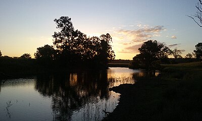 | |
 Nanango Weir | |
| Location | 9.6 km (6 mi) North West of Nanango, Queensland |
| Coordinates | 26.650182°S 151.924437°E |
| Type | Weir |
| Primary inflows | Barkers Creek |
| Primary outflows | Barkers Creek |
| Basin countries | Australia |
The weir is located on Barkers Creek.
Recreation
The weir is widely unknown to the public because of its unsigned location and small access track. The weir is a great spot for canoeing, picnics and other watersports. There is no constructed boat ramps and large vessels or motors are highly discouraged. The weir is usually full though long dry periods can affect water levels.
See also
References
Water supply in Queensland, Australia | |||||||||||||||||||||||
|---|---|---|---|---|---|---|---|---|---|---|---|---|---|---|---|---|---|---|---|---|---|---|---|
| |||||||||||||||||||||||
| |||||||||||||||||||||||
| |||||||||||||||||||||||
This article about a building or structure in Queensland is a stub. You can help Wikipedia by expanding it. |
Текст в блоке "Читать" взят с сайта "Википедия" и доступен по лицензии Creative Commons Attribution-ShareAlike; в отдельных случаях могут действовать дополнительные условия.
Другой контент может иметь иную лицензию. Перед использованием материалов сайта WikiSort.org внимательно изучите правила лицензирования конкретных элементов наполнения сайта.
Другой контент может иметь иную лицензию. Перед использованием материалов сайта WikiSort.org внимательно изучите правила лицензирования конкретных элементов наполнения сайта.
2019-2025
WikiSort.org - проект по пересортировке и дополнению контента Википедии
WikiSort.org - проект по пересортировке и дополнению контента Википедии