geo.wikisort.org - Mountains
Truskmore (Irish: Trosc Mór, meaning 'big cod')[3] is a mountain with a height of 647 metres (2,123 ft) on the border of County Sligo and County Leitrim in Ireland. It is the highest summit in the Dartry Mountains and the highest in Sligo.[1] It is in the middle of a plateau whose edges are marked by high cliffs,[4] including Benbulbin (526m), Benwiskin (514m), Slievemore (597m) and Kings Mountain (462m).[1] The top of Truskmore lies in County Sligo, a short distance from the border with County Leitrim; however, the mountain itself is in both counties.[4]
| Truskmore | |
|---|---|
| Trosc Mór | |
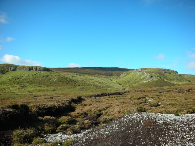
 Truskmore seen from Gleniff Horseshoe Drive | |
| Highest point | |
| Elevation | 647 m (2,123 ft)[1][2] |
| Prominence | 560 m (1,840 ft)[1] |
| Listing | County Top (Sligo), Marilyn, Hewitt |
| Coordinates | 54°22′27″N 8°22′18″W |
| Naming | |
| English translation | big cod (fish) |
| Language of name | Irish |
| Geography | |
 Truskmore Location in Ireland | |
| Location | border of County Sligo and County Leitrim, Republic of Ireland |
| Parent range | Dartry Mountains |
| OSI/OSNI grid | G758473 |
Transmission site
The Truskmore television transmitter opened on 1 February 1962, the second of the original five main Telefis Éireann transmitters to go on air after Kippure (December 1961). It used as antenna carrier a 135 metres tall mast. Initially its transmissions were only in 405 lines on VHF channel 11, with 625-lines transmissions beginning in November 1963 on Channel I. The new RTÉ Radio VHF FM radio service was added in 1966. The second television service came in 1978 on Channel G and UHF television transmission began in 1996 with the advent of Teilifís na Gaeilge. In 2009 a new 175-m mast was erected in preparation for the changeover to digital television transmission and the original 1961 mast was removed. Since the national shutdown of the analog television networks on 24 October 2012,[5] Truskmore now broadcasts[6] the Irish DTT service Saorview and the national FM radio channels to the northwest of Ireland, including a large area of the west of Northern Ireland. The site is owned and operated by 2RN, a subsidiary[7] of the Irish public service broadcaster RTÉ.
Current transmissions
Digital television
| Frequency | UHF | kW | Multiplex | Pol |
|---|---|---|---|---|
| 642 MHz | 42 | 160 | Saorview 1 | H |
| 666 MHz | 45 | 160 | Saorview 2 | H |
Analog FM radio
| Frequency | kW | Service |
|---|---|---|
| 88.2 MHz | 125 | RTÉ Radio 1 |
| 97.8 MHz | 125 | RTÉ lyric fm |
| 90.4 MHz | 125 | RTÉ 2fm |
| 92.6 MHz | 125 | RTÉ Raidió na Gaeltachta |
| 100.0 MHz | 125 | Today FM |
| 102.5 MHz | Ocean FM | |
| 104.4 MHz | iRadio | |
| 107.4 MHz | Newstalk |
DTT relay transmitters
| Relay transmitter | County | Mux 1 | Mux 2 | kW | Pol |
|---|---|---|---|---|---|
| Aranmore | Donegal | 47 | 44 | 4 | V |
| Castlebar | Mayo | 22 | 25 | 2 | H |
| Dooncarton | Mayo | 27 | 32 | 0.5 | V&H |
| Glencolumcille | Donegal | 33 | 36 | 0.2 | H |
| Glenties | Donegal | 32 | 34 | 0.1 | H |
Gallery
 Truskmore (in the distance) from the south
 OSI Triangulation pillar marking the summit of Truskmore
 Transmission site on the summit


See also
- Truskmore SE Cairn
- List of Irish counties by highest point
- List of tallest structures in Ireland
- Lists of mountains in Ireland
- Lists of mountains and hills in the British Isles
- List of Marilyns in the British Isles
- List of Hewitt mountains in England, Wales and Ireland
References
- Truskmore MountainViews. Retrieved: 2012-05-06.
- Truskmore Peakbagger. Retrieved: 2012-05-06.
- Placenames Database of Ireland
- Ordnance Survey Ireland - Online map viewer
- The Irish Times. "Analogue consigned to broadcasting history". The Irish Times. Retrieved 23 January 2016.
- "Saorview Frequencies" (PDF). 2RN. 2RN. Retrieved 19 August 2022.
- RTÉ NL. "About RTÉ NL" (PDF). RTÉ. Retrieved 29 October 2012.
| British Isles |  | |
|---|---|---|
| Scotland | ||
| Outside Scotland | ||
| England | ||
| Ireland | ||
| County tops | ||
Mountains and hills of Connacht | |||||||
|---|---|---|---|---|---|---|---|
List of mountains in Ireland | |||||||
| Achill Island |  | ||||||
| Curlew Mountains | |||||||
| Dartry Mountains | |||||||
| Maumturks | |||||||
| Mweelrea Mountains |
| ||||||
| Nephin Range | |||||||
| Ox Mountains | |||||||
| Partry Mountains | |||||||
| Sheeffry Range | |||||||
| Twelve Bens |
| ||||||
| Others | |||||||
Другой контент может иметь иную лицензию. Перед использованием материалов сайта WikiSort.org внимательно изучите правила лицензирования конкретных элементов наполнения сайта.
WikiSort.org - проект по пересортировке и дополнению контента Википедии