geo.wikisort.org - Mountains
Seltannasaggart (from Irish: Sailtean na Sagart, meaning 'willow plantation of the priests'),[2] also called Corry Mountain, is a low mountain near Lough Allen on the border of County Roscommon and County Leitrim in Ireland; it is the highest point in Roscommon.
| Seltannasaggart | |
|---|---|
| Sailtean na Sagart Corry Mountain | |
 Seltannasaggart from the southwest | |
| Highest point | |
| Elevation | 428 m (1,404 ft)[1] |
| Prominence | 137 m (449 ft)[1] |
| Listing | County Top (Roscommon) |
| Coordinates | 54°7′21″N 8°8′36″W[1] |
| Naming | |
| English translation | willow plantation of the priests |
| Language of name | Irish |
| Geography | |
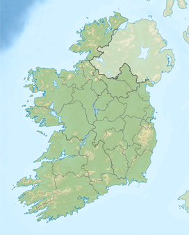 Seltannasaggart County Roscommon/County Leitrim, Republic of Ireland | |
| Parent range | Arigna Mountains |
| OSI/OSNI grid | G908142 |
Geography
The mountain is the highest point of County Roscommon. It is part of the Arigna Mountains and rises to a height of 428 metres (1,404 ft).[1] On the southern slopes are the remains of a promontory fort and sweat houses.
Access to the summit
There is a wind farm and a quarry on the summit, which is easily accessible. The Miners Way trail passes over it.
See also
- Lists of mountains in Ireland
- List of Irish counties by highest point
- List of mountains of the British Isles by height
References
- "Seltannasaggart". MountainViews.ie.
- Tempan, Paul. Irish Hill and Mountain Names. MountainViews.ie.
| British Isles |  | |
|---|---|---|
| Scotland | ||
| Outside Scotland | ||
| England | ||
| Ireland | ||
| County tops |
| |
Mountains and hills of Connacht | |||||||
|---|---|---|---|---|---|---|---|
List of mountains in Ireland | |||||||
| Achill Island |  | ||||||
| Curlew Mountains | |||||||
| Dartry Mountains | |||||||
| Maumturks | |||||||
| Mweelrea Mountains |
| ||||||
| Nephin Range | |||||||
| Ox Mountains | |||||||
| Partry Mountains | |||||||
| Sheeffry Range | |||||||
| Twelve Bens |
| ||||||
| Others | |||||||
This article related to the geography of County Roscommon, Ireland is a stub. You can help Wikipedia by expanding it. |
Текст в блоке "Читать" взят с сайта "Википедия" и доступен по лицензии Creative Commons Attribution-ShareAlike; в отдельных случаях могут действовать дополнительные условия.
Другой контент может иметь иную лицензию. Перед использованием материалов сайта WikiSort.org внимательно изучите правила лицензирования конкретных элементов наполнения сайта.
Другой контент может иметь иную лицензию. Перед использованием материалов сайта WikiSort.org внимательно изучите правила лицензирования конкретных элементов наполнения сайта.
2019-2026
WikiSort.org - проект по пересортировке и дополнению контента Википедии
WikiSort.org - проект по пересортировке и дополнению контента Википедии