geo.wikisort.org - Mountains
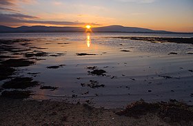
Knockalongy (from Irish: Cnoc na Loinge, meaning 'hill of the encampment')[3] is a 544 m (1,785 ft) Marilyn in County Sligo, Ireland. It is the highest of the Ox Mountains.[1] The nearest village is Skreen.[4]
| Knockalongy | |
|---|---|
| Cnoc na Loinge | |
 | |
| Highest point | |
| Elevation | 544 m (1,785 ft)[1][2] |
| Prominence | 490 m (1,610 ft)[1] |
| Listing | Marilyn |
| Coordinates | 54°11′39″N 8°45′37″W |
| Naming | |
| English translation | hill of the encampment |
| Language of name | Irish |
| Geography | |
 Knockalongy Ireland | |
| Location | County Sligo, Republic of Ireland |
| Parent range | Ox Mountains |
| OSI/OSNI grid | G504275 |
There are many megalithic tombs on the plain between Knockalongy and Sligo Bay to the north. There are also two small loughs at the foot of the mountain—Lough Aghree and Lough Minnaun.[4]
See also
- List of mountains in Ireland
References
- "Doonvinalla e Top 117m hill, Mayo Coastal Hill Ireland at MountainViews.ie".
- Peakbagger
- Placenames Database of Ireland
- "Ordnance Survey Ireland - Online map viewer". Archived from the original on 29 August 2012. Retrieved 27 July 2010.
Текст в блоке "Читать" взят с сайта "Википедия" и доступен по лицензии Creative Commons Attribution-ShareAlike; в отдельных случаях могут действовать дополнительные условия.
Другой контент может иметь иную лицензию. Перед использованием материалов сайта WikiSort.org внимательно изучите правила лицензирования конкретных элементов наполнения сайта.
Другой контент может иметь иную лицензию. Перед использованием материалов сайта WikiSort.org внимательно изучите правила лицензирования конкретных элементов наполнения сайта.
2019-2025
WikiSort.org - проект по пересортировке и дополнению контента Википедии
WikiSort.org - проект по пересортировке и дополнению контента Википедии
