geo.wikisort.org - Island
İmralı is a small Turkish prison island in the south of the Sea of Marmara, west of the Armutlu-Bozburun peninsula within Bursa Province. It measures 8 kilometres (5 miles) in the north–south direction with a width of 3 kilometres (2 miles), and has an area of 9.98 square kilometres (3.85 sq mi). The highest peak is Türk Tepesi at an altitude of 217 metres (712 feet) above sea level. It is prohibited to fly over it or fish near its shores.
 Satellite image of İmrali island in Turkey. | |
 | |
 İmralı Location of İmralı within Marmara Region 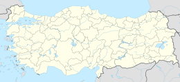 İmralı Location of İmralı within Turkey | |
| Geography | |
|---|---|
| Location | Sea of Marmara |
| Coordinates | 40°32′15″N 28°32′06″E |
| Area | 9.98 km2 (3.85 sq mi) |
| Coastline | 19.4 km (12.05 mi) |
| Highest elevation | 217 m (712 ft) |
| Highest point | Türk Tepesi |
| Administration | |
Turkey | |
| Region | Marmara Region |
| Province | Bursa Province |
History
The Roman authors Pliny the Elder and Strabo called the island Besbicus (Ancient Greek: Βέσβικος).[1] It was later known as Kalonymos (Greek: Καλώνυμος) and Kalolimnos (Greek: Καλόλιμνος). In antiquity, it was a member of the Delian League since it appears in tribute records of Athens between 434/3 and 418/7 BCE.[2]
The Turkish name İmralı derives from the name of the island's conqueror, Emir Ali, one of the first Ottoman admirals. In 1308 İmralı became the first island to be conquered by the newly established Ottoman Navy. Its strategic location enabled the Ottomans to control the movement of ships in the Sea of Marmara with a naval base established on it, cutting the Byzantine Empire's connection to Bursa.
In 1913, the island had 250 houses, a school, three monasteries, and 1,200 residents, all of whom were Greeks. The economic activity of the island's residents consisted mainly of fishing and farming onions, with most of the grown onions sold to Istanbul. There were three Greek villages on the island, engaged mostly in growing grapes, winemaking, silk production and fishing, until the Turkish War of Independence (1919–1923). The island was uninhabited after the 1923 forced population exchange between Greece and Turkey until 1936, when prisoners entered a newly founded semi-open prison facility.[3] The prisoners earned money by working in agriculture and fishing.
One well-known islander was Kimon Friar who emigrated to the United States and became a scholar and translator of Greek language poetry.[4]
There is a military base on the island, and the area around the island is a forbidden zone. It served from 1999 until 2009 as a maximum-security prison island for its only inmate, Abdullah Öcalan the leader of the PKK.[5] The other prisoners on the island were transferred elsewhere on mainland Turkey so that Öcalan was the island's sole prisoner.[6] In November 2009, several other prisoners were transferred to a newly constructed building on the island, where Öcalan is incarcerated.
References
- Sir William Smith, ed. Dictionary of Greek and Roman Geography, vol. 1 (London: John Murray, 1872) p. 395.
- Mogens Herman Hansen & Thomas Heine Nielsen (2004). An inventory of archaic and classical poleis. New York: Oxford University Press. p. 978. ISBN 0-19-814099-1.
- Sipahi, Ali (2016). "Convict Labor in Turkey, 1936-1953: A Capitalist Corporation in the State?". International Labor and Working-Class History (90): 246. ISSN 0147-5479 – via JSTOR.
- American College of Greece Archived 13 October 2007 at the Wayback Machine
- "PKK leader Ocalan gets company in prison". United Press International. 17 November 2009. Retrieved 9 June 2021.
{{cite web}}: CS1 maint: url-status (link) - King, Laura (1 March 1999). "Ocalan Affecting Turkish Town". Associated Press. Retrieved 9 June 2021.
{{cite web}}: CS1 maint: url-status (link)
Sources
- (in Turkish) Brief history Archived 8 December 2012 at archive.today
- (in Turkish) On the island[permanent dead link]
- (in Turkish) Brief history
- (in Turkish) About the name of the island
| Black Sea |
| ||||||||||
|---|---|---|---|---|---|---|---|---|---|---|---|
| Marmara Sea |
| ||||||||||
| Aegean Sea |
| ||||||||||
| Mediterranean |
| ||||||||||
| Lake Van |
| ||||||||||
| Authority control |
|
|---|
На других языках
[de] İmralı
İmralı (früher auch Emrali, griechisch Καλόλιμνος .mw-parser-output .Latn{font-family:"Akzidenz Grotesk","Arial","Avant Garde Gothic","Calibri","Futura","Geneva","Gill Sans","Helvetica","Lucida Grande","Lucida Sans Unicode","Lucida Grande","Stone Sans","Tahoma","Trebuchet","Univers","Verdana"}Kalolimnos) ist die flächenmäßig viertgrößte Insel im Marmarameer und dient der Türkei als Gefängnisinsel. Benannt ist die Insel nach dem osmanischen Admiral und Eroberer der Insel, Emir Ali.- [en] İmralı
[es] Imrali
Imrali[1] (en turco, İmralı Adası) es una pequeña isla turca situada en el sur del mar de Mármara, al oeste de la península de Armutlu-Bozburun, en la provincia de Bursa. Sirvió, desde 1999 hasta 2009, como una isla prisión de máxima seguridad para su único preso, Abdullah Öcalan, el líder del Partido de los Trabajadores de Kurdistán, un partido político que lucha por la independencia de Kurdistán. En noviembre de 2009, varios prisioneros fueron trasladados a un edificio de la prisión de nueva construcción en la isla, donde Abdullah Ocalan también fue encarcelado.[fr] İmralı
İmralı (en turc : İmralı Adası, prononcé [imrɑ'lɯ]) est une petite île turque située dans le sud de la mer de Marmara, à l’ouest de la péninsule d’Armutlu-Bozburun dans la province de Bursa.[it] İmralı
İmralı (in greco Kalòlimnos, Καλόλιμνος) è una piccola isola della Turchia collocata nel sud del Mar di Marmara, ad ovest della penisola che si trova nel territorio della provincia di Bursa. L'isola è attualmente utilizzata come prigione di massima sicurezza per un solo detenuto, Abdullah Öcalan, il leader del Partito dei Lavoratori del Kurdistan (PKK).[ru] Имралы
Имралы, также Имрали (тур. İmralı Adası; ранее также употреблялись исконные греческие названия Весвикос, Калонимос и Калолимнос; греч. Βέσβικος; Καλώνυμος; Καλόλιμνος) — небольшой остров в юго-восточной части Мраморного моря. Длина с севера на юг — 8 км, максимальная ширина — около 3 км. Площадь 9,98 км². Принадлежит Турецкой Республике.Другой контент может иметь иную лицензию. Перед использованием материалов сайта WikiSort.org внимательно изучите правила лицензирования конкретных элементов наполнения сайта.
WikiSort.org - проект по пересортировке и дополнению контента Википедии