geo.wikisort.org - Island
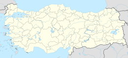
Yumurtalık Island (also known as Atlas Island) is a small Mediterranean island in Yumurtalık ilçe (district) of Adana Province, Turkey. The midpoint of the island is at 36°46′09″N 35°47′49″E. It is situated about 300 metres (980 ft) to the east of the port.
Native name: Yumurtalık Adası | |
|---|---|
 Yumurtalık Island | |
| Geography | |
| Location | Mediterranean Sea |
| Coordinates | 36°46′09″N 35°47′49″E |
| Administration | |
Turkey | |
| İl (province) | Adana Province |
| İlçe | Yumurtalık |
Its surface area is about 6,000 square metres (65,000 sq ft). There is a small castle in the north of the island. The castle was built in the 11th century, [1] during the late Byzantine or Cilician Armenia era. It faces the castle in the main land (Aegeae). It was an auxiliary unit of the port. [2]
Sometimes the island is also called Kızkalesi with the very same story of the Kızkalesi (castle) in Mersin Province.
References
Текст в блоке "Читать" взят с сайта "Википедия" и доступен по лицензии Creative Commons Attribution-ShareAlike; в отдельных случаях могут действовать дополнительные условия.
Другой контент может иметь иную лицензию. Перед использованием материалов сайта WikiSort.org внимательно изучите правила лицензирования конкретных элементов наполнения сайта.
Другой контент может иметь иную лицензию. Перед использованием материалов сайта WikiSort.org внимательно изучите правила лицензирования конкретных элементов наполнения сайта.
2019-2025
WikiSort.org - проект по пересортировке и дополнению контента Википедии
WikiSort.org - проект по пересортировке и дополнению контента Википедии