geo.wikisort.org - Island
Kalem Island (Turkish: Kalem Adası, literally "Pen Island") is an Aegean island of Turkey. Administratively, the island is a part of Dikili ilçe (district) of İzmir Province at 9°0′12″N 26°47′42″E.[1] It is close to Bademli town and its distance to main land (Anatolia) is about 400 metres (1,300 ft). It is a narrow island where the maximum length in the north to south direction is about 1.5 kilometres (0.93 mi)
Native name: Kalem Adası | |
|---|---|
 Kalem Island | |
| Geography | |
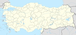
| Location | Aegean Sea |
| Coordinates | 39°0′12″N 26°47′42″E |
| Administration | |
Turkey | |
| İl (province) | İzmir Province |
| İlçe | Dikili |
The island and Garip Island to the west were known as Arginusae islands (Greek: Ἀργινούσαι Arginóusai) in antiquity. The naval battle of Arginusae was fought around Kalem island in 406 B.C.
Presently the island is a private property. There is a hotel and a beach for the tourists and the divers.[2]
References
| Black Sea |
| ||||||||||
|---|---|---|---|---|---|---|---|---|---|---|---|
| Marmara Sea |
| ||||||||||
| Aegean Sea |
| ||||||||||
| Mediterranean |
| ||||||||||
| Lake Van |
| ||||||||||
На других языках
- [en] Kalem Island
[ru] Калем (остров)
Калем[2] (тур. Kalem Adasi — «карандаш») — небольшой остров в Эгейском море близ побережья Малой Азии в Турции. Располагается в проливе Митилини к юго-востоку от греческого острова Лесбос. С юга закрывает бухту Бадемлилиман, гавань города Бадемли[en][2]. Административно относится к району Дикили в иле Измир.Текст в блоке "Читать" взят с сайта "Википедия" и доступен по лицензии Creative Commons Attribution-ShareAlike; в отдельных случаях могут действовать дополнительные условия.
Другой контент может иметь иную лицензию. Перед использованием материалов сайта WikiSort.org внимательно изучите правила лицензирования конкретных элементов наполнения сайта.
Другой контент может иметь иную лицензию. Перед использованием материалов сайта WikiSort.org внимательно изучите правила лицензирования конкретных элементов наполнения сайта.
2019-2026
WikiSort.org - проект по пересортировке и дополнению контента Википедии
WikiSort.org - проект по пересортировке и дополнению контента Википедии