geo.wikisort.org - Island
Saplı Islet (Turkish: Saplı Ada, meaning "Island with a handle", also called Boynuince Islet) is a Mediterranean tombolo of Turkey. The island is at the Yenikaş coast which is located 4 kilometres (2.5 mi) west of Aydıncık ilçe (district) of Mersin Province. At 36°07′48″N 33°17′41″E it forms the west wall of the bay named Soğuksu. Its distance to Mersin is about 177 kilometres (110 mi)
Native name: Saplı Ada | |
|---|---|
 Path between the mainland and the islet from the east | |
 Saplı Islet | |
| Geography | |
| Location | Mediterranean Sea |
| Coordinates | 36°07′48″N 33°17′41″E |
| Administration | |
Turkey | |
| İl (province) | Mersin Province |
| İlçe | Aydıncık |
The surface area of the tombolo is about 17×103 square metres (1.8×10⁵ sq ft). It is connected to the main land by a short path. There are ruins of the antiquity on the islet. Although currently there is no archaeological excavation on the islet, it is included in SİT areas in Turkey.[1]
References
| |||||||||||||||||||||
| |||||||||||||||||||||
| |||||||||||||||||||||
| |||||||||||||||||||||
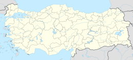
Mersin Province | |||||||||||||||||||||
| Black Sea |
| ||||||||||
|---|---|---|---|---|---|---|---|---|---|---|---|
| Marmara Sea |
| ||||||||||
| Aegean Sea |
| ||||||||||
| Mediterranean |
| ||||||||||
| Lake Van |
| ||||||||||
Текст в блоке "Читать" взят с сайта "Википедия" и доступен по лицензии Creative Commons Attribution-ShareAlike; в отдельных случаях могут действовать дополнительные условия.
Другой контент может иметь иную лицензию. Перед использованием материалов сайта WikiSort.org внимательно изучите правила лицензирования конкретных элементов наполнения сайта.
Другой контент может иметь иную лицензию. Перед использованием материалов сайта WikiSort.org внимательно изучите правила лицензирования конкретных элементов наполнения сайта.
2019-2026
WikiSort.org - проект по пересортировке и дополнению контента Википедии
WikiSort.org - проект по пересортировке и дополнению контента Википедии