geo.wikisort.org - Island
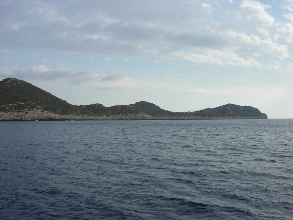
İç Ada (Turkish: İç Ada, literally "internal island"; Greek: Αλιμενταριά; Italian: Alimentaria [1]) is a Turkish islet near Kaş (ancient Antiphellos), in the homonymous district of Antalya province. It lies in the eastern Mediterranean Sea, about five nautical miles west-southwest of the island of Kekova, and about halfway between Kekova and the Greek islet of Stroggyli. The island has the shape of a right triangle elongated along a northeast-southwest axis, whose legs are 2.5 kilometres (1.6 miles) and 1.2 kilometres (0.7 miles) long. It is separated by the mainland by a 150 metres (492 feet) wide strait. Iç Ada is uninhabited and is covered with macchia.
Contended between Italy and Turkey after the Italian occupation of Kastelorizo, the 1932 Convention between Italy and Turkey which defined the sea border between the two powers assigned it to Turkey.[2]
Notes
- Bertarelli (1929), p.134
- Text of the convention, Art. 1
Sources
- Bertarelli, L.V. (1929). Guida d'Italia, Vol. XVII (in Italian). Milano: Consociazione Turistica Italiana.
See also
This geographical article about a location in Antalya Province, Turkey is a stub. You can help Wikipedia by expanding it. |
На других языках
- [en] Iç Ada, Antalya
[es] Isla Iç
Isla Iç (en turco: Iç Ada;[1] literalmente "isla interior"; en griego: Αλιμενταριά; en italiano Alimentaria), es un islote de Turquía cerca de Kaş (la antigua Antifelo), en el distrito homónimo de la provincia de Antalya. Se encuentra al este del mar Mediterráneo, cerca de cinco millas náuticas al oeste-suroeste de la isla de Kekova, y a mitad de camino entre Kekova y el islote griego de Strongili. La isla tiene forma de triángulo alargado a lo largo de un eje noreste-suroeste, cuyos extremos son de 2,5 km y 1,2 km de largo. Está separada del continente por un estrecho de 150 m de ancho. La isla está deshabitada y cubierta únicamente de Maquia.[it] Iç Ada
İç Ada (letteralmente "isola interna" in turco; in greco: Αλιμενταριά; in italiano Alimentaria [1]) è un'isoletta turca posta vicino a Kaş (l'antica Antiphellos), nell'omonimo distretto della provincia di Adalia. L'isola si trova nel Mar Mediterraneo orientale, a circa cinque miglia nautiche a ovest-sud-ovest dell'isola di Kekova, e circa a metà strada tra Kekova e l'isolotto greco di Strongili. İç Ada ha la forma di un triangolo rettangolo allungato lungo un asse nord est-ovest, i cui lati misurano rispettivamente 2,5 e 1,2 chilometri di lunghezza. È separata dalla terraferma da uno stretto ampio 150 metri. İç Ada è disabitata ed è ricoperta da macchia.Другой контент может иметь иную лицензию. Перед использованием материалов сайта WikiSort.org внимательно изучите правила лицензирования конкретных элементов наполнения сайта.
WikiSort.org - проект по пересортировке и дополнению контента Википедии