geo.wikisort.org - Island
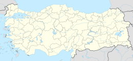
Mardaliç Island (also called "Corci Island" Turkish: Mardaliç Adası) is an Aegean island of Turkey.
Native name: Mardaliç Adası | |
|---|---|
 Mardaliç Island | |
| Geography | |
| Location | Aegean Sea |
| Coordinates | 38°55′N 26°49′E |
| Area | 2.1 km2 (0.81 sq mi) |
| Administration | |
Turkey | |
| İl (province) | İzmir Province |
| İlçe | Dikili |
Location
The island at 38°55′N 26°49′E is a part of Dikili ilçe (district) of İzmir Province. The island faces Narlıdere Bay in mainland Anatolia.[1] Its distance to the nearest point is in the mainland is about 1.5 kilometres (0.93 mi). The island measures 2.1 square kilometres.
History
In the antiquity the island was known as Elaiousa Erythraion.[2] In the 14th century the island was a part of the Republic of Genoa. Francesco I Gattilusio and his successors controlled Lesbos and the smaller islands around like Mardaliç for about a century. In 1462 Mahmut Pasha of the Ottoman Empire captured the island. But soon the island became a pirates' island. Especially Georgia Maria from the island Corsica who allied himself with the Republic of Venice became a big problem for the people living in the coastal area of west Anatolia. In 17th century Ottoman navy recaptured the island.[3] Corci, the alternative name of the island is a corrupt form of the name Georgia.
The island today
The island is uninhabited. But there are some ruins from Genoa era. Most important ruin is an observation tower. Birds such as sea gull and partridge as well as some snakes and lizards make up the fauna of the island. Olive, thyme and scale fern are some of the plants.
References
На других языках
- [en] Mardaliç Island
[ru] Мардалыч
Мардалыч[1][2][3] (тур. Mardaliç Adası, Corci Adası, Kızkulesi Adası) — необитаемый остров в Турции, в Эгейском море, у западного побережья Малой Азии. Расположен у входа в залив Чандарлы[3]. На северо-востоке острова есть две бухты, пригодные для якорной стоянки яхт[4]. Наивысшая точка — 145 м над уровнем моря[1][2]. Остров закрывает с запада бухту Конуч (Нарлыдере, Narlidere Limanı). Административно относится к району Дикили в иле Измир.Другой контент может иметь иную лицензию. Перед использованием материалов сайта WikiSort.org внимательно изучите правила лицензирования конкретных элементов наполнения сайта.
WikiSort.org - проект по пересортировке и дополнению контента Википедии