geo.wikisort.org - Island
Hoynat Islet (a.k.a. Perşembe Islet Turkish: Hoynat Adası) is a Turkish islet in the Black Sea.
Native name: Hoynat Adası | |
|---|---|
 From the mainland (south) | |
 Hoynat Island | |
| Geography | |
| Location | Black Sea |
| Coordinates | 41°07′03″N 37°43′43″E |
| Administration | |
Turkey | |
| İl (province) | Ordu Province |
| İlçe | Perşembe |
| Additional information | |
 | |
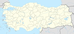
The rocky islet is at 41°07′03″N 37°43′43″E.[1] Administratively it is a part of Perşembe ilçe (district) of Ordu Province. The distance between the coast and the islet is less than 100 metres (330 ft). The total area of the islet is about 700 square metres (7,500 sq ft).
Historically the uninhabited islet was a hideout and storage location of the sailors. Now the island is known as the main reproduction area of the European shags in Turkey.[2]
References
Текст в блоке "Читать" взят с сайта "Википедия" и доступен по лицензии Creative Commons Attribution-ShareAlike; в отдельных случаях могут действовать дополнительные условия.
Другой контент может иметь иную лицензию. Перед использованием материалов сайта WikiSort.org внимательно изучите правила лицензирования конкретных элементов наполнения сайта.
Другой контент может иметь иную лицензию. Перед использованием материалов сайта WikiSort.org внимательно изучите правила лицензирования конкретных элементов наполнения сайта.
2019-2025
WikiSort.org - проект по пересортировке и дополнению контента Википедии
WikiSort.org - проект по пересортировке и дополнению контента Википедии