geo.wikisort.org - Island
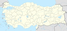
Arap Islet (Turkish: Arap Adası) is an uninhabited island of Turkey. According to Turkish Atlas it is situated on the borderline of Aegean Sea and the Mediterranean Sea.[1] Administratively it is a part of Marmaris ilçe (district) of Muğla Province at 36°39′5″N 28°8′48″E.[2] It is very close to the mainland (Anatolia). The channel between the mainland and the island is quite shallow; no more than 6 metres (20 ft).[3] Its surface area is about 0.025 square kilometres (0.0097 sq mi).
Native name: Arap Adası | |
|---|---|
 Arap Island | |
| Geography | |
| Location | Aegean Sea |
| Coordinates | 36°39′5″N 28°8′48″E |
| Area | 0.025 km2 (0.0097 sq mi) |
| Administration | |
Turkey | |
| İl (province) | Muğla Province |
| İlçe | Marmaris |
References
- Sabri Duran:Büyük Atlas ISBN 975-7537-04-7, p. 27
- Map page
- Coastquide (in Turkish)
| Black Sea |
| ||||||||||
|---|---|---|---|---|---|---|---|---|---|---|---|
| Marmara Sea |
| ||||||||||
| Aegean Sea |
| ||||||||||
| Mediterranean |
| ||||||||||
| Lake Van |
| ||||||||||
Текст в блоке "Читать" взят с сайта "Википедия" и доступен по лицензии Creative Commons Attribution-ShareAlike; в отдельных случаях могут действовать дополнительные условия.
Другой контент может иметь иную лицензию. Перед использованием материалов сайта WikiSort.org внимательно изучите правила лицензирования конкретных элементов наполнения сайта.
Другой контент может иметь иную лицензию. Перед использованием материалов сайта WikiSort.org внимательно изучите правила лицензирования конкретных элементов наполнения сайта.
2019-2026
WikiSort.org - проект по пересортировке и дополнению контента Википедии
WikiSort.org - проект по пересортировке и дополнению контента Википедии