geo.wikisort.org - River
The Kromme Rijn (Dutch pronunciation: [ˈkrɔmə ˈrɛin]) ("Crooked Rhine", for its many bends) is a river in the central Netherlands.
This article does not cite any sources. (December 2009) |
| Kromme Rijn Crooked Rhine | |
|---|---|
 | |
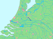 Location of Kromme Rijn in dark blue. | |
| Location | |
| Country | Netherlands |
| Province | Utrecht |
| Physical characteristics | |
| Source | Nederrijn |
| • location | Wijk bij Duurstede, Utrecht |
| • coordinates | 51°58′15″N 5°21′06″E |
| Mouth | Leidse Rijn |
• location | Utrecht, Utrecht |
• coordinates | 52°04′52.5″N 5°07′31″E |
| Length | 28 km (17 mi) |
In Roman times, this northernmost branch of the Rhine delta was the main distributary of this major European river. Along its banks the Romans built their frontier castella part of the Limes Germanicus.
Since the Middle Ages, however, the stream lost its importance as it silted up, and eventually it is nearly cut off from the Nederrijn-Lek main artery. Yet it retained the name "Rhine".
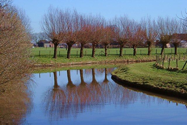
The Kromme Rijn splits off the Nederrijn-Lek main artery at the old town of Wijk bij Duurstede (called Dorestad in the early medieval period), after which it twists and turns through the province of Utrecht, past the towns of Cothen, Werkhoven, Odijk and Bunnik, and ends in the moat of the city of Utrecht.
Originally, the city of Utrecht was built by the Romans at a ford near the place where the Kromme Rijn forks into rivers Vecht (north) and Leidse Rijn (west); the last stretch within the city walls, however, was channelised to form the Oudegracht canal. Rivers Leidse Rijn and Vecht extend from the city moat and are the continuation of the Kromme Rijn.


На других языках
[de] Kromme Rijn
Der Kromme Rijn (deutsch Krummer Rhein) ist der Abschnitt des ursprünglichen Rheins, der bei Wijk bij Duurstede als Abzweigung vom heute Nederrijn (Niederrhein) genannten Rhein beginnt und in vielen Kurven bis Utrecht verläuft. Ab dort bis Harmelen heißt er Leidse Rijn, und der Rest bis zur ursprünglichen Rheinmündung bei Katwijk in die Nordsee heißt Oude Rijn. Im Krommen Rijn fließt nur noch wenig Wasser. Das meiste Wasser des Nederrijns fließt als Lek südwestlich zum Rhein-Maas-Delta. Das Wasser des Krommen Rijns fließt ab Utrecht in der Vecht nach Norden zum IJsselmeer. Die alten Rhein-Abschnitte bis nach Katwijk sind Stillgewässer geworden.- [en] Kromme Rijn
[es] Kromme Rijn
El Kromme Rijn (en neerlandés: ‘Rin sinuoso’, por sus muchas curvas) es un río en la provincia de Utrecht, en los Países Bajos. En la Época romana, esta rama se encontraba situada más al norte del delta del Rin era el distribuidor principal de este importante río europeo. A lo largo de sus orillas los romanos construyeron su frontera castellum del Limes Germanicus[it] Kromme Rijn
Il Kromme Rijn (in lingua italiana:"Reno storto" per via delle sue innumerevoli pieghe e anse) è un fiume nella provincia di Utrecht nei Paesi Bassi.[ru] Кромме-Рейн
Кромме-Рейн (нидерл. Kromme Rijn — «кривой Рейн») — протока дельты Рейна. Название получил из-за меандров. Длина — 28 км.Другой контент может иметь иную лицензию. Перед использованием материалов сайта WikiSort.org внимательно изучите правила лицензирования конкретных элементов наполнения сайта.
WikiSort.org - проект по пересортировке и дополнению контента Википедии