geo.wikisort.org - Reservoir
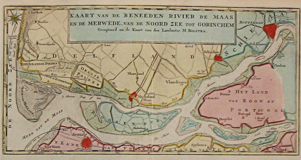
The Brielse Meer ("Lake Den Briel") is a long, narrow lake between the Dutch estuary islands of Voorne and Rozenburg in the province of South Holland.
| Brielse Meer Lake Den Briel | |
|---|---|
 Satellite image of the Rhine-Meuse delta, showing the lake (u) | |
 Brielse Meer Lake Den Briel | |
| Location | South Holland, Netherlands |
| Coordinates | 51°54′20″N 4°11′23″E |
| Basin countries | Netherlands |
| Settlements | Den Briel |
The lake takes its name from Den Briel, a town on its shore. It was formerly a branch of the Meuse known as Brielse Maas (Den Briel Meuse), which ran from the Botlek strait near Rotterdam into the North Sea. The first stretch, between Botlek and the former confluence with the Het Scheur branch, was alternatively known as (the last stretch of) Nieuwe Maas.
When the Brielse Maas silted up in the late nineteenth century, the Nieuwe Waterweg ship canal was constructed (1872) and Het Scheur was separated from the Brielse Maas by a dam. As a precursor to the Delta Works sea barrier constructions, the Brielse Maas was closed off at both ends in 1950, becoming the Brielse Meer.

This South Holland location article is a stub. You can help Wikipedia by expanding it. |
На других языках
- [en] Brielse Meer
[fr] Lac de Brielle
Le lac de Brielle (Brielse Meer en néerlandais) est un lac formé par un bras mort de la Meuse de Brielle, aux Pays-Bas, entre la Mer du Nord et la Vieille Meuse. La ville de Brielle, qui lui donne son nom, est située sur sa rive sud. Le bras du fleuve a été fermé en 1950.Другой контент может иметь иную лицензию. Перед использованием материалов сайта WikiSort.org внимательно изучите правила лицензирования конкретных элементов наполнения сайта.
WikiSort.org - проект по пересортировке и дополнению контента Википедии