geo.wikisort.org - Mountains
Tai Sheung Tok (Chinese: 大上托) is a hill between the communities of Sau Mau Ping and Tseng Lan Shue, Hong Kong.
| Tai Sheung Tok, Hong Kong | |
|---|---|
| 大上托 | |
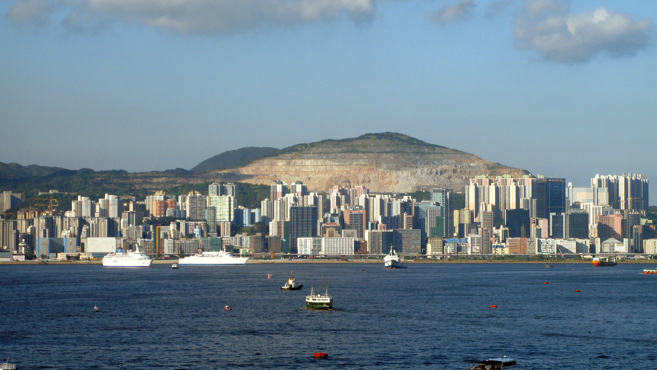
 View of Tai Sheung Tok | |
| Highest point | |
| Elevation | 399 m (1,309 ft) |
| Coordinates | 22°19′30.74″N 114°14′18.18″E |
| Geography | |
 Tai Sheung Tok, Hong Kong Location of Tai Sheung Tok in Hong Kong | |
| Location | |
Geography
Tai Sheung Tok used to be 419m in height, but because of mining activities by Macau gambling billionaire Lui Che-woo at the Anderson Quarry in the 20th century, its height has been reduced to 399m.[1]
Civic construction work on the Development at Anderson Road (DAR)[2] is being finished, while another project called the Development of Anderson Road Quarry Site (ARQ)[3][4] has recently commenced at the foot of Tai Sheung Tok.
Access
Section 3 of the Wilson Trail runs along the north eastern side of Tai Sheung Tok, connecting Ma Yau Tong with Tseng Lan Shue.
See also
- List of mountains, peaks and hills in Hong Kong
- Wilson Trail
References
- Ovalles, Cesar; Rechsteiner, Carl E. Jr. (2015-04-02). Analytical Methods in Petroleum Upstream Applications. CRC Press. ISBN 9781138001480.
- "Major Projects - Development at Anderson Road". www.cedd.gov.hk. Retrieved 2019-09-09.
- "Planning Study on Future Land Use at Anderson Road Quarry - Feasibility Study". www.pland.gov.hk. Retrieved 2019-09-09.
- "Development of Anderson Road Quarry Site - About Development of Anderson Road Quarry Site". arqs.hk. Retrieved 2019-09-09.
External links
Wikimedia Commons has media related to Tai Sheung Tok.
| 900 meters or more | |
|---|---|
| 800 to 899 meters | |
| 700 to 799 meters | |
| 600 to 699 meters |
|
| 500 to 599 meters |
|
| 400 to 499 meters (excerpt) |
|
| 300 to 399 meters (excerpt) |
|
| 200 to 299 meters (excerpt) |
|
| 100 to 199 meters (excerpt) |
|
| 99 meters or less (excerpt) |
|
| Collectively |
|
Текст в блоке "Читать" взят с сайта "Википедия" и доступен по лицензии Creative Commons Attribution-ShareAlike; в отдельных случаях могут действовать дополнительные условия.
Другой контент может иметь иную лицензию. Перед использованием материалов сайта WikiSort.org внимательно изучите правила лицензирования конкретных элементов наполнения сайта.
Другой контент может иметь иную лицензию. Перед использованием материалов сайта WikiSort.org внимательно изучите правила лицензирования конкретных элементов наполнения сайта.
2019-2026
WikiSort.org - проект по пересортировке и дополнению контента Википедии
WikiSort.org - проект по пересортировке и дополнению контента Википедии