geo.wikisort.org - Mountains
Kowloon Peak,[1] also known as Fei Ngo Shan (literally: "Soaring Goose Mountain"), is a 602 m (1,975 ft) tall mountain in the northeast corner of New Kowloon, Hong Kong, situated in Ma On Shan Country Park.[2] It is the tallest mountain in Kowloon, and is crossed by both the Wilson Trail and the MacLehose Trail. On the lower slopes is Gilwell Campsite, belonging to The Scout Association.

| Kowloon Peak, Hong Kong | |
|---|---|
| 飛鵝山 | |
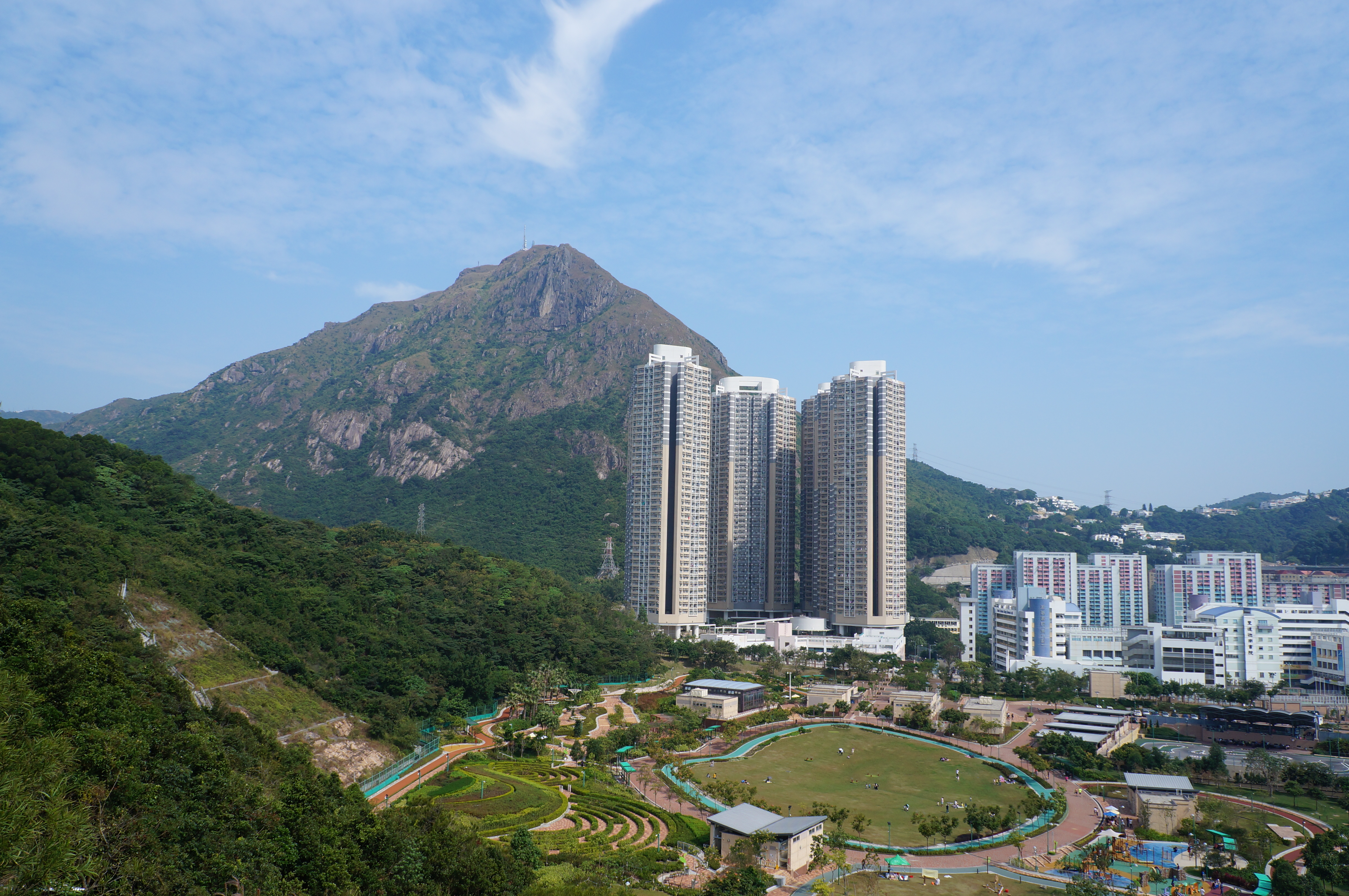 View of Kowloon Peak in November 2012 | |
| Highest point | |
| Elevation | 602 m (1,975 ft) Hong Kong Principal Datum |
| Coordinates | 22°20′27.16″N 114°13′23.64″E |
| Geography | |
 Kowloon Peak, Hong Kong Location of Kowloon Peak in Hong Kong | |
| Location | |
| Kowloon Peak | |||||||||||||
|---|---|---|---|---|---|---|---|---|---|---|---|---|---|
| Traditional Chinese | 飛鵝山 | ||||||||||||
| Simplified Chinese | 飞鹅山 | ||||||||||||
| Cantonese Yale | Fēi ngòh sāan | ||||||||||||
| |||||||||||||
Hiking and access
It has been suggested that portions of this section be split out into another article titled Fei Ngo Shan Road. (Discuss) (October 2022) |
There are several paths from Jat's Incline and Fei Ngo Shan Road that lead to the summit. One of Hong Kong's most treacherous and dangerous climbs is the rock climb from Clear Water Bay Road to Kowloon Peak's summit through Suicide Cliff.
Suicide Cliff is not necessarily a place where people commit suicide, but it's such named most likely because the climb is so treacherous, it's akin to committing suicide. Only experts in rock climbing and hiking should attempt the Suicide Cliff ascent. Casual tourists and inexperienced hikers must not attempt the Suicide Cliff hike as this hike has seen numerous injuries and fatalities.[3][4][5] In one instance, two mainland Chinese tourists ran into trouble on Kowloon Peak's Suicide Cliff and caused an extensive rescue operation involving 160 firefighters.[6]
For casual hikers, choosing the easiest path to the summit through Fei Ngo Shan Road is recommendable.

See also
- List of mountains, peaks and hills in Hong Kong
- Eight Mountains of Kowloon
References
- "GeoInfo Map.Map of Hong Kong provided by HKSARG". www.map.gov.hk. Retrieved 2021-04-14.
- "飛鵝山 Fei Ngo Shan/ Kowloon Peak". www.hiking.com.hk. Retrieved 2019-10-26.
- "Hiker dies after falling down steep slope in Hong Kong country park". sg.news.yahoo.com. Retrieved 2020-04-29.
- Standard, The. "Another hiker killed". The Standard. Retrieved 2019-10-26.
- "6 girls rescued at Kowloon Peak after getting lost on hike since yesterday". www.msn.com. Retrieved 2019-10-26.
- "Hikers underestimate danger of 'suicide cliff' in Hong Kong". South China Morning Post. 2017-08-28. Retrieved 2019-10-26.

| 900 meters or more | |
|---|---|
| 800 to 899 meters | |
| 700 to 799 meters | |
| 600 to 699 meters |
|
| 500 to 599 meters |
|
| 400 to 499 meters (excerpt) |
|
| 300 to 399 meters (excerpt) |
|
| 200 to 299 meters (excerpt) |
|
| 100 to 199 meters (excerpt) |
|
| 99 meters or less (excerpt) |
|
| Collectively |
|
This New Kowloon location article is a stub. You can help Wikipedia by expanding it. |
This New Territories location article is a stub. You can help Wikipedia by expanding it. |
This article related to a mountain or hill in Hong Kong is a stub. You can help Wikipedia by expanding it. |
На других языках
[de] Kowloon Peak
Kowloon Peak oder Fei Ngo Shan (chinesisch 飛鵝山 / .mw-parser-output .Hans{font-size:110%}飞鹅山, Pinyin Fēi'é Shān, Jyutping Fei1ngo4 Saan1, Yale Fēi Ngòh Sāan, kantonesisch Fei Ngo Shan – „Fliegende-Gans-Berg“) ist ein Berg im Ma On Shan Country Park im Nordosten von New Kowloon in Hongkong.[1][2] Er ist die höchste Erhebung auf der Halbinsel Kowloon und wird sowohl vom Wilson Trail, als auch vom MacLehose Trail überquert. Der Berg liegt verwaltungstechnisch zwischen den Regionen der New Territories Sha Tin, Sai Kung und den Kowlooner Region Wong Tai Sin und Kwun Tong selbst.- [en] Kowloon Peak
[fr] Pic Kowloon
Le pic Kowloon (en anglais : Kowloon Peak ; en chinois traditionnel : 飛鵝山) est situé à Hong Kong, entre les districts de Wong Tai Sin et de Sai Kung. Il marque la limite de la ville de New Kowloon ; il surplombe Ngau Chi Wan à l'est et Jeung Shan au nord. Culminant à une altitude de 603 mètres, le sommet est le plus élevé de New Kowloon.Другой контент может иметь иную лицензию. Перед использованием материалов сайта WikiSort.org внимательно изучите правила лицензирования конкретных элементов наполнения сайта.
WikiSort.org - проект по пересортировке и дополнению контента Википедии