geo.wikisort.org - Mountains
Sunset Peak or Tai Tung Shan (Chinese: 大東山) is the third-highest peak in Hong Kong. It is situated on Lantau Island within Lantau South Country Park and Lantau North Country Park and stands at a height of 869 metres (2,851 ft) above sea level.[1][2][3] The second-highest Lantau Peak is located to the west of Sunset Peak.
| Sunset Peak | |
|---|---|
| 大東山 | |
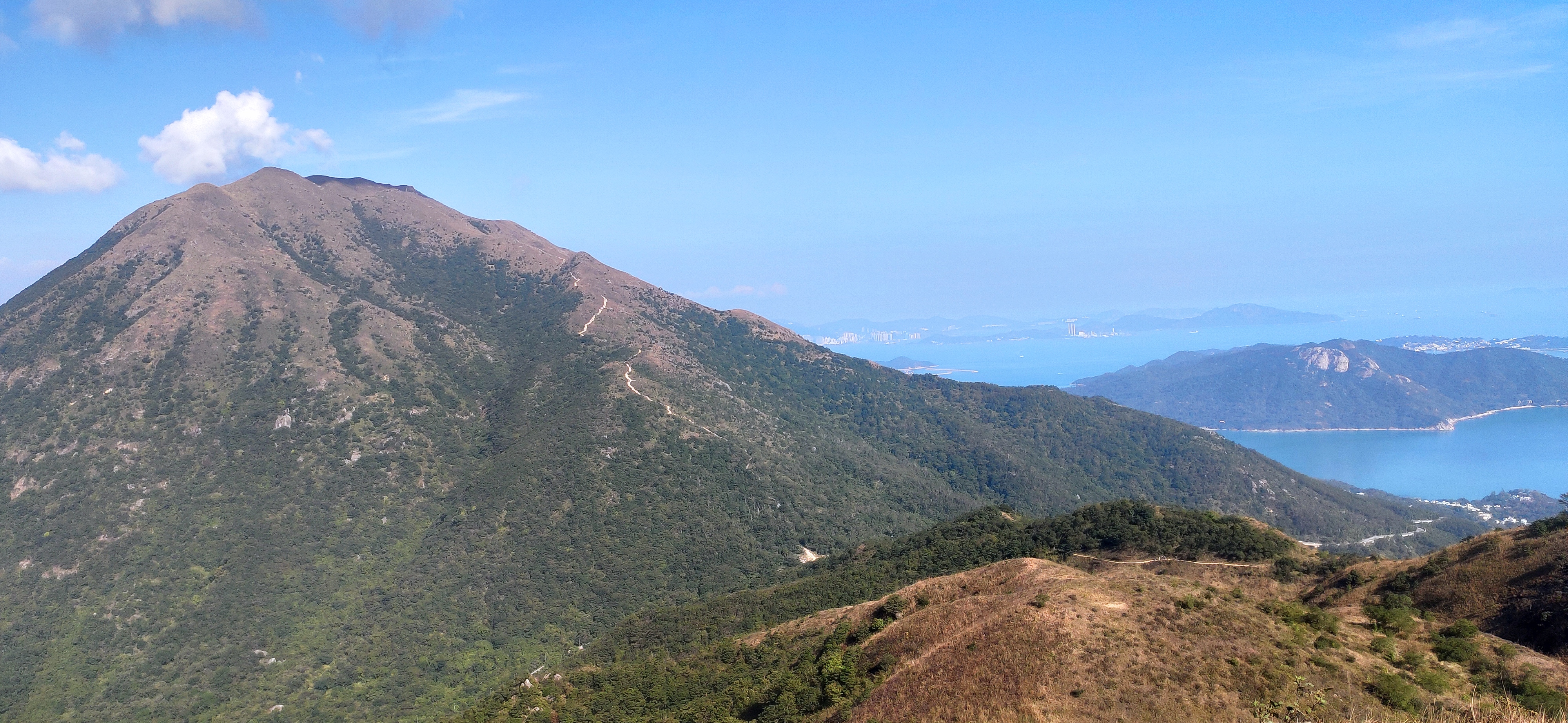 View of Sunset Peak (2020) | |
| Highest point | |
| Elevation | 869 m (2,851 ft) Hong Kong Principal Datum |
| Coordinates | 22°15′26″N 113°57′10″E |
| Geography | |
 Sunset Peak Location of Sunset Peak in Hong Kong | |
| Location | Southern Lantau Island, Hong Kong |
Name
The Cantonese name Tai Tung Shan (Chinese: 大東山; Jyutping: Daai6 Dung1 Saan1) literally means "Big East Mountain".

Access
Sunset Peak is only accessible by foot. It is located on section 2 of the 70-km long Lantau Trail. Section 2 is 6.5 km long and goes from Nam Shan Campsite west of Mui Wo on South Lantau Road (elevation about 120 m), to Pak Kung Au, another campsite on the Tung Chung Road (elevation about 340 m). Both campsites are served by a number of bus routes going to Mui Wo, Tung Chung, and other destinations on Lantau island.[4]

See also
- List of mountains, peaks and hills in Hong Kong
- Lantau Peak
References
- 地理日記:大東山 二東山 Archived 2012-08-02 at archive.today
- Lands Department (February 2011). "Hong Kong Geographic Data" (PDF). Retrieved 29 April 2011.
- "Ch 15 - LVIA". www.epd.gov.hk. Retrieved 4 November 2019.
- Stage 2 Nam Shan to Pak Kung Au on hiking.gov.hk. The elevations at Nam Shan and Pak Kung Au are taken from a local map.
| 900 meters or more | |
|---|---|
| 800 to 899 meters | |
| 700 to 799 meters | |
| 600 to 699 meters |
|
| 500 to 599 meters |
|
| 400 to 499 meters (excerpt) |
|
| 300 to 399 meters (excerpt) |
|
| 200 to 299 meters (excerpt) |
|
| 100 to 199 meters (excerpt) |
|
| 99 meters or less (excerpt) |
|
| Collectively |
|
This Hong Kong location article is a stub. You can help Wikipedia by expanding it. |
На других языках
- [en] Sunset Peak (Hong Kong)
[fr] Pic Sunset
Le pic Sunset (en anglais : Sunset Peak), ou Tai Tung Shan (en chinois : 大東山) est le troisième plus haut sommet de Hong Kong, situé sur l'île de Lantau, dans le parc rural du Sud-Lantau et le parc rural du Nord-Lantau, et culminant à une altitude de 869 mètres[1],[2]. Le deuxième plus haut sommet de l'île, le pic de Lantau, se situe dans la partie occidentale de l'île.Другой контент может иметь иную лицензию. Перед использованием материалов сайта WikiSort.org внимательно изучите правила лицензирования конкретных элементов наполнения сайта.
WikiSort.org - проект по пересортировке и дополнению контента Википедии