geo.wikisort.org - Mountains
Ma On Shan (Chinese: 馬鞍山; literally: Horse Saddle Peak) is a saddle-shaped peak in east of Tolo Harbour in the New Territories of Hong Kong. With a height of 702 metres (2,303 ft), it stands among the ten highest mountains in Hong Kong. The mountain borders Sha Tin and Tai Po districts.
| Ma On Shan | |
|---|---|
| 馬鞍山 | |
 View of Ma On Shan from Sha Tin Racecourse | |
| Highest point | |
| Elevation | 702 m (2,303 ft) Hong Kong Principal Datum |
| Coordinates | 22°24′32″N 114°15′6″E |
| Geography | |
 Ma On Shan Location of Ma On Shan in Hong Kong | |
| Location | |

Beneath the west face of the mountain along Tolo Harbour, the Ma On Shan new town extension, administratively part of Sha Tin, is named after the hill. It ends north in Wu Kai Sha.
A group of villages located east of the peak is named Shap Sze Heung and the harbour of Three Fathoms Cove.


Geography
Ma On Shan can be distinguished by the west face which looks like a saddle, and "Ma On Shan" can be translated as "horse saddle mountain". Nine streams flow down from Ma On Shan, with the biggest located on the southwest slope of Ma On Shan, near Ma On Shan Village.
Geology
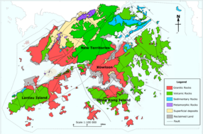
Ma On Shan is formed by Volcanic rocks, much like many of the tallest mountains in Hong Kong, such as Tai Mo Shan. Some shorter mountains in Hong Kong are formed by older Granitic rocks.
In the 20th century, the mountain was formerly mined for its high-purity (60%) iron ore, with annual output in the 1950s and 1960s exceeding 100,000 tonnes.[1] An extensive network of tunnels is buried under the hill. The iron mine was abandoned when it became uncompetitive, in the 1970s.
Vegetation
The north slope of Ma On Shan is mostly tree-covered, while the south slope is mainly shrubs and grasses. On these hostile volcanic hills, only hardy and highly adaptable plants survive. There are some rare flora species, including Rhododendron simsii, which blooms with red flowers in late March, and two other species of native Rhododendron. Rare and protected species of plants also grow on Ma On Shan including the Chinese Lily (Lilium brownii) which is found on the mountain's eastern slope.
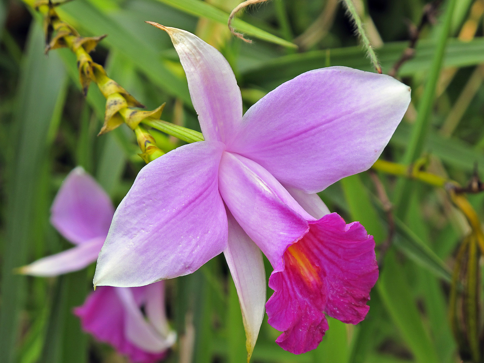
A few types of wild orchid grow in the streams of Ma On Shan, including Hong Kong's most common orchid, the Bamboo Orchid, so called because its distinctive stem resembles bamboo.
Wildlife
The natural environment of Ma On Shan is relatively undisturbed, so this valuable sanctuary gives shelter to many wildlife species. Common mammals are Chinese pangolin (Manis pentadactyla), Chinese porcupine (Hystrix brachyura), wild boar (Sus scrofa) and common muntjac (Muntiacus muntjac).
See also
- List of mountains, peaks and hills in Hong Kong
- Ma On Shan (town) - new town development to the northern side of the peak
References
- Take a glimpse of Hong Kong’s mining past, EJ Insight, 26 Sept 2015
| 900 meters or more | |
|---|---|
| 800 to 899 meters | |
| 700 to 799 meters | |
| 600 to 699 meters |
|
| 500 to 599 meters |
|
| 400 to 499 meters (excerpt) |
|
| 300 to 399 meters (excerpt) |
|
| 200 to 299 meters (excerpt) |
|
| 100 to 199 meters (excerpt) |
|
| 99 meters or less (excerpt) |
|
| Collectively |
|
На других языках
- [en] Ma On Shan (peak)
[fr] Ma On Shan (montagne)
Le Ma On Shan (en chinois : 馬鞍山) est une montagne en forme de selle de cheval située à l'est de Tai Po Hoi dans les Nouveaux Territoires de Hong Kong. D'une altitude de 702 mètres, elle figure parmi les plus hautes montagnes de Hong Kong. La montagne borde les districts de Sha Tin et de Tai Po.Другой контент может иметь иную лицензию. Перед использованием материалов сайта WikiSort.org внимательно изучите правила лицензирования конкретных элементов наполнения сайта.
WikiSort.org - проект по пересортировке и дополнению контента Википедии