geo.wikisort.org - Mountains
Sugarloaf is a 552 metres (1,811 ft) peak in west Wicklow, Ireland that lies on the northern edge of the Glen of Imaal. With a prominence of only 14 metres (46 ft), it is not listed in any of the recognised categories of mountains in Ireland, and is a subsidiary summit of Lobawn 636 metres (2,087 ft), to the north.[1]
| Sugarloaf | |
|---|---|
 Sugarloaf (l) and Lobawn (r) from the Glen of Imaal in the south | |
| Highest point | |
| Elevation | 552 m (1,811 ft)[1] |
| Prominence | 14 m (46 ft)[1] |
| Listing | none |
| Coordinates | 53.011092°N 6.558082°W. |
| Geography | |
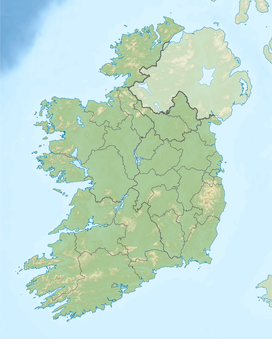 Sugarloaf Ireland | |
| Location | Wicklow, Ireland |
| Parent range | Wicklow Mountains |
| OSI/OSNI grid | S968965[1] |
| Topo map | OSi Discovery 56 |
| Geology | |
| Mountain type | Dark slate-schist, quartzite & coticule[1] |

Sugarloaf should not be confused with the better known Great Sugar Loaf 501 metres (1,644 ft), and the Little Sugar Loaf 342 metres (1,122 ft) in the northeastern section of the Wicklow Mountains.[2]
Bibliography
- Fairbairn, Helen (2014). Dublin & Wicklow: A Walking Guide. Collins Press. ISBN 978-1848892019.
- MountainViews Online Database (Simon Stewart) (2013). A Guide to Ireland's Mountain Summits: The Vandeleur-Lynams & the Arderins. Collins Books. ISBN 978-1-84889-164-7.
See also
Wikimedia Commons has media related to Sugarloaf (West Wicklow).
- Wicklow Way
- Wicklow Mountains
- Lists of mountains in Ireland
- List of mountains of the British Isles by height
- List of Hewitt mountains in England, Wales and Ireland
References
- "Sugarloaf (West Wicklow)". MountainViews Online Database. Retrieved 11 July 2019.
- Fairbairn, Helen (2014). Dublin & Wicklow: A Walking Guide. Collins Press. ISBN 978-1848892019.
| British Isles |  | |
|---|---|---|
| Scotland | ||
| Outside Scotland | ||
| England | ||
| Ireland | ||
| County tops | ||

Lists of long-distance trails in Ireland | ||||||
|---|---|---|---|---|---|---|
| Long-Distance |
|   | ||||
| Pilgrim path |
| |||||
| Cycle greenway |
| |||||
| Boarded mountain | ||||||
| Fell running | ||||||
External links
- MountainViews: The Irish Mountain Website, Sugarloaf (West Wicklow)
- MountainViews: Irish Online Mountain Database
- The Database of British and Irish Hills , the largest database of British Isles mountains ("DoBIH")
- Hill Bagging UK & Ireland, the searchable interface for the DoBIH
This article related to the geography of County Wicklow, Ireland is a stub. You can help Wikipedia by expanding it. |
Текст в блоке "Читать" взят с сайта "Википедия" и доступен по лицензии Creative Commons Attribution-ShareAlike; в отдельных случаях могут действовать дополнительные условия.
Другой контент может иметь иную лицензию. Перед использованием материалов сайта WikiSort.org внимательно изучите правила лицензирования конкретных элементов наполнения сайта.
Другой контент может иметь иную лицензию. Перед использованием материалов сайта WikiSort.org внимательно изучите правила лицензирования конкретных элементов наполнения сайта.
2019-2025
WikiSort.org - проект по пересортировке и дополнению контента Википедии
WikiSort.org - проект по пересортировке и дополнению контента Википедии