geo.wikisort.org - Mountains
Little Sugar Loaf (Irish: Giolspar, meaning 'Giltspur')[2] is a 342 metres (1,122 ft) hill in the far northeastern sector of the Wicklow Mountains in Ireland. It does not have the elevation to rank on Arderin, Hewitt, or Vandeleur-Lynam scales,[3][4][5] however, its prominence of 247 metres (810 ft) ranks it as a Marilyn.[6]
| Little Sugar Loaf | |
|---|---|
| Giolspar | |
 Little Sugar Loaf, from the east | |
| Highest point | |
| Elevation | 342 m (1,122 ft)[1] |
| Prominence | 247 m (810 ft)[1] |
| Listing | Marilyn |
| Coordinates | 53°10′8″N 6°7′12″W |
| Naming | |
| English translation | Giltspur |
| Language of name | Irish |
| Geography | |
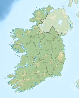 Little Sugar Loaf Ireland | |
| Location | Wicklow, Ireland |
| Parent range | Wicklow Mountains |
| OSI/OSNI grid | O2606514480 |
| Topo map | OSi Discovery 56 |
| Geology | |
| Mountain type | Quartzite Bedrock[1] |
The Little Sugar Loaf is situated northeastwards from the Great Sugar Loaf, but separated by the N11 dual carriageway. The northern side of Little Sugar Loaf directly overlooks the town of Bray; the eastern side (see photo) looks across the R761 between Bray and Greystones to the western slope of Bray Head. Little Sugar Loaf has a distinctive profile of a rocky double summit.[7] Like the Great Sugar Loaf, it consists of Cambrian Period quartzite bedrock.[8]
Irish academic Paul Tempan notes that the Irish name Giolspar is likely a translation of the English "gilt spur", based on a record of a 12th-century transaction by Diarmait Mac Murchada of land in the area which involved the payment of a pair of "gilt spurs" to him and his heirs on an annual basis.[2]
Bibliography
- Fairbairn, Helen (2014). Dublin & Wicklow: A Walking Guide. Collins Press. ISBN 978-1848892019.
- Fairbairn, Helen (2014). Ireland's Best Walks: A Walking Guide. Collins Press. ISBN 978-1848892118.
- MountainViews Online Database (Simon Stewart) (2013). A Guide to Ireland's Mountain Summits: The Vandeleur-Lynams & the Arderins. Collins Books. ISBN 978-1-84889-164-7.
See also
- Wicklow Way
- Wicklow Mountains
- Lists of mountains in Ireland
- List of mountains of the British Isles by height
- List of Marilyns in the British Isles
References
- "Little Sugar Loaf". MountainViews Online Database. Retrieved 11 July 2019.
- Paul Tempan (February 2012). "Irish Hill and Mountain Names" (PDF). MountainViews.ie.
- Simon Stewart (October 2018). "Arderins: Irish mountains of 500+m with a prominence of 30m". MountainViews Online Database.
- Simon Stewart (October 2018). "Vandeleur-Lynams: Irish mountains of 600+m with a prominence of 15m". MountainViews Online Database.
- Mountainviews, (September 2013), "A Guide to Ireland's Mountain Summits: The Vandeleur-Lynams & the Arderins", Collins Books, Cork, ISBN 978-1-84889-164-7
- Fairbairn, Helen (2014). Dublin & Wicklow: A Walking Guide. Collins Press. ISBN 978-1848892019.
- Dillion, Paddy (1993). The Mountains of Ireland: A Guide to Walking the Summits. Cicerone. ISBN 978-1852841102.
Walk 2: Tonduff and Kippure
- Sile Daly (May 2016). "The Great Sugar Loaf: Geological Context" (PDF). Irish Mountaineering Club. Retrieved 11 July 2019.
Popularly mistaken for a volcano, its metamorphism has rendered the rock extremely erosion-resistant and the mountain owes its shape to the weathering characteristics of quartzite.
External links
- MountainViews: The Irish Mountain Website, Little Sugar Loaf
- MountainViews: Irish Online Mountain Database
- The Database of British and Irish Hills , the largest database of British Isles mountains ("DoBIH")
- Hill Bagging UK & Ireland, the searchable interface for the DoBIH
| British Isles |  | |
|---|---|---|
| Scotland | ||
| Outside Scotland | ||
| England | ||
| Ireland | ||
| County tops |
| |

Lists of long-distance trails in Ireland | ||||||
|---|---|---|---|---|---|---|
| Long-Distance |
|   | ||||
| Pilgrim path |
| |||||
| Cycle greenway |
| |||||
| Boarded mountain | ||||||
| Fell running | ||||||
На других языках
- [en] Little Sugar Loaf
[fr] Little Sugar Loaf
Le Little Sugar Loaf, aussi appelé Giltspur Mountain[1] (en irlandais : Giolspar, anciennement Beannach Bheag) est un sommet des montagnes de Wicklow culminant à 342 mètres d'altitude, en Irlande, au sud de Bray. Le Great Sugar Loaf se trouve à l'ouest-sud-ouest, sur l'autre côté de la route N11 reliant Wicklow à Dublin. Sur son versant oriental passe la route R761 qui mène de Bray à Greystones et le sépare de Bray Head. Il est facilement identifiable par son double sommet qui contraste avec les autres hauteurs de la région aux pentes généralement plus régulières. Composé de quartzite formé au Cambrien[2], il contraste avec les sommets de granite du Dévonien à l'ouest de Great Sugar Loaf.Другой контент может иметь иную лицензию. Перед использованием материалов сайта WikiSort.org внимательно изучите правила лицензирования конкретных элементов наполнения сайта.
WikiSort.org - проект по пересортировке и дополнению контента Википедии