geo.wikisort.org - Mountains
The Silvretta Alps are a mountain range of the Central Eastern Alps shared by Tirol, Vorarlberg (both in Austria) and Graubünden (Switzerland). The Austrian states of Tirol and Vorarlberg are connected by a pass road (Silvretta Hochalpenstraße at 2032 m). The majority of the peaks are elevated above three thousand metres and are surrounded by glaciers. Thus, the area is also known as the "Blue Silvretta".
This article needs additional citations for verification. (May 2019) |
| Silvretta Alps | |
|---|---|
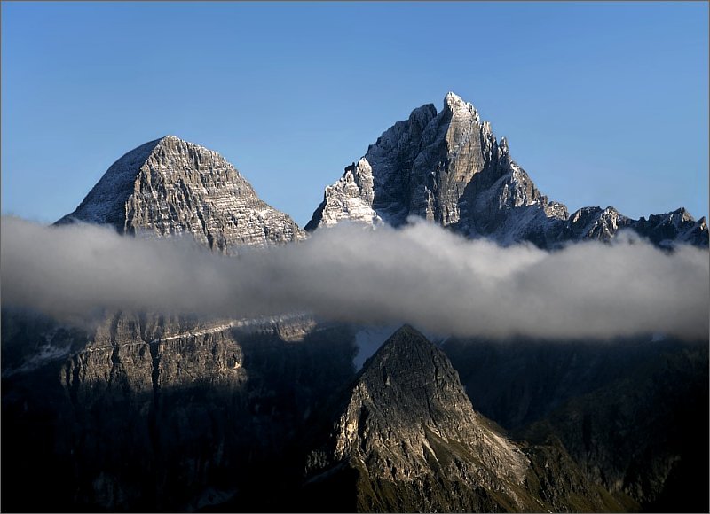
 | |
| Highest point | |
| Peak | Piz Linard |
| Elevation | 3,410 m (11,190 ft) |
| Coordinates | 46°50′N 10°02′E |
| Geography | |

| |
| Countries | Austria and Switzerland |
| States | Tirol, Vorarlberg and Graubünden |
| Range coordinates | 46°52′N 10°07′E |
| Parent range | Central Eastern Alps |
| Borders on | Rätikon, Verwall Alps, Samnaun Alps, Sesvenna Range and Albula Range |
Borders
According to the Alpine Clubs, the Silvretta Alps are outlined from other groups by the following borders: St. Gallenkirch - Ill river as far as Partenen - Zeinisjoch - Zeinisbach - Paznauntal as far as Ischgl - Fimbertal - Fimber Pass - Val Chöglias - Val Sinestra - Inn River from the mouth of the Branclabach to the mouth of the Susasca - Val Susasca - Flüela Pass - Davos - Wolfgang - Laretbach - Klosters - Schlappinbach - Schlappiner Joch - Valzifensbach - Gargellental - St. Gallenkirch.
The Silvretta Alps are surrounded by the Rätikon, Verwall, Samnaun, Sesvenna, Albula and Plessur ranges.
The Piz Buin is not the highest, but the most popular peak of the range. It can relatively easily be ascended from north or south through glaciers and stretches of easy climbing.
The Silvretta is famous for its skiing especially its many backcountry skiing possibilities. In the 1920s Ernest Hemingway was staying in the region for a winter (he lived at Schruns in Montafon, Austria). Later, he wrote a couple of short stories about his skiing experiences in the Silvretta. Some of these short stories are to be found in A moveable feast.[1]

Adjacent valleys
- Montafon
- Paznaun
- Engadin
Peaks


| Peak | Elevation |
|---|---|
| Piz Linard | 3,411 m (11,191 ft) |
| Fluchthorn | 3,399 m (11,152 ft) |
| Piz Buin | 3,312 m (10,866 ft) |
| Verstanclahorn | 3,301 m (10,830 ft) |
| Piz Fliana | 3,284 m (10,774 ft) |
| Silvrettahorn | 3,244 m (10,643 ft) |
| Augstenberg | 3,228 m (10,591 ft) |
| Plattenhörner | 3,221 m (10,568 ft) |
| Dreiländerspitze | 3,212 m (10,538 ft) |
| Piz Tasna | 3,183 m (10,443 ft) |
| Gross Seehorn | 3,123 m (10,246 ft) |
| Gross Litzner | 3,111 m (10,207 ft) |
| Flüela Wisshorn | 3,088 m (10,131 ft) |
| Piz Minschun | 3,072 m (10,079 ft) |
| Piz Murtera | 3,044 m (9,987 ft) |
| Piz Davo Lais | 3,027 m (9,931 ft) |
| Unghürhörner | 2,994 m (9,823 ft) |
| Piz d'Anschatscha | 2,983 m (9,787 ft) |
| Piz da las Clavigliadas | 2,983 m (9,787 ft) |
| Pischahorn | 2,982 m (9,783 ft) |
| Piz Chapisun | 2,931 m (9,616 ft) |
| Hohes Rad | 2,912 m (9,554 ft) |
| Roggenhorn | 2,891 m (9,485 ft) |
| Rotbüelspitz | 2,852 m (9,357 ft) |
| Chessler | 2,836 m (9,304 ft) |
| Hochmaderer | 2,823 m (9,262 ft) |
| Vallüla | 2,813 m (9,229 ft) |
Mountain huts
- Berghaus-Verein, private
- Bodenalpenhaus, private
- Chamanna Dal Linard, Swiss Alpine Club (SAC)
- Fergen Hut, SAC
- Heidelberger Hut, German Alpine Club (DAV), Heidelberg Section
- Jamtal Hut DAV, Schwaben Section
- Klostertaler Umwelt Hut, DAV
- Madlenerhaus, DAV Wiesbaden Section
- Saarbrücken Hut, DAV, Alpenverein u. Skiclub Silvretta
- Seetal Hut, SAC
- Silvretta Hut, SAC
- Tuoi Hut, SAC
- Tübingen Hut, DAV, Tübingen Section
- Wiesbaden Hut, DAV Wiesbaden Section
Ski areas in the Silvretta Alps
- Silvretta Montafon –
 Vorarlberg, Austria – largest ski area offering 113 km of slopes
 - Silvretta Bielerhöhe – Partenen – Vorarlberg, Austria
- Gargellen – Vorarlberg, Austria
- Galtür – Silvapark – Tyrol, Austria
- Scuol (Motta Naluns) –
 Graubünden, Switzerland
 - Parsenn (Davos Klosters) – Graubünden, Switzerland – highest ski area which extends up to an altitude of 2,844m
- Madrisa (Davos Klosters) – Graubünden, Switzerland
- Pischa (Davos Klosters) – Graubünden, Switzerland
- Selfranga – Klosters – Graubünden, Switzerland
- Ardez – Graubünden, Switzerland
- Guarda – Graubünden, Switzerland[2]
See also
- Passes of the Silvretta and Rätikon Ranges
- Swiss Alps
References
- "Ernest Hemingway in Montafon | montafon.at". www.montafon.at. Retrieved 2019-03-24.
- "Ski resorts Silvretta Alps - skiing in the Silvretta Alps". www.skiresort.info. Retrieved 2019-03-24.
Mountain ranges of the Central Eastern Alps according to the AVE | ||
|---|---|---|
|  | |
Authority control | |
|---|---|
| General |
|
| National libraries | |
На других языках
[de] Silvretta
Die Silvretta ist eine Gebirgsgruppe in den zentralen Ostalpen. Anteil haben Österreich mit den Bundesländern Tirol und Vorarlberg und die Schweiz mit dem Kanton Graubünden. Auf dem Gipfel der Dreiländerspitze stoßen die Gebiete von Tirol, Vorarlberg und Graubünden zusammen. In der Silvretta liegen viele Berggipfel mit einer Höhe von mehr als 3000 Metern (Dreitausender). Vor allem auf der Nordseite in Österreich sowie in der Schweiz nördlich des Flüelapasses gibt es eine Vielzahl größerer und kleinerer Gletscher. Deshalb wird das Gebiet auch „Die Blaue Silvretta“ genannt.- [en] Silvretta Alps
[es] Alpes de Silvretta
Los Alpes de Silvretta son una cadena montañosa de los Alpes centrales del este compartidos por Tirol, Vorarlberg (ambos en Austria) y Graubünden (Suiza). Los estados austriacos de Tirol y Vorarlberg están conectados por una carretera de montaña ( Silvretta Hochalpenstraße a 2032 m). La mayoría de los picos se elevan por encima de los tres mil metros y están rodeados de glaciares. Así, la zona también es conocida como la "Silvretta Azul".[fr] Silvretta
Le massif de Silvretta est un massif des Alpes orientales centrales. Il s'élève entre l'Autriche (Vorarlberg et Tyrol) et la Suisse (canton des Grisons). Il tire son nom d'un sommet central du massif. Il occupe une surface de 771 km2[1].[it] Gruppo del Silvretta
Il Gruppo del Silvretta (detto anche Silvretta) è un gruppo montuoso delle Alpi Retiche occidentali. Si trova in Svizzera (Canton Grigioni) ed Austria (Vorarlberg e Tirolo). Prende il nome dal Monte Silvretta.Другой контент может иметь иную лицензию. Перед использованием материалов сайта WikiSort.org внимательно изучите правила лицензирования конкретных элементов наполнения сайта.
WikiSort.org - проект по пересортировке и дополнению контента Википедии